5th stretch: Zone – San Bartolomeo
The trail / der Weg
ATTENTION: temporary closure to vehicular and pedestrian traffic of Via Valurbes (cemetery area) up to Croce di Zone.
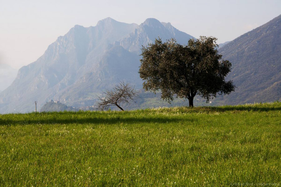
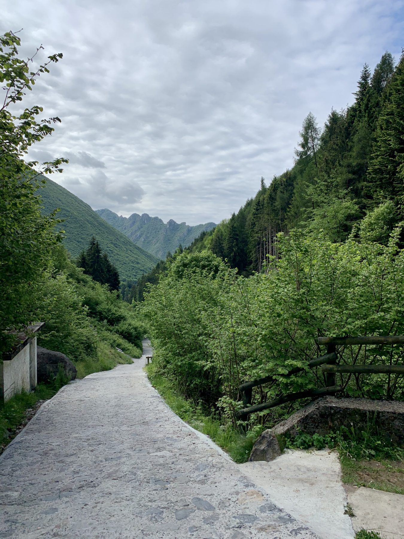
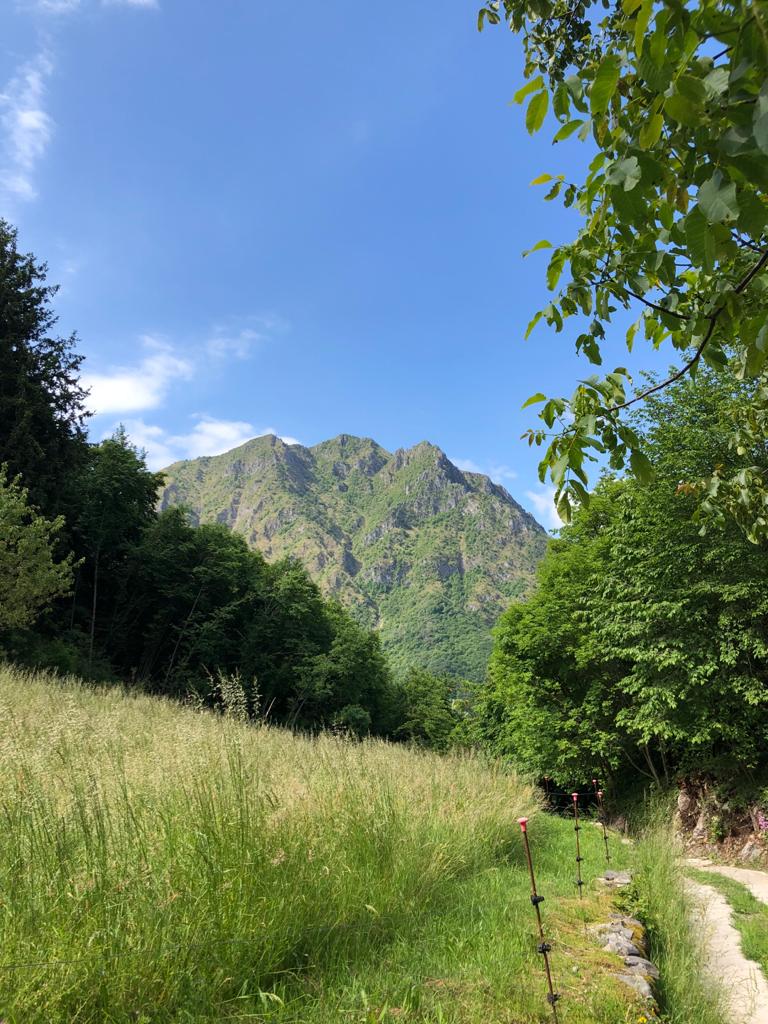
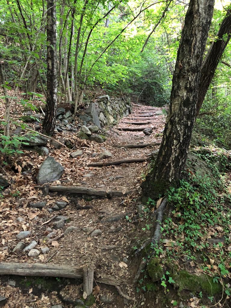
After leaving the village northwards and going beyond the cemetery, the Antica Strada Valeriana turns into an old cobbled road that goes up to Valurbes. The surroundings change again and, there are conifers such as the norway spruce (Picea abies) and some rare european larches (Larix decidua), and by the sides of the road several hazels continue skirting the slope. Along the way, it seems it would still be possible to run into old wayfarers shepherds and merchants which once used to walk along these paths. At this point, you are on the slopes of Monte Guglielmo, called Gölem in the local dialect, a really popular destination both in Summer and in Winter. From here you will enjoy the sight of its North-Western crest, from Monte Agolo to Punta Caravina and Dosso Pedalta. In the narrow valley, by the cobbled road, one can see the church of Disgiolo, beyond which the path turns to left. Now the road is flat; on the right you can see some fields and cascina Croce towering in the middle of them: this is the sign of your imminent arrival at Passo Croce di Zone, at 903 mt a.s.l., the most elevated height of this stretch, as well as a crossroads of several trails throughout the Camonica Valley. Turn into the mule track downhill which, at this point, clashes with CAI path 205. You will go through a little wood rich in many species of trees and deserving a careful study. Among them, the chestnut stands out from other trees such as the european beech (Fagus sylvatica), the norway spruce, the common holly (Ilex aquifolium) and the hazel. Some age-old chestnuts and some fields indicate the arrival at Piazze. From here, you can see the Northern austere mountainside of Corna Trentapassi, the hamlet of Sedergnò and S. Bartolomeo. The descent, at first made of large steps, is quite steep up to the hairpin of the hamlet “Le Volte”, a place from where the eye embraces the upper part of Lake Iseo, Val Cavallina and Val Borlezza, located in the province of Bergamo. A mule track in the chestnut grove drives the hiker to the next hairpin of the itinerary from which, behind an old fountain, starts a lane leading to the Church of San Bartolomeo in Sedergnò. This hamlet is worthy of a visit, you can find an area equipped with benches and tables, shaded by imposing sweet chestnuts.
DE – Die Antica Strada verlässt die Stadt Zone in nördlicher Richtung, hinter dem Friedhof, und verlässt den Asphalt für ein Kopfsteinpflaster mit einem uralten Geschmack, das in die Valurbes geht. Es scheint immer noch in der Lage zu sein, die Wanderer, Hirten und Kaufleute, die dieselben Steine betraten, auf einem langsamen und unermüdlichen Weg zu treffen, der im Laufe der Jahrhunderte verloren gegangen ist. Man befindet sich an den Hängen des Berges Guglielmo, dem Ziel zahlreicher Sommer- und Winteraufstiege. Von der Antica Strada Valeriana genießt man den Blick auf den Nordwestgrat, der vom Berg Agolo über die Punta Caravina bis zum Dosso Pedalta führt. In dem engen Tal, neben dem Kopfsteinpflaster, befindet sich die Disgiolo Kirche, nach der sich der Weg nach links biegt. Die Straße wird flacher, die Wiesen öffnen sich rechts mit dem Croce-Bauernhaus in der Mitte. Es ist das Signal für die bevorstehende Ankunft am Passo Croce di Zone, in einer Höhe von 903 Metern, der höchsten Höhe dieser Strecke, sowie einer Kreuzung mehrerer Wege. An dieser Stelle kann man auf den Bänken des ausgestatteten Bereichs eine kurze Pause einlegen. Auf dem Maultierweg, der in diesem Abschnitt mit dem Pfad 205 der CAI Pisogne zusammenfällt, überquert man einen abwechslungsreichen Wald, der reich an zahlreichen Pflanzenarten ist, die eine sorgfältige Beobachtung verdienen. Einige jahrhundertealte Exemplare von Kastanienbäumen und ausgedehnten Wiesen kündigen die Ankunft in der Ortschaft Piazze an. Von hier aus genießt man einen Panoramablick auf die Nordseite des Corna Trentapassi, die Ortschaft Sedergnò und San Bartolomeo, das nächste Ziel. Weiter betritt man einen bewaldeten Ort, der aus Kastanienbäumen, Birken (Betula pendula) und Fichten besteht. Der Abstieg erfolgt zunächst stufenweise bis zur Haarnadelkurve in der Ortschaft „Le Volte“, von der aus man einen hervorragenden Blick über den gesamten oberen Iseosee, das Val Cavallina und das Val Borlezza genießen kann. Ein Saumpfad im Kastanienwald führt den Wanderer zur nächsten Kurve, von der aus neben dem großen Brunnen eine kleine Straße zur Kirche San Bartolomeo in der Ortschaft Sedergnò führt. Diese Kirche ist einen Besuch wert und in unmittelbarer Nähe befindet sich ein gut ausgestatteter Rastplatz mit Bänken und Tischen im Schatten majestätischer Kastanienbäume.
How to arrive and where to park / Anreise und Parkplätze
On the coastal road ex SP 510, once you have reached Marone, follow the signs for Zone.
On the provincial road 510 Brescia / Valle Camonica, take the exit Colpiano and then turn right towards Zone.
Parking spaces in Cislano (Zone), in the centre of the village or next to the cemetery.
DE – Sobald man Marone durch die SP 510 erreicht hat, biegt man in Richtung Zone ab.
Auf der Provinzstraße 510 Brescia / Valle Camonica nimmt man die Ausfahrt Colpiano und biegt dann rechts in Richtung Zone ab.
Parkplätze in Cislano (Zone), im Zentrum des Dorfs oder in der Nähe vom Friedhof.
Book now:
Monte Isola and Franciacorta with Susanna Allegri
Lovere
A few steps in Franciacorta, among vineyards and cellars, and in Monte Isola, where the road is comp...
 BOOK NOW
What comes out of the top hat
Lovere
FISH FROM THE HAT AND FIND OUT WHAT YOU HAVE WON! With Susanna Allegri Hiking and MTB guide Trekking...
BOOK NOW
Excursion to the Pyramids of Zone and Corna Trentapassi
Zone
Your perfect day among the natural beauties surrounding Lake Iseo! Ready for an excursion that takes...
BOOK NOW
Treasure hunt in Franciacorta
Franciacorta
A fun experience suitable for everyone in the vineyards of Franciacorta: a team orientation test bet...
BOOK NOW


