Cycle-pedestrian path between Vello and Toline
The trail / der Weg
Attention!
LAST UPDATE ON NOVEMBER 16TH, 2023
The cycle-pedestrian path between Vello and Toline has been reopened only in the part located in the Municipality of Pisogne.
The part located in the Municipality of Marone remains CLOSED until further notice due to safety works.
It is therefore NOT possible to complete the tour of the lake by bike, in the absence of an alternative route.
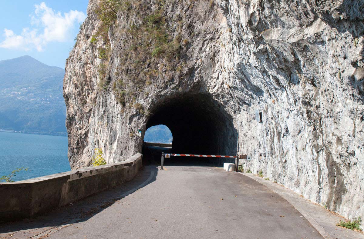
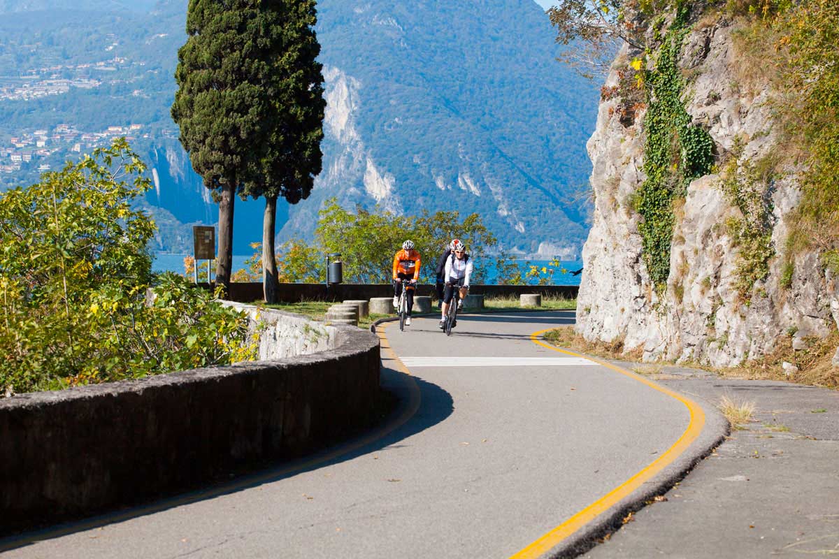
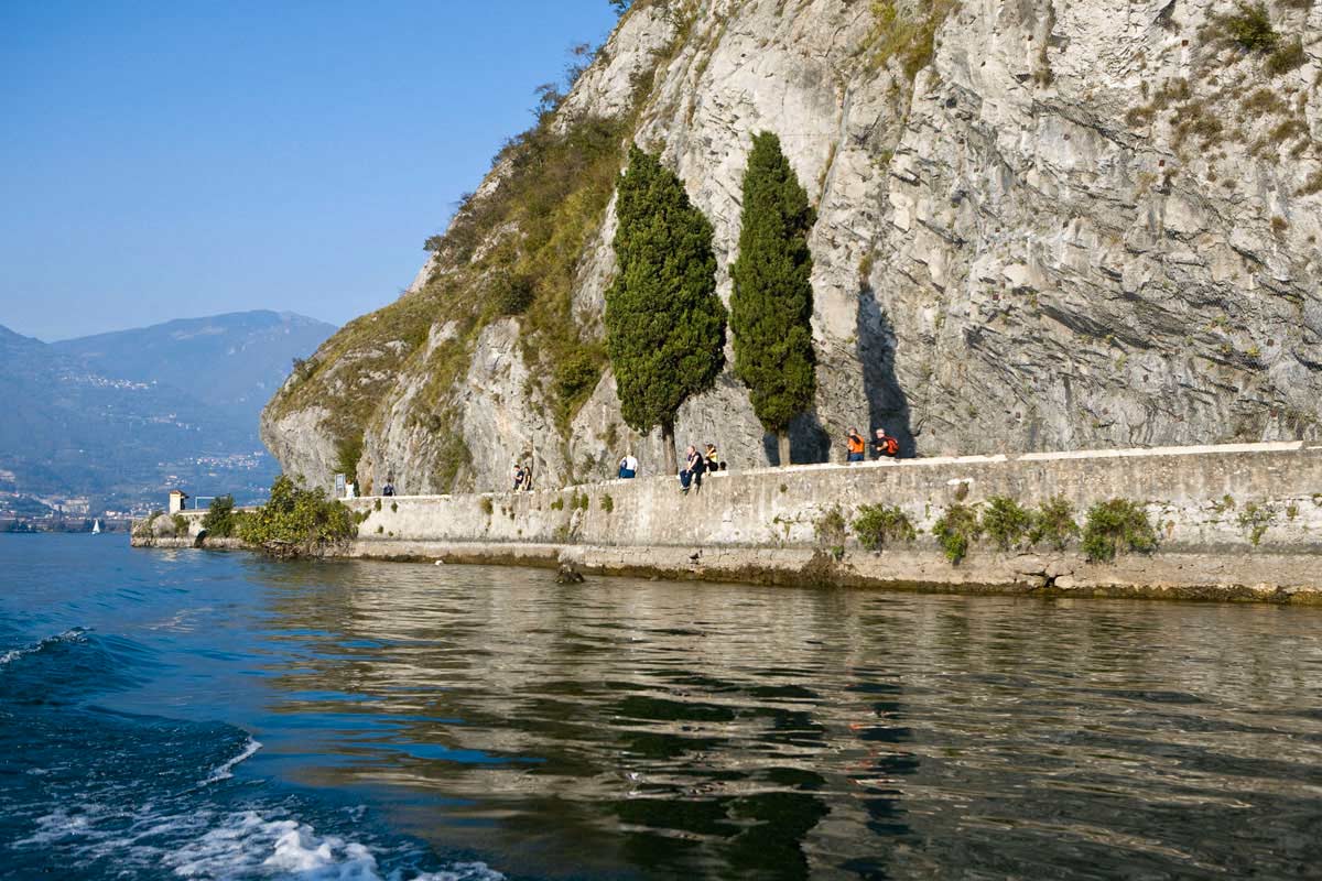
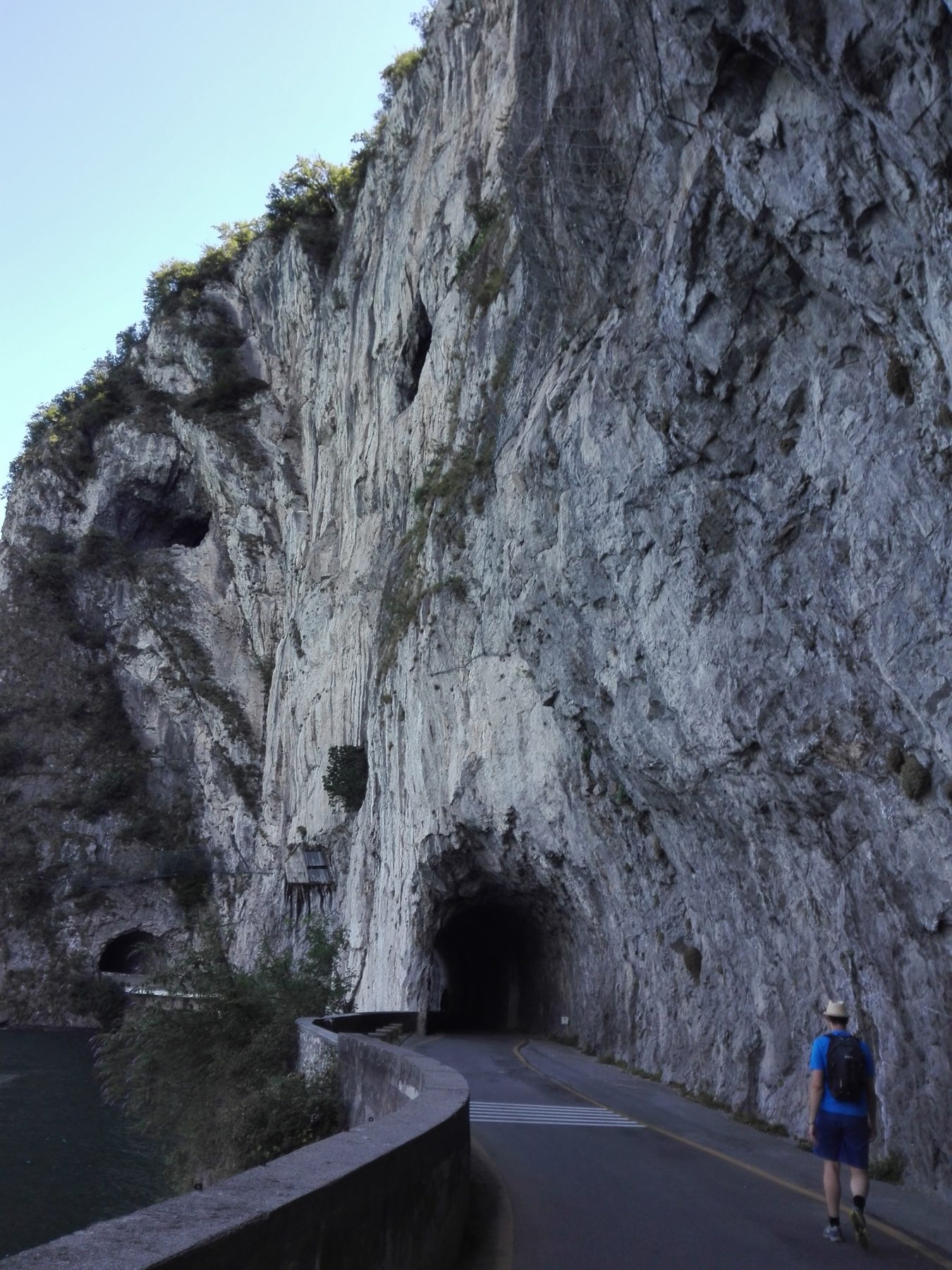
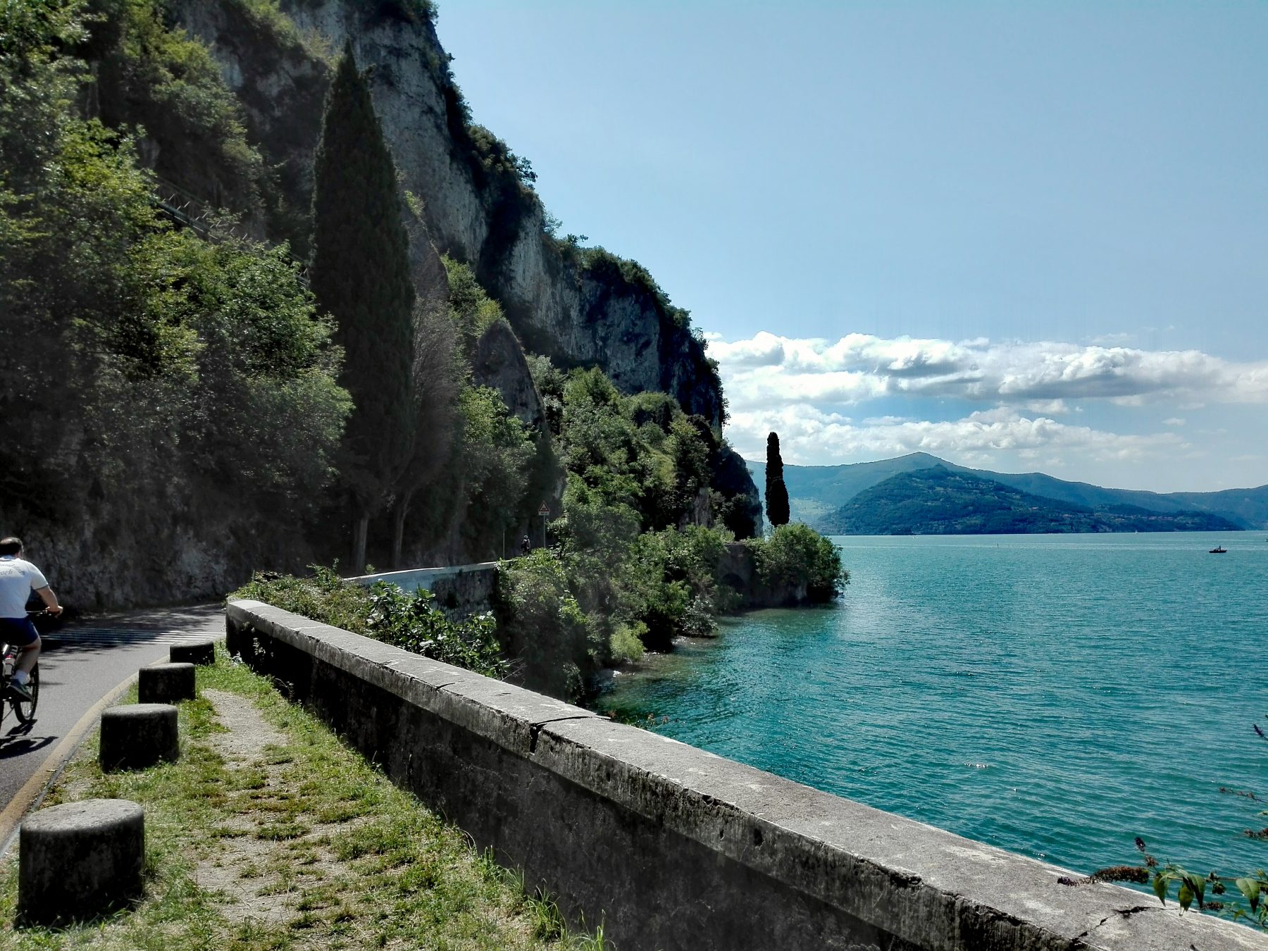
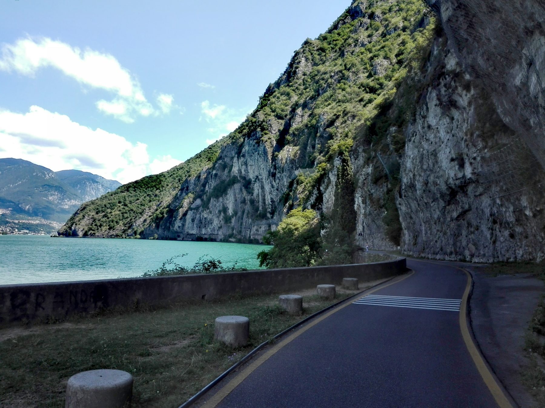
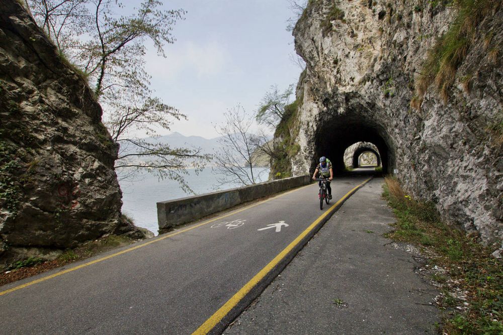
The cycle-pedestrian path between Vello (Marone) and Toline (Pisogne) represents a simple but very suggestive itinerary that can be done on foot or by bicycle.
The route is located just over a kilometer after the first tunnels of the Iseo-Pisogne coastal road, in the municipality of Marone, at a lower level than the road. Located on the water, with tunnels and rest points, it has Vello di Marone as its starting point and Toline di Pisogne as its arrival point. From the cemetery of Vello (the fifteenth-century church is noteworthy), continue by bicycle through the town. The flat itinerary begins at the first tunnel and, always skirting the lake, passes through the engraved furrow of the Valle Finale and ends at the small promontory of Punta delle Croci Bresciane. From it you can enjoy wide and panoramic views of the lake and rocks among which, on the other side of the lake, the ravine of Bogn di Castro stands out.
DE – Die Fahrrad-Fußgängerroute zwischen Vello (Marone) und Toline (Pisogne) stellt eine einfache, aber sehr eindrucksvolle Route dar, die zu Fuß oder mit dem Fahrrad befahren werden kann.
Die Route befindet sich etwas mehr als einen Kilometer nach den ersten Tunneln der Küstenstraße Iseo-Pisogne in der Gemeinde Marone auf einem niedrigeren Niveau als die Küstenstraße. Am Wasser gelegen, mit Tunneln und Rastplätzen, hat es Vello di Marone als Ausgangspunkt und Toline di Pisogne als Zielpunkt. Vom Friedhof von Vello (bemerkenswert ist die Kirche aus dem 15. Jahrhundert) fährt man mit dem Fahrrad durch die Stadt. Die flache Route beginnt am ersten Tunnel und führt, immer am See entlang, durch die eingravierte Furche des Valle Finale und endet an der kleinen Landzunge Punta delle Croci Bresciane. Von dort aus genießt man einen weiten Panoramablick auf den See und die Felsen, zwischen denen auf der anderen Seite des Sees die Schlucht von Bogn di Castro hervorsticht.
How to arrive and where to park / Anreise und Parkplätze
Follow the SP 510 road until the exit called Vello / Marone / Sale Marasino Sulzano.
Paid parking spaces in the centre of Vello.
DE –Man muss der SP 510 bis zur Ausfahrt Vello / Marone / Sale Marasino Sulzano folgen.
Im Zentrum von Vello gibt es gebührenpflichtige Parkplätze.
Book now:
As smooth as river Oglio – bike and kayak
Lovere
This experience is suitable for everyone who wishes to spend an alternative day, doing a little move...
 BOOK NOW
Along the cycle route of the River Oglio…my own way! – 4 nights
Lovere
The cycle path of the Oglio river was nominated by the jury for the Green Road Award “the most...
BOOK NOW
Franciacorta by night – bike tour
Franciacorta
If you want to live a truly exclusive experience, take part in the new excursion by Iseo Bike “...
BOOK NOW
Bike rental
Iseo
Iseo Bike rents city bikes, mountain bikes, pedal assisted electric bicycles, for individuals, famil...
BOOK NOW


