Trekking from Bossico to Magnolini Hut
Hike from the village of Bossico to Magnolini Hut.
DE- Wanderung vom Dorf Bossico bis zur Magnolini Hütte.
The path/Der Weg
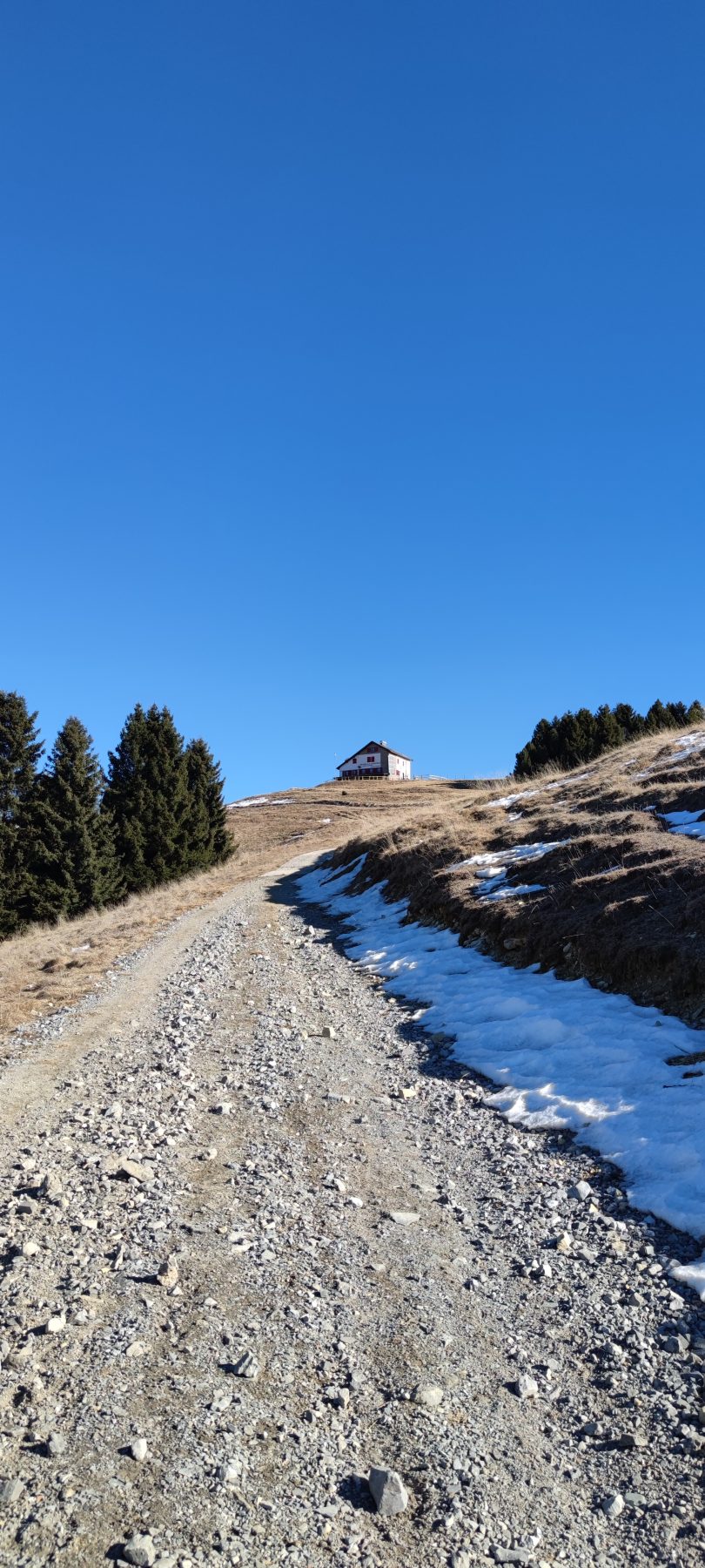
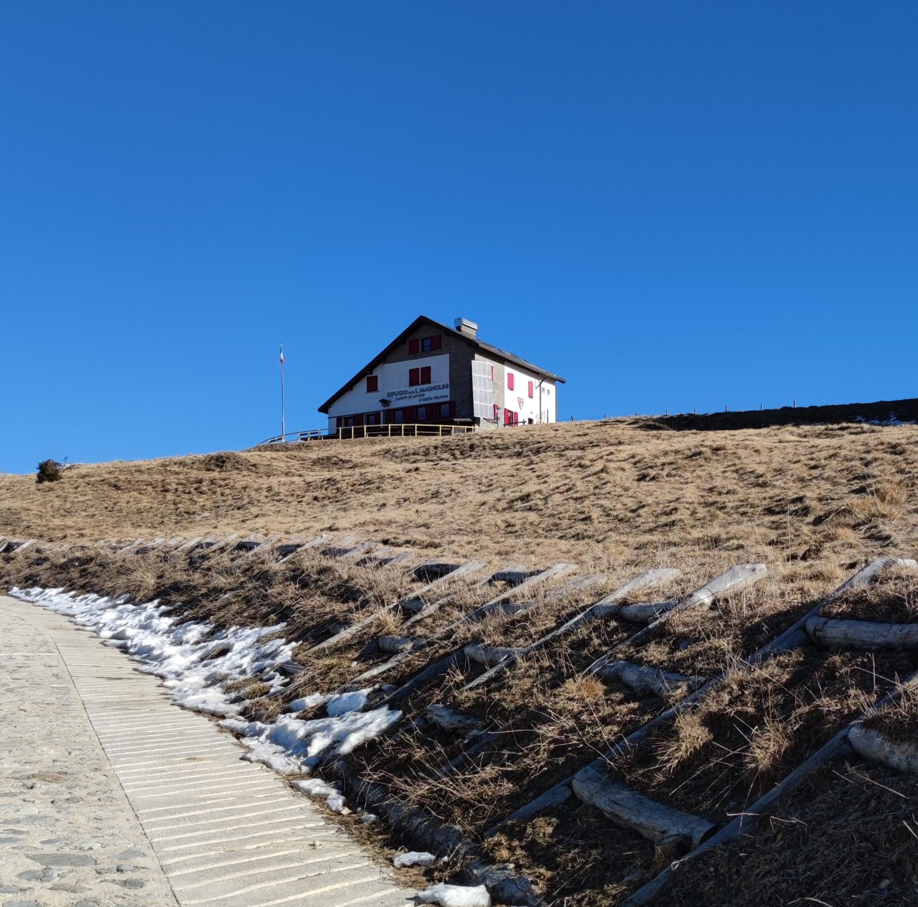
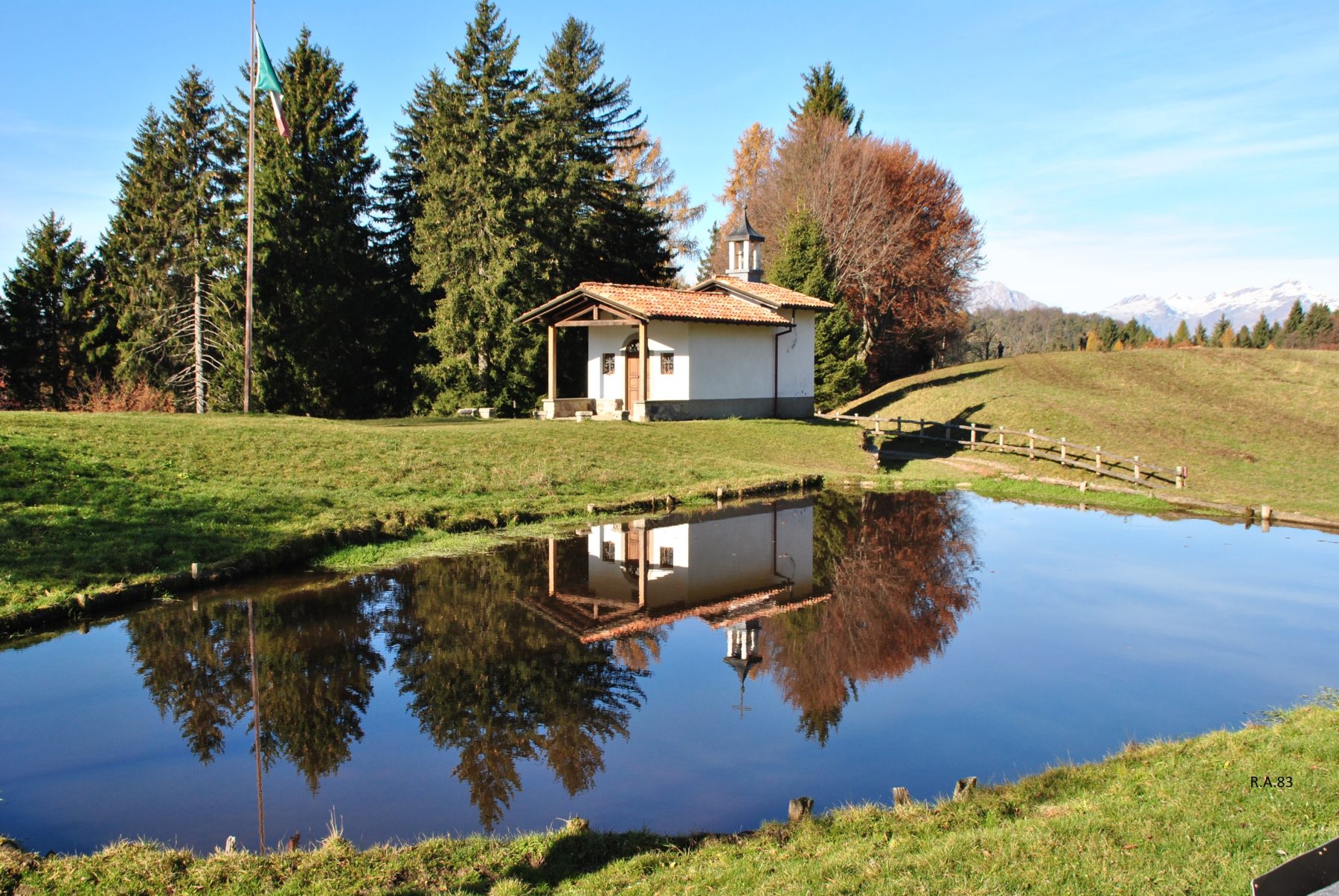
Starting from the car park in the Volpi area, continue along the slightly uphill paved road towards the “Monte di Lovere”. On the route, on the left, it is possible see the historic building Villa Aventino. Once you reach the crossroads near the Cinque Abeti farmhouse, turn left along path 552 and continue following the signs up to the “Forcellino di Bossico”. Once you arrive at the Forcellino (dropout), continue following trail sign 554 towards the Church of San Fermo, with a small water pond and a covered picnic area. The itinerary continues behind the small church with the 555 trail sign towards the wooded slopes of “Co de Soc” up to the “Forcellino di Ramello”, where you continue uphill following the 551 sign towards the Magnolini Hut.
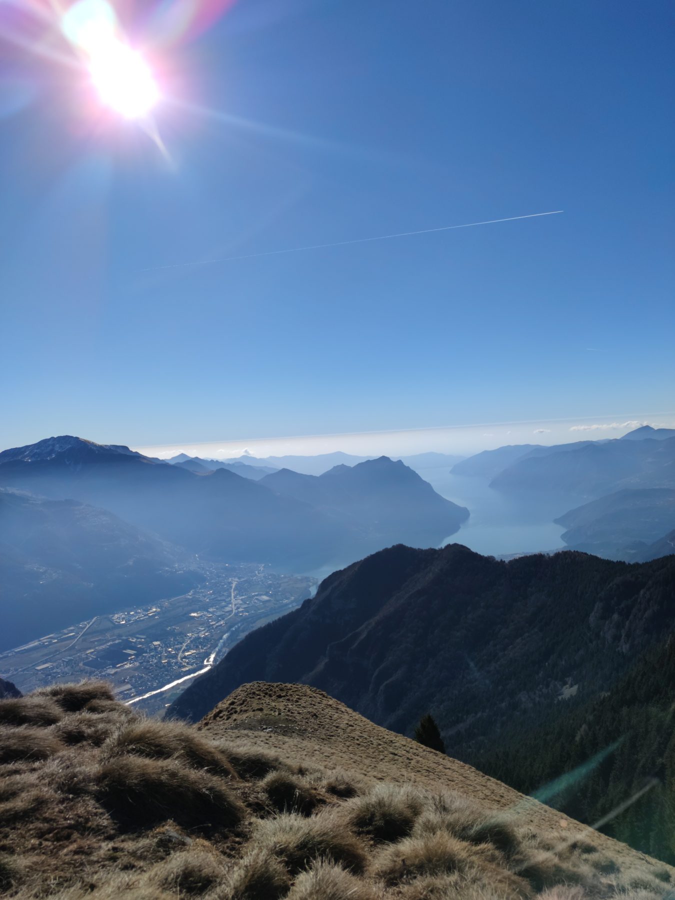
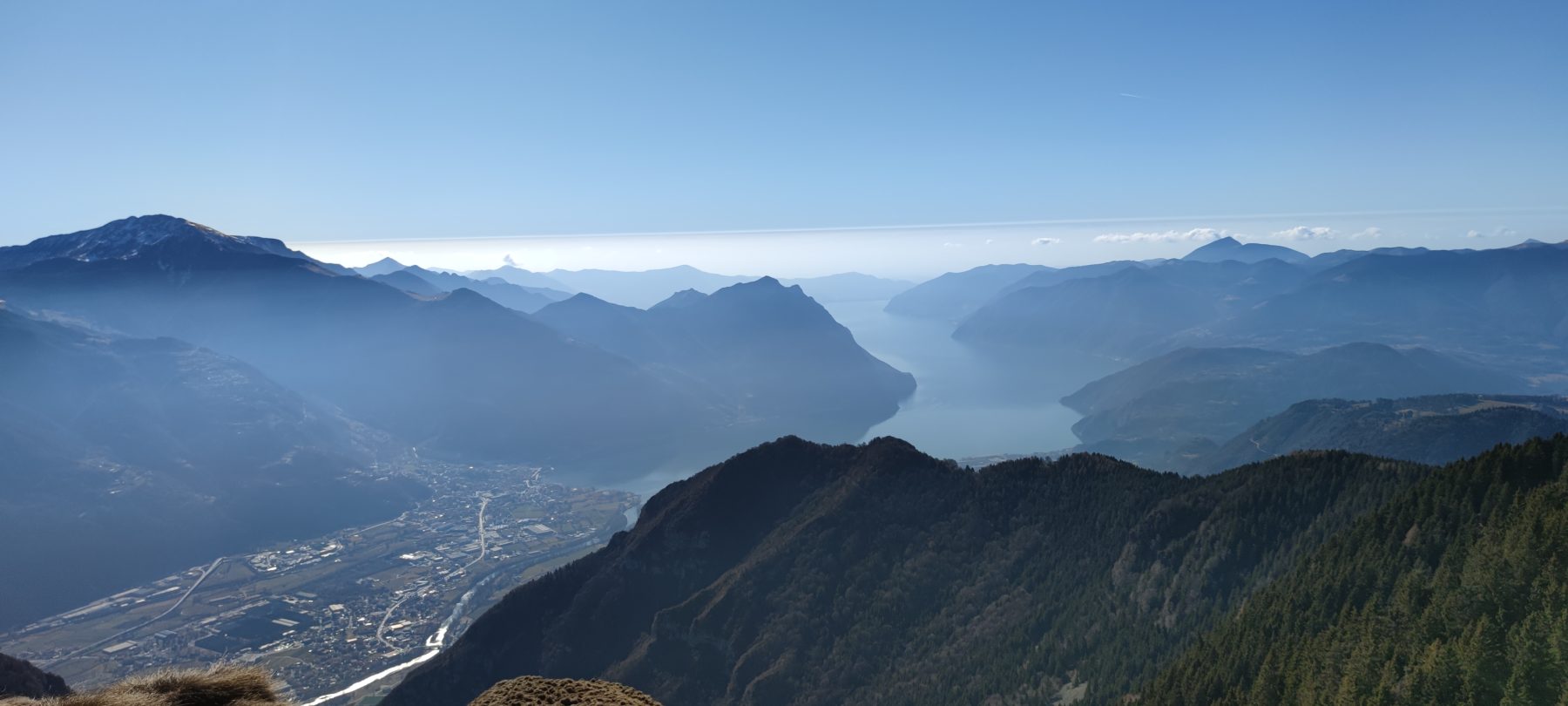
Recommended route: from the Church of San Fermo, continue along path 555 and, as soon as you enter the woods, take the path that branches off to the right towards the top of Monte Colombina (trail sign is on a tree), with breathtaking views of the Bossico plateau and the Lake Iseo.
DE- Vom Parkplatz im Volpi Gebiet aus geht es weiter auf der leicht ansteigenden Asphaltstraße in Richtung “Monte di Lovere”. Auf der Route kann man auf der linken Seite das historische Gebäude Villa Aventino sehen. Sobald man die Kreuzung in der Nähe des Bauernhauses Cinque Abeti erreicht hat, biegt man links auf den Weg 552 ab und folgt den Schildern weiter bis zum “Forcellino di Bossico”. Wenn man am Forcellino (Ausstiegspunkt) angekommen ist, folgt man dem Wegweiser 554 weiter in Richtung der Kirche San Fermo, mit einem kleinen Wasserteich und einem überdachten Picknickplatz. Hinter der kleinen Kirche geht es weiter mit dem Wegweiser 555 in Richtung der bewaldeten Hänge des “Co de Soc” bis zum “Forcellino di Ramello”, wo man weiter bergauf geht und dem Wegweiser 551 in Richtung der Magnolini-Hütte folgt.
Empfohlene Route: Man geht von der Kirche San Fermo aus weiter auf dem Weg 555 und, sobald man den Wald betritt, nimmt man den Weg, der rechts zum Gipfel des Monte Colombina abzweigt (Wegweiser befindet sich an einem Baum), mit atemberaubender Aussicht Blick auf das Bossico-Plateau und den Iseosee.
How to arrived and where to park/Anreise und Parkplatz
Follow the signs for Lake Iseo and then for Lovere. Take the SP 53 of Valle Borlezza and continue following the signs for Bossico.
Possibility of parking in Località Volpi, almost at the end of Via Sette Colli.
DE- Man folgt den Schildern zum Iseosee und dann nach Lovere. Dann nimmt man die Provinzstraße SP 53 von Valle Borlezza und folgt weiter den Schildern nach Bossico.
Parkmöglichkeit in Località Volpi, fast am Ende der Via Sette Colli.
Credits: Pro Loco Bossico
DETAILS
- Difficulty:
Medium - Duration:
3 h 30 min - Distance:
7,9 km - Elevation gain:
+820 m - Starting point:
Via Sette Colli, Bossico - Arrival point:
Rifugio Magnolini - Trail number:
CAI 552, 554,555, 551
Book now:
Monte Isola and Franciacorta with Susanna Allegri
Lovere
A few steps in Franciacorta, among vineyards and cellars, and in Monte Isola, where the road is comp...
 BOOK NOW
Treasure hunt in Franciacorta
Franciacorta
A fun experience suitable for everyone in the vineyards of Franciacorta: a team orientation test bet...
BOOK NOW
Excursion to the Pyramids of Zone and Corna Trentapassi
Zone
Your perfect day among the natural beauties surrounding Lake Iseo! Ready for an excursion that takes...
BOOK NOW
What comes out of the top hat
Lovere
FISH FROM THE HAT AND FIND OUT WHAT YOU HAVE WON! With Susanna Allegri Hiking and MTB guide Trekking...
BOOK NOW


