Ring route from Fonteno to Monte Boario
From Fonteno, a ring towards the top of Monte Boario, to get plenty of views of the mountains surrounding Lake Iseo, Adamello, and Presolana.
DE – Von Fonteno aus ein Ring zum Gipfel des Monte Boario, um die Aussicht auf die Berge rund um den Iseosee, Adamello und Presolana zu genießen.
The trail / der Weg
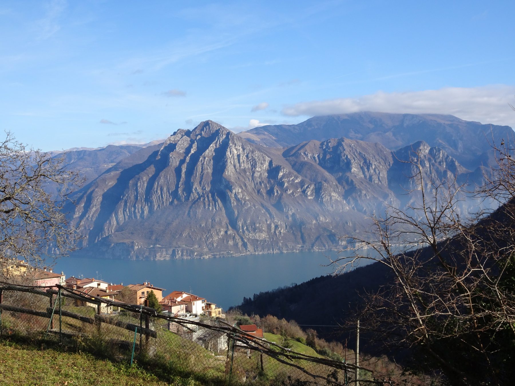
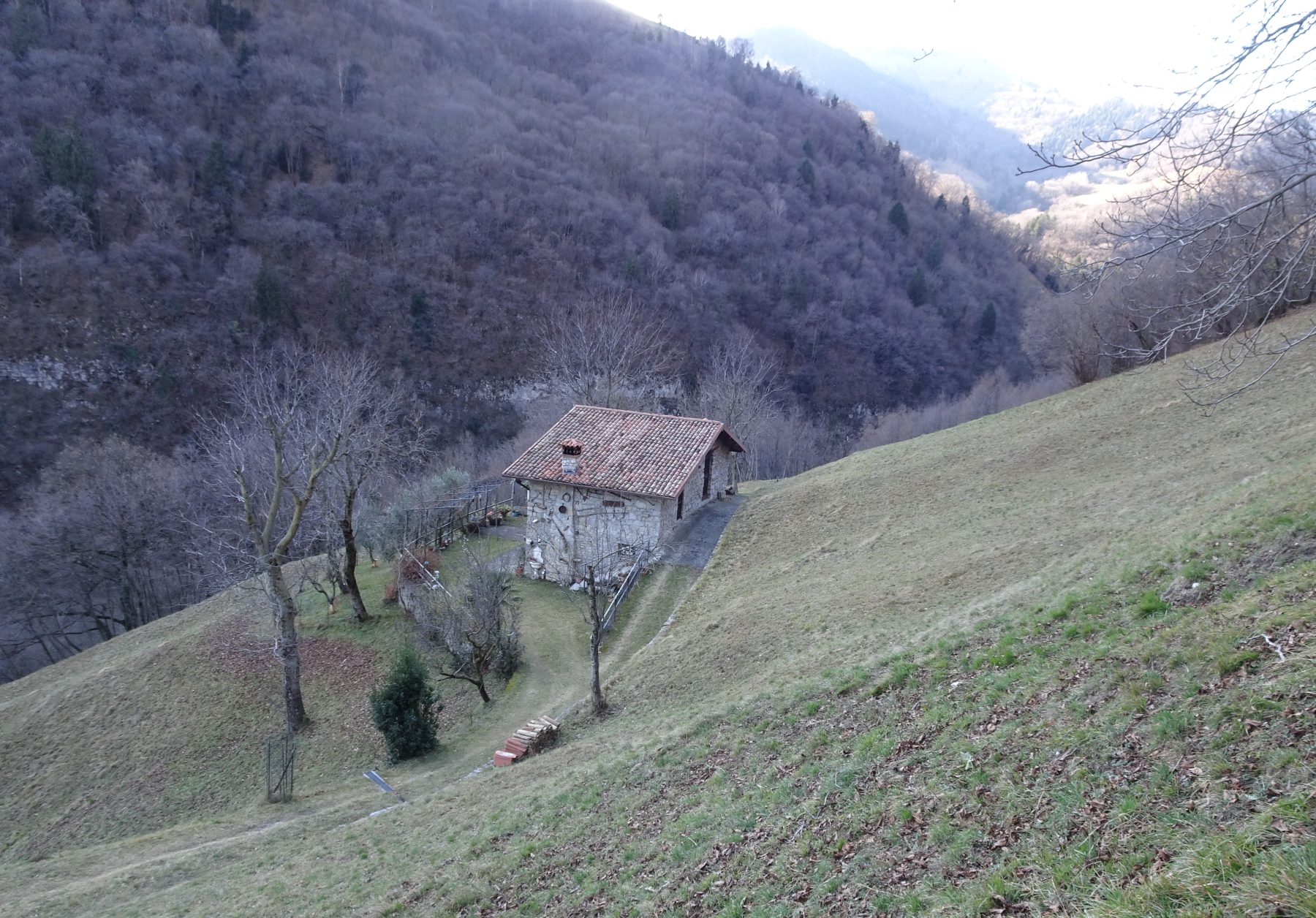
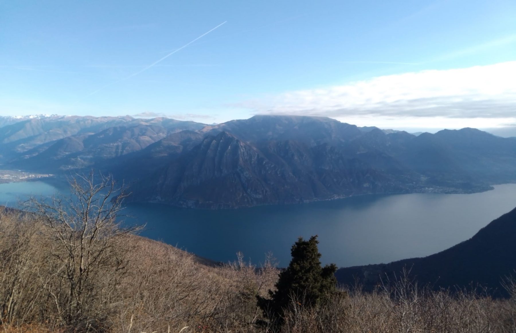
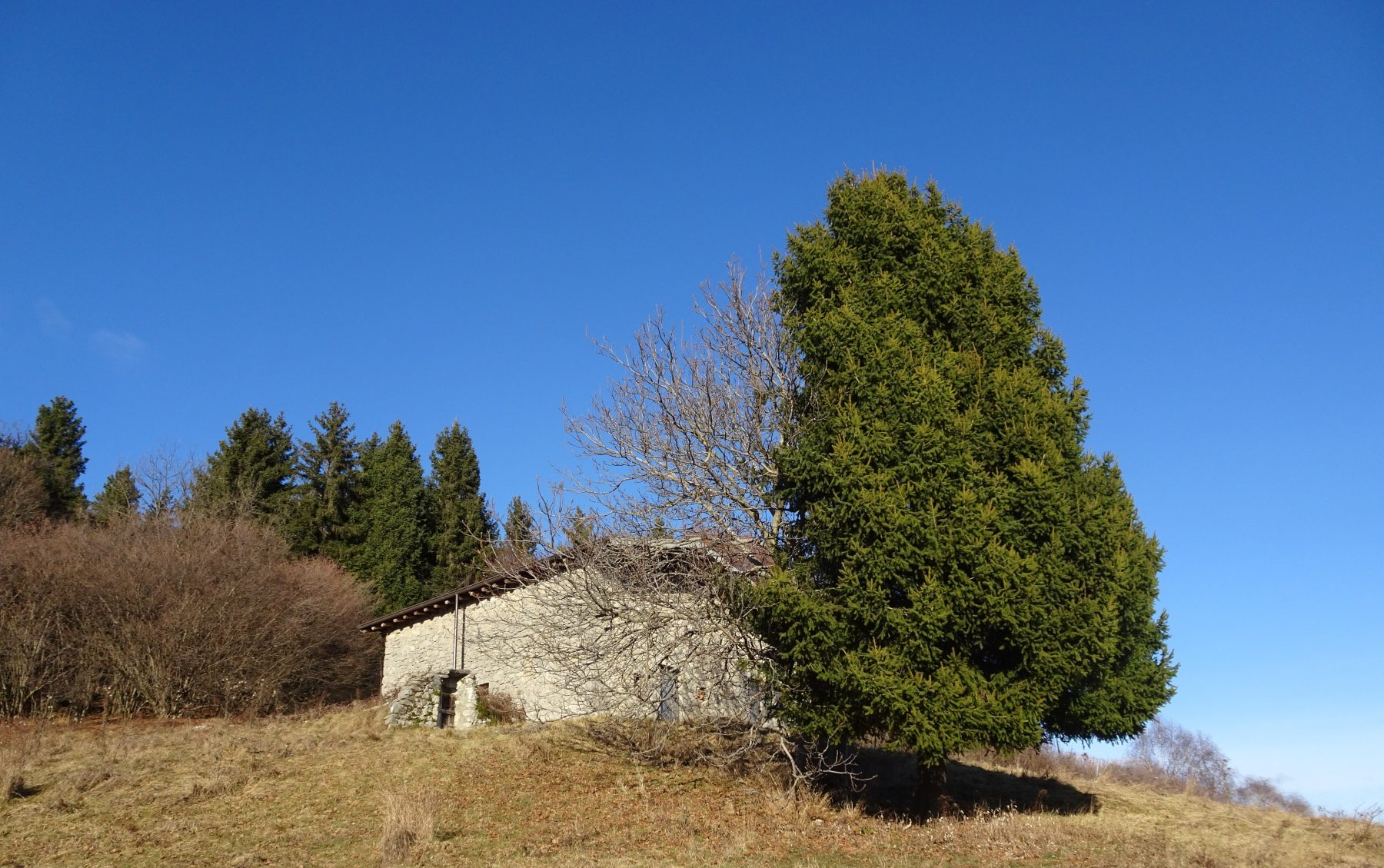
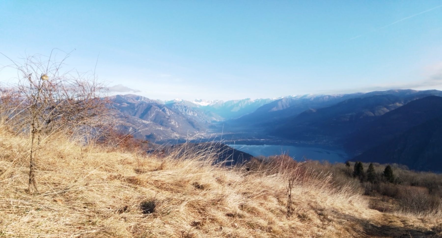
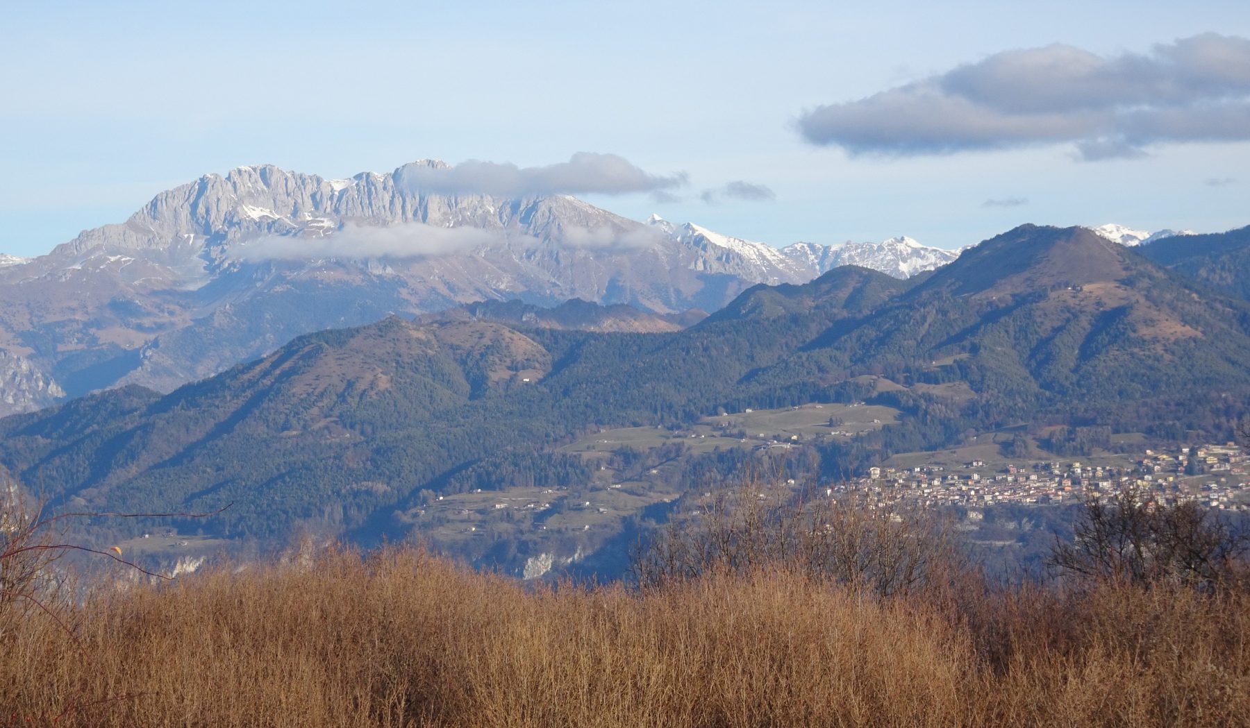
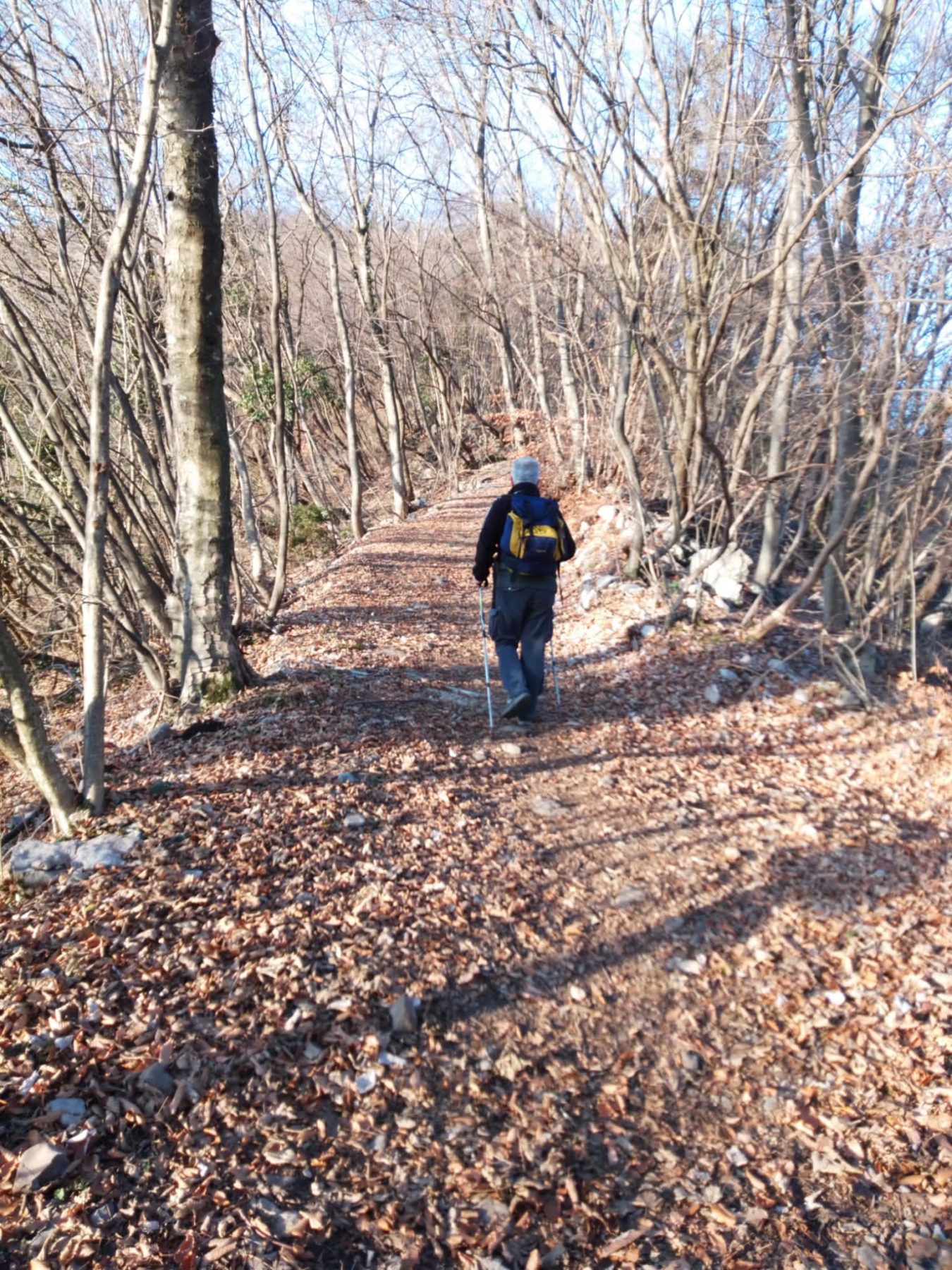
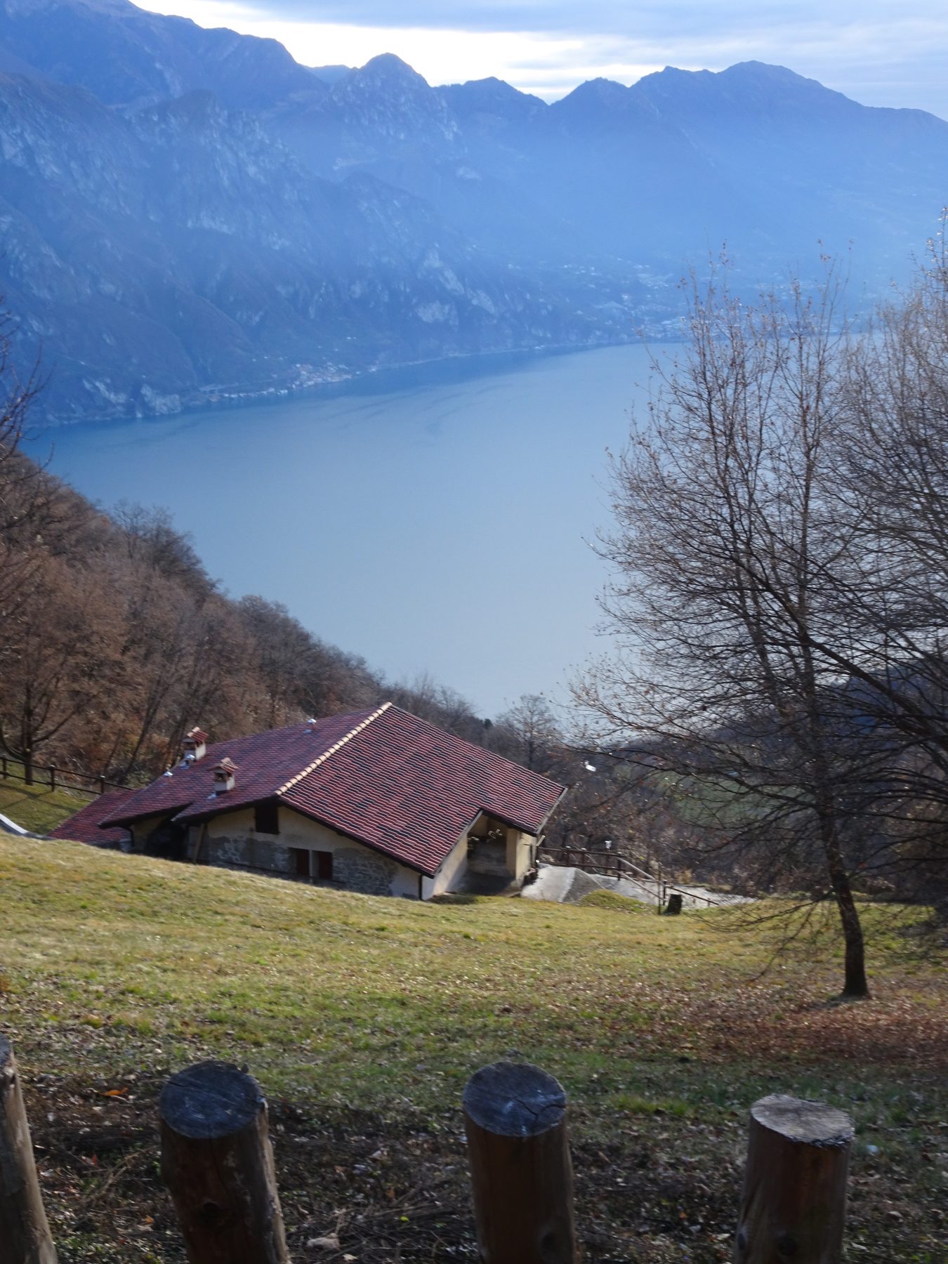
The trail to follow is CAI path n. 568-direction Monte Boario. The red and white signs indicate the climb to the church and follow the steep Via Tasso with wide views of the lake. The paved road becomes then cemented up to the large terrace of a farmstead. Shortly after, the road reaches the locality of Font, where the road turns into a path. Following the signs, go up to the right into a deciduous forest. Keep to the right, following the 568/A trail and continue uphill until you reach the wide wooded ridge, in the locality Colle di Luen. Near a ruin, you come to another crossroads, where you keep to the left following the signs. Once out of the woods, a vast panorama is shown, with the Presolana on the right, the Valle Camonica with the peaks of Adamello in the North. You climb up a steep slope, sinking your boots into the dry grass of the pasture, until you reach a farmstead guarded by two imposing trees. After passing the rural building, the slope softens and in ten minutes you reach a pleasant birch grove that surrounds a picnic area hosting the “Santella del Boèr”, behind which the track reaches a crossroads. Here you keep left for the summit and after a steep and decisive stretch in the woods you reach a concrete parallelepiped in which, until not long ago, was raised a rustic wooden cross that signaled the most panoramic point in the immediate vicinity of the summit of Monte Boario. From here the show is remarkable, especially towards the lake, the Corna Trentapassi and the Valle Camonica.
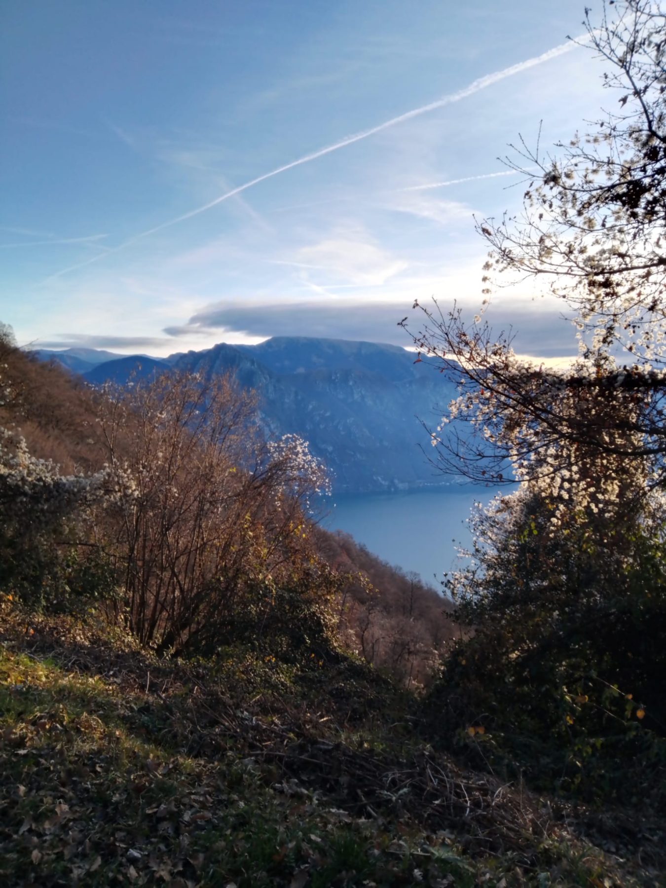
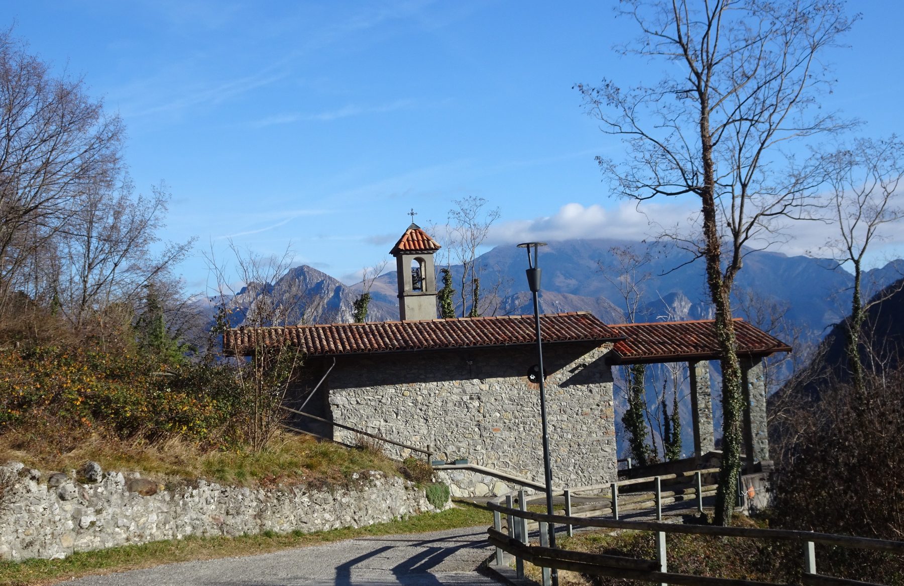
The real summit can be reached by taking a few more steps, immersed in the deciduous forest and therefore devoid of landscape views. It is reached with the aim of continuing south along the ridge that connects it with Monte Sicolo and, further on, towards Monte Torrezzo. The signs of the CAI lead to a ups and downs that touches two rocks placed on the ridge. After the second hunting post, you reach Colle del Dis (1200 m) where the road of Bosco Brugai arrives, which descends towards the Fonteno valley. Once you leave the CAI path n. 568, continue on the asphalt until you cross the mule track that connects the village to Monte Torrezzo and take it turning left. Going down towards Fonteno, you can admire some of the many farmsteads that dot the valley. One kilometer from the crossroads you will find the charming Alpine church of Santello. The next steps are slowed by the spectacular images given by the views that frame the small village in the frame of the lake and its mountains until you reach the first houses and then the parking.
DE – Der Weg, dem man folgen muss, ist der CAI-Weg Nr. 568 – Richtung Monte Boario. Die rot-weißen Schilder weisen auf den Aufstieg zur Kirche und den anschließenden steilen Via Tasso mit weitem Blick auf den See hin. Die Asphaltstraße wird dann betoniert bis zur großen Terrasse eines Bauernhauses. Etwas weiter erreicht die Straße die Ortschaft Font, wo die Straße in einen Weg übergeht. Man folgt den Schildern und geht rechts hinauf in einen Laubwald. Nach etwas mehr als einer Stunde Fußmarsch erreicht man eine Kreuzung. Man hält sich rechts, folgt dem Weg 568/A und setzt den Anstieg fort, bis man den großen bewaldeten Bergrücken im Gebiet Colle di Luen erreicht. In der Nähe einer Ruine erreicht man eine weitere Kreuzung, an der man sich links hält und den Wegweisern folgt. Sobald man den Wald verlässt, eröffnet sich ein weites Panorama mit Presolana auf der rechten Seite, Valle Camonica im Norden und den Adamello-Gipfeln. Mühsam erklimmt man einen steilen Hang und versenkt die Stiefel im trockenen Gras der Weide, bis man ein Bauernhaus erreicht, das von zwei imposanten Bäumen bewacht wird. Nachdem man das ländliche Gebäude passiert hat, wird die Steigung sanfter und in zehn Minuten erreicht man einen angenehmen Birkenhain, der einen Picknickplatz mit der „Santella del Boèr“ umgibt, hinter dem der Weg eine Kreuzung erreicht. Hier hält man sich links in Richtung Gipfel und erreicht nach einem steilen und entscheidenden Stück im Wald ein Betonquader, auf dem bis vor Kurzem ein rustikales Holzkreuz aufgestellt war, das den Aussichtspunkt mit dem besten Ausblick in unmittelbarer Nähe des Monte-Gipfels anzeigte Boario. Von hier aus ist die Aussicht bemerkenswert, insbesondere auf den See, die Corna Trentapassi und das Valle Camonica.
Den eigentlichen Gipfel erreicht man über ein paar weitere Schritte, eingebettet in den Laubwald und somit ohne Landschaftsblicke. Man erreicht ihn mit dem Ziel, in südlicher Richtung weiterzugehen, entlang des Bergrückens, der ihn mit dem Monte Sicolo verbindet, und weiter in Richtung Monte Torrezzo. Die CAI-Schilder führen zu einem Auf- und Abweg, der an zwei auf dem Bergrücken gelegenen Felsen vorbeiführt. Nachdem man den zweiten Jagdstand passiert hat, erreicht man Colle del Dis (1200 m), wo die Bosco-Brugai-Straße ankommt, die in Richtung Fonteno-Tal führt. Sobald man den CAI-Pfad n. 568 verlassen hat, geht man weiter auf Asphalt, bis man auf den Saumpfad stoßt, der die Stadt mit Monte Torrezzo verbindet, und diesen nehmen, indem Sie links abbiegen. Beim Abstieg in Richtung Fonteno können Sie einige der zahlreichen Bauernhäuser bewundern, die das Tal verstreuen. Einen Kilometer von der Kreuzung entfernt stößt man auf die bezaubernde kleine Alpenkirche Santello. Die weiteren Schritte werden durch die spektakulären Bilder verlangsamt, die die Panoramen bieten, die das kleine Dorf im Rahmen des Sees und seiner Berge umrahmen, bis man die ersten Häuser und dann den Parkplatz erreicht.
How to arrive and where to park / Anreise und Parkplätze
Follow the signs for Lake Iseo and take the SP 469 to Riva di Solto. Here you go up along the SP 77 to Solto Collina and continue following the signs to Fonteno.
There are some parking spaces in Piazza Ongaro or in Piazza Belvedere.
DE – Man folgt der Beschilderung zum Iseosee und nimmt die SP 469 nach Riva di Solto.
Man fährt entlang der SP 77 bis nach Solto Collina und folgt weiter den Schildern bis nach Fonteno.
Parkplätze auf der Piazza Ongaro oder auf der Piazza Belvedere.
Credits: Valter Agliati e Facundo Luchetti
DETAILS
- Difficulty:
Medium - Duration:
3h 30 min - Distance:
8,7 km - Elevation gain:
+630 m - Starting point:
Piazza Ongaro, Fonteno - Arrival point:
Piazza Ongaro, Fonteno - Trail number:
568
Book now:
Scenic walk to the Big Bench in Franciacorta
Rovato
Among vineyards, woods, and breathtaking views, enjoy an authentic experience in the heart of Franci...
 BOOK NOW
Treasure hunt in Franciacorta
Franciacorta
A fun experience suitable for everyone in the vineyards of Franciacorta: a team orientation test bet...
BOOK NOW


