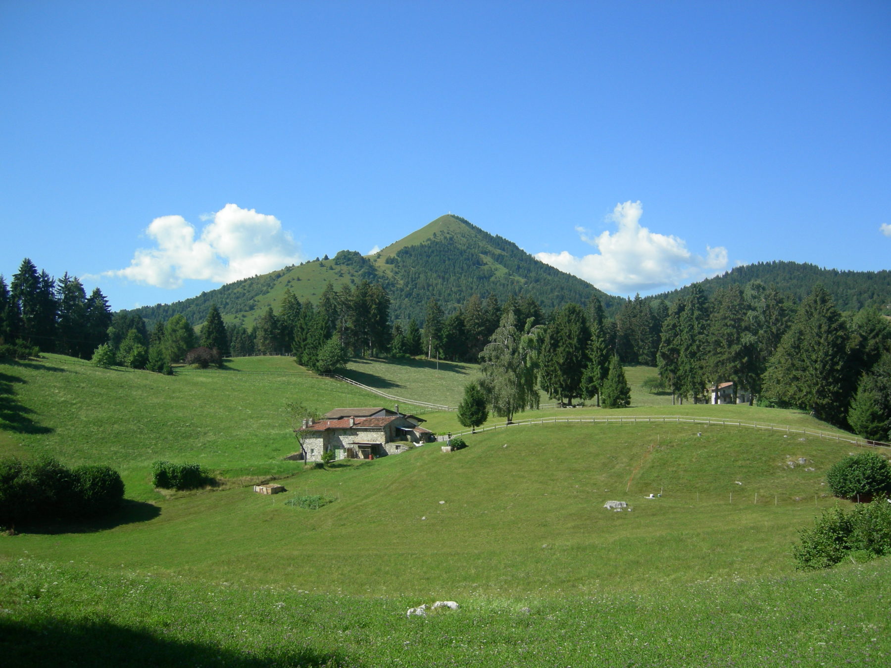
Trekking from Bossico to Monte Colombina
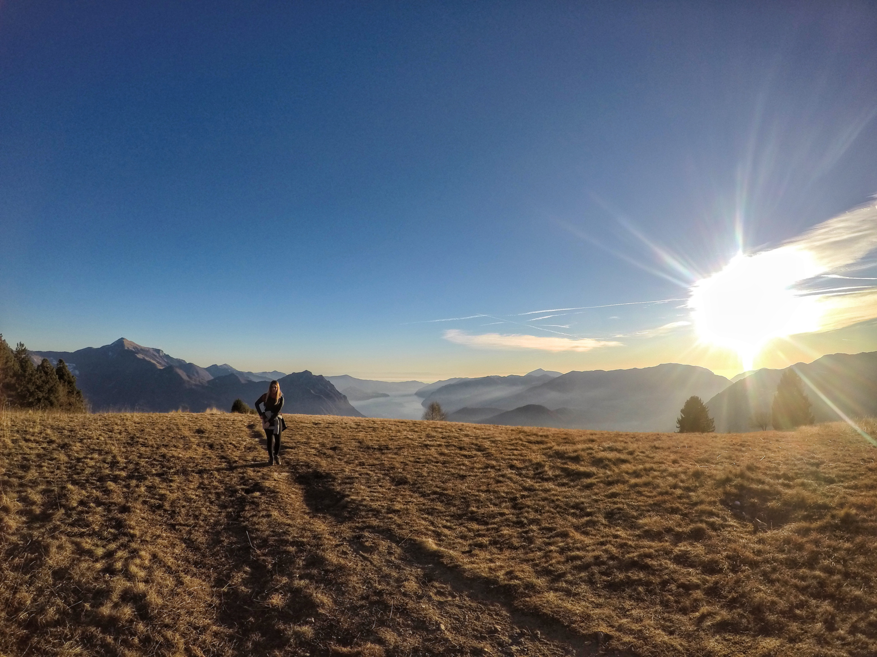
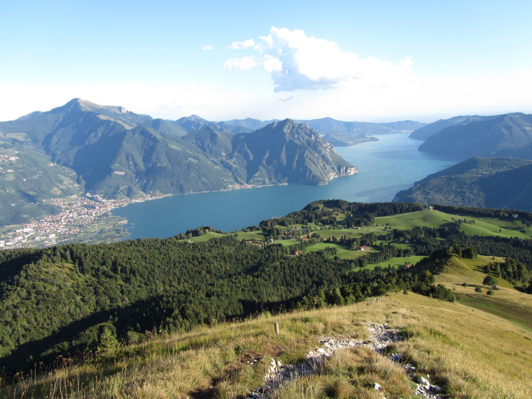
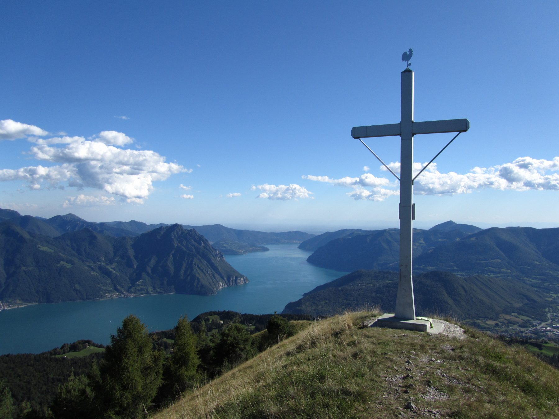
Monte Colombina is a mountain blessed with almost constant sun, overlooking the plateau of Bossico. Its peak offers an unusual perspective of Lake Iseo, seen from the northwest.
DE – Monte Colombina ist ein von der Sonne geküsster Berg, der die Bossico-Hochebene dominiert. Sein Gipfel bietet eine ungewöhnliche Perspektive auf den Iseosee, von Nordwesten ausgesehen.
The trail / der Weg
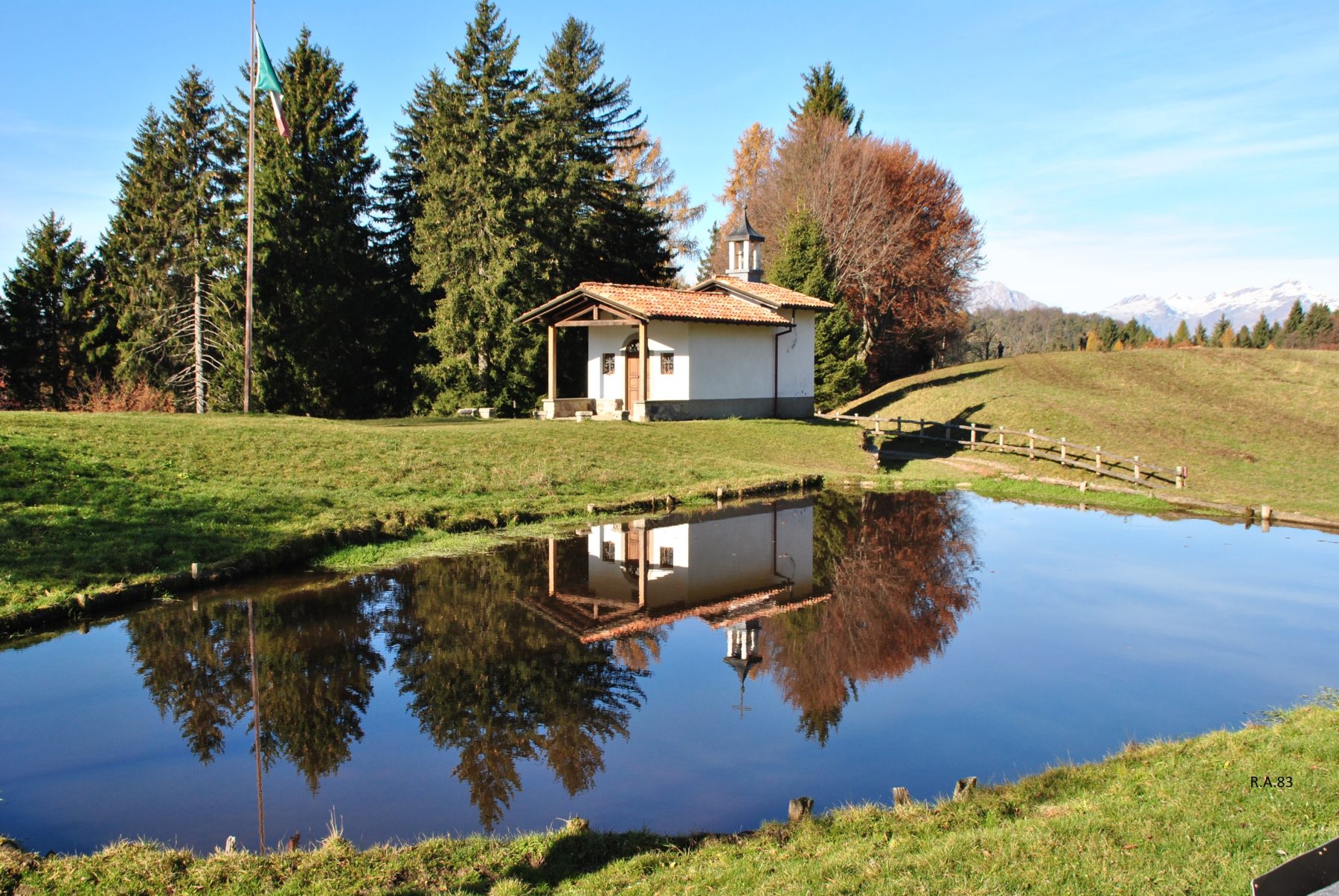
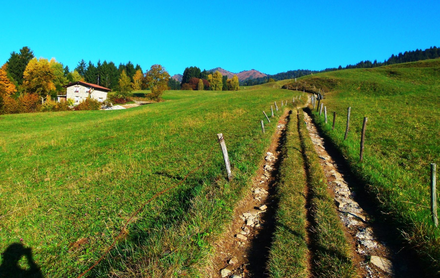
Starting from the small locality of Pila, where there is a small picnic area with tables and drinking water, take the path toward the pine forest. At the second crossroads, follow the signs on the left to Pozza d’Ast. After a rather steep but short climb you arrive again at a crossroads. Continuing on the main path, called “Via Fosca”, the way continues shady in the woods; keeping instead the right, the road runs through sunny meadows. After a few hundred meters the two paths meet in a single road that leads to Pozza d’Ast, where you can stop in a clearing with a large stone and wood shed, equipped with tables and benches, barbecue and a fresh water source. In the clearing, surrounded by majestic fir and beech trees, there is a church built in 1973 and dedicated to the fallen of Bossico of all the wars and a pool called Pozza d’Ast.
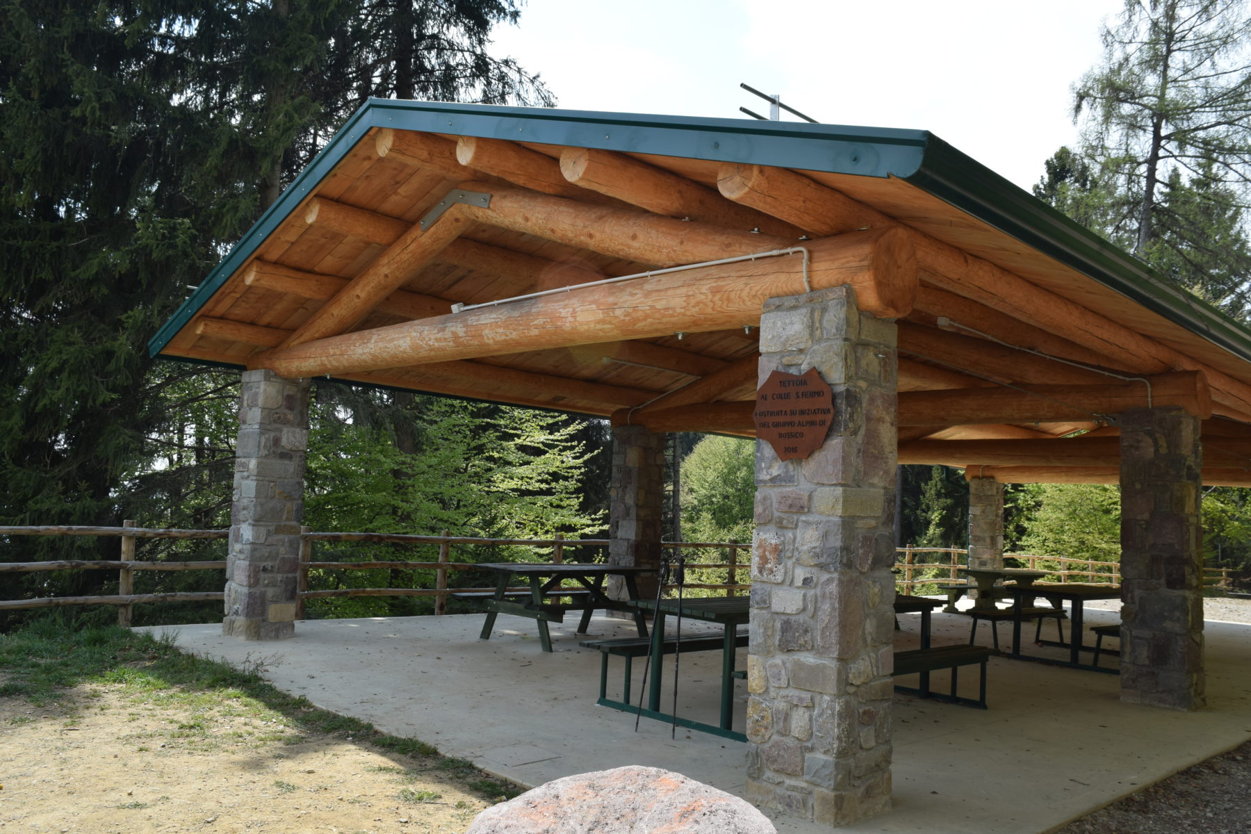
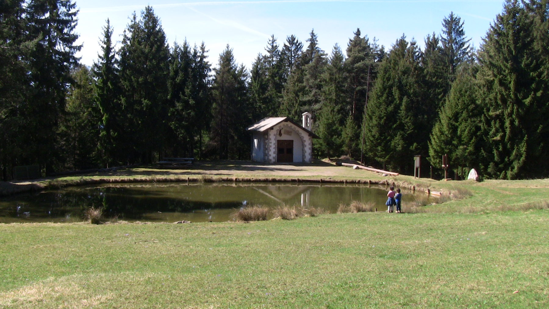
From the locality of Pozza d’Ast it is necessary to take the uphill path until you reach, after almost two kilometers, the Colle di San Fermo (1250 m) where there is a picnic area with a large wooden shed equipped with tables, benches and barbecue, a pool and a small nineteenth century church renovated in 1902.
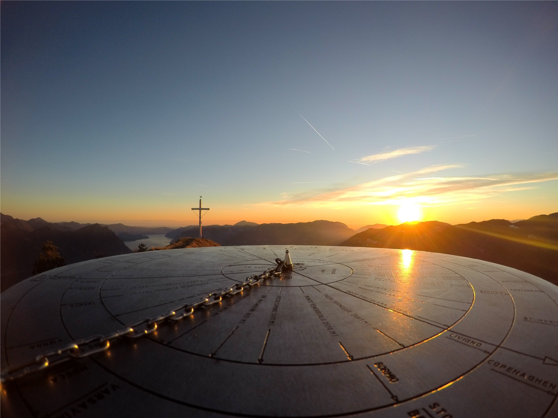
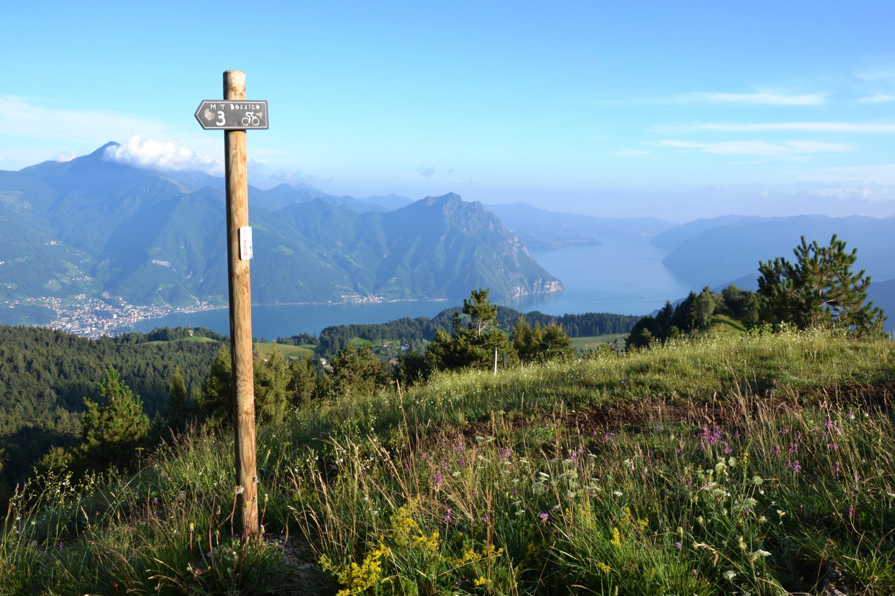
From Colle San Fermo, near the pool, pass behind the church and take the path keeping left and then, after a few meters, right. Go up along the path that leads to the top of Monte Colombina (1458 m), where in May 1951 an iron cross was placed. On the top of the mountain a geolabium/orientation plate with the names of the many mountains that can be admired thanks to the spectacular 360-second view was installed. In the structure of the geolabium there is a small drawer that contains a summit diary. The last part of the path, from Colle San Fermo to the top of Monte Colombina, includes a further 30-minute walk for 800 meters of development and a difference in altitude of 200 meters.
DE – Von Pila aus, wo es einen kleinen Picknickplatz mit Tischen und Trinkwasser gibt, nimmt man den Weg in Richtung Kiefernwald. An der zweiten Kreuzung folgt man den Schildern links nach Pozza d’Ast. Nach einem recht steilen, aber kurzen Anstieg erreicht man wieder eine Kreuzung. Weiter auf dem Hauptweg, dem „Via Fosca“ genannt wird, verläuft der Weg schattig im Wald; Stattdessen verläuft die Route, indem man sich rechts hält, durch sonnige Wiesen. Nach ein paar hundert Metern vereinen sich die beiden Wege wieder zu einer einzigen Straße, die nach Pozza d’Ast führt. Auf der Lichtung, umgeben von majestätischen Tannen und Buchen, befindet sich eine kleine Kirche aus dem Jahr 1973, die den Gefallenen von Bossico in allen Kriegen gewidmet ist, sowie ein Teich namens Pozza d’Ast.
Von Pozza d’Ast aus muss man den Weg bergauf nehmen, bis man nach fast zwei Kilometern den Colle di San Fermo (1250 m) erreicht, wo es einen Picknickplatz mit einem großen Holzschuppen mit Tischen, Bänken und Grills sowie eine Pfütze gibt, und eine kleine Kirche aus dem 19. Jahrhundert.
Von Colle San Fermo, in der Nähe der Pfütze, geht man hinter der kleinen Kirche vorbei und nimmt den Weg, der links und dann, nach ein paar Metern, rechts bleibt. Man steigt auf dem Weg hinauf, der zum Gipfel des Monte Colombina (1458 m) führt, wo im Mai 1951 ein Eisernes Kreuz aufgestellt wurde. Auf dem Gipfel des Berges wurde eine Geolabe/Orientierungstafel mit den Namen der vielen Berge angebracht, die dank der spektakulären 360°-Aussicht bewundert werden können. Im Geolabe-Aufbau befindet sich eine kleine Schublade, die ein Gipfeltagebuch enthält. Der letzte Abschnitt des Weges, vom Colle San Fermo bis zum Gipfel des Monte Colombina, erfordert eine weitere Wanderung von etwa einer halben Stunde über 800 Meter und einen Höhenunterschied von 200 Metern.
How to arrive and where to park / Anreise und Parkplätze
Follow the directions for Lake Iseo and then for Lovere. Take the SP 53 della Valle Borlezza and continue following the signs for Bossico.
From the center of Bossico take Via Tre Santelle until you reach parking 1 in Pila.
DE – Man muss den Schildern für den Iseosee und dann für Lovere folgen. Man nimmt die SP 53 des Borlezza-Tals (Valle Borlezza) und folgt dann den Schildern nach Bossico.
Parkplatz 1 in Pila di Bossico. Am Eingang des Dorfs biegt man links in Via Tre Santelle ab, bis man den Parkplatz erreicht.
Credits: Pro Loco Bossico
DETAILS
- Difficulty:
Medium - Duration:
1h 30 min - Distance:
4,6 km - Elevation gain:
+500 m - Starting point:
Località Pila, Bossico - Arrival point:
Monte Colombina
Book now:
Treasure hunt in Franciacorta
Franciacorta
A fun experience suitable for everyone in the vineyards of Franciacorta: a team orientation test bet...
 BOOK NOW
Scenic walk to the Big Bench in Franciacorta
Rovato
Among vineyards, woods, and breathtaking views, enjoy an authentic experience in the heart of Franci...
BOOK NOW


