Trekking from Pilzone d’Iseo to Punta dell’Orto
Itinerary to discover the hamlet of Pilzone d’Iseo and its viewpoints.
DE – Wanderung zur Entdeckung von Pilzone d’Iseo und ihrer Aussichtspunkte.
The path/Der Weg
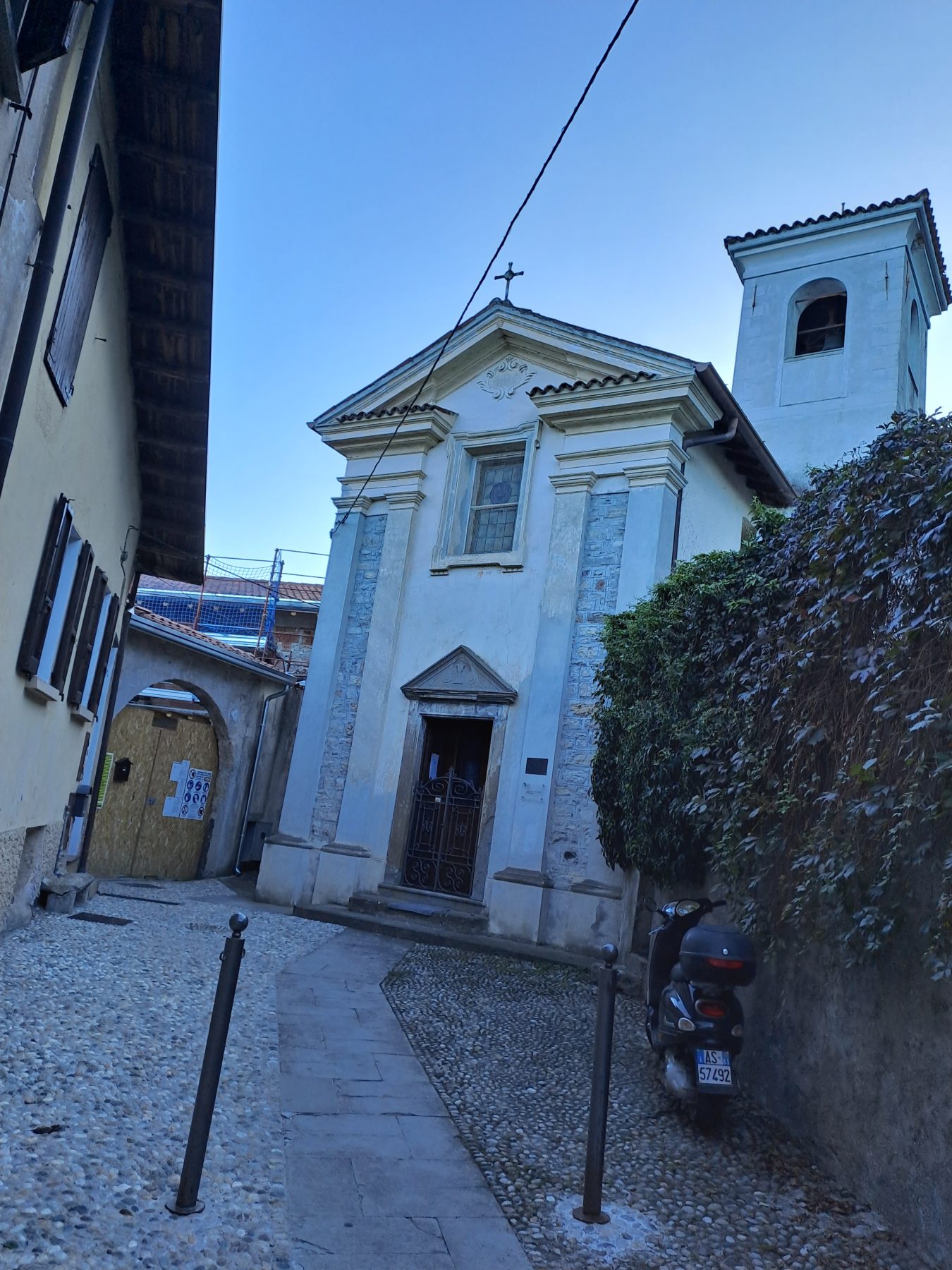
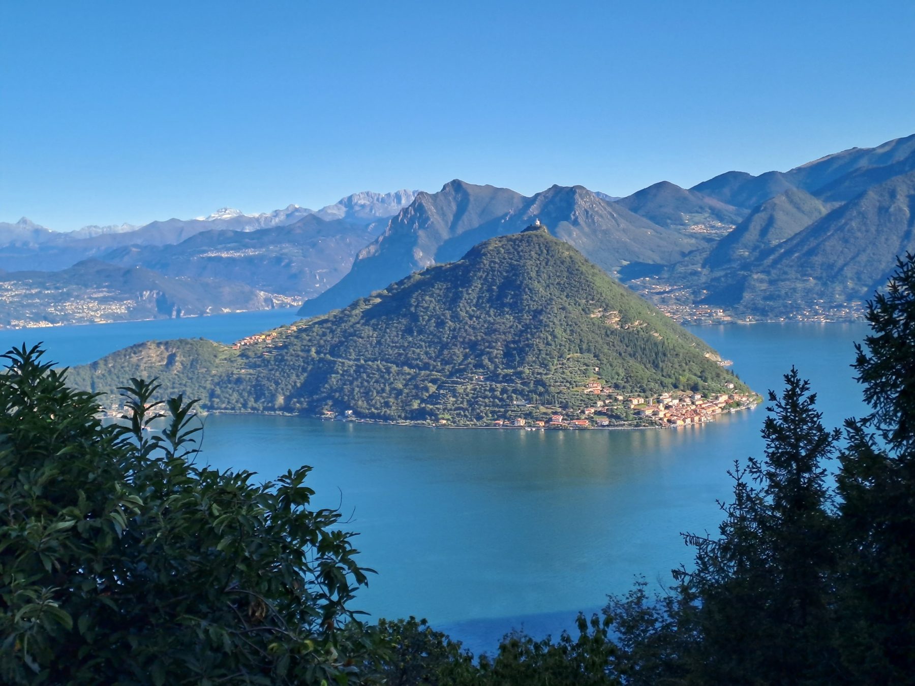
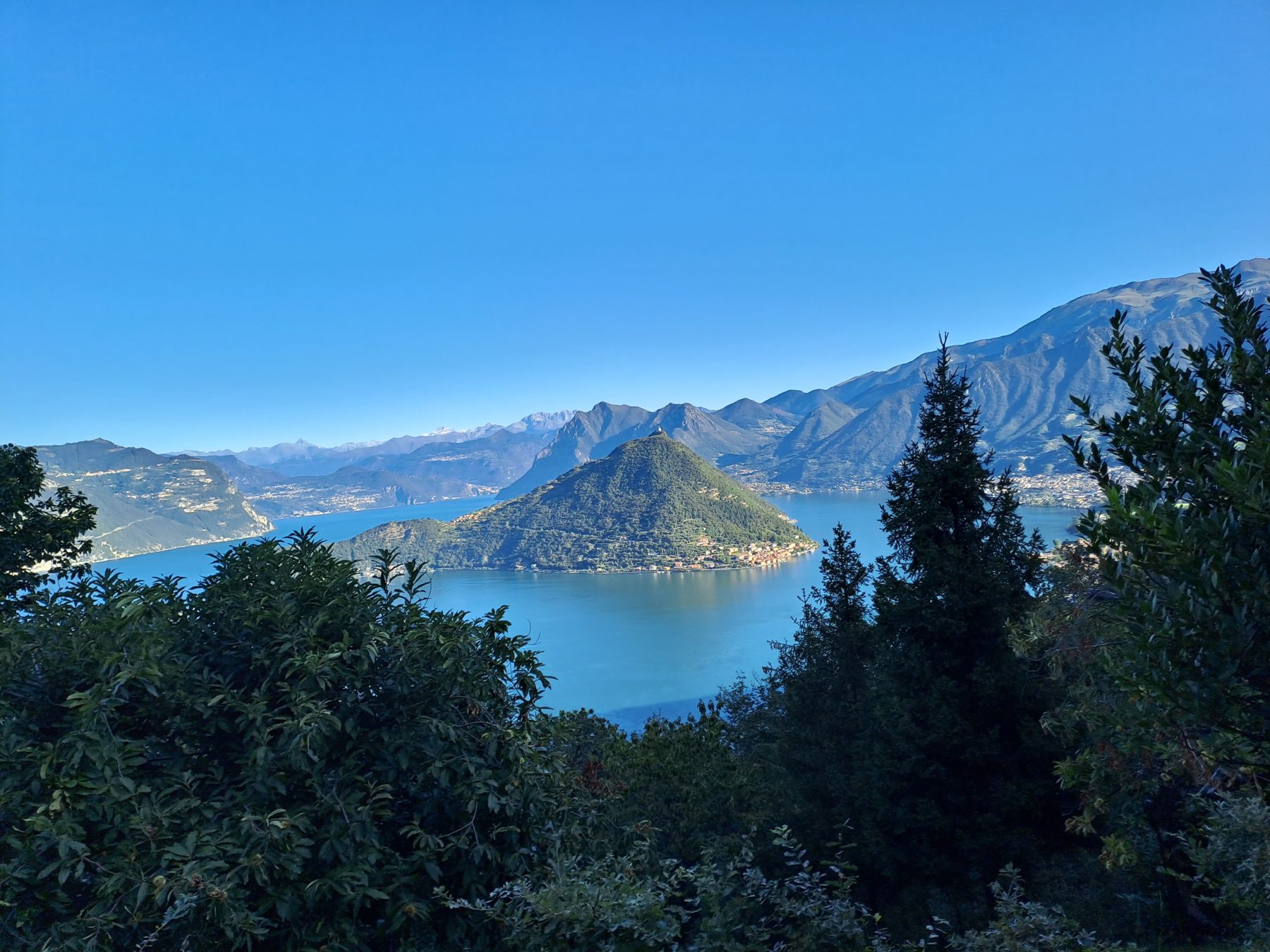
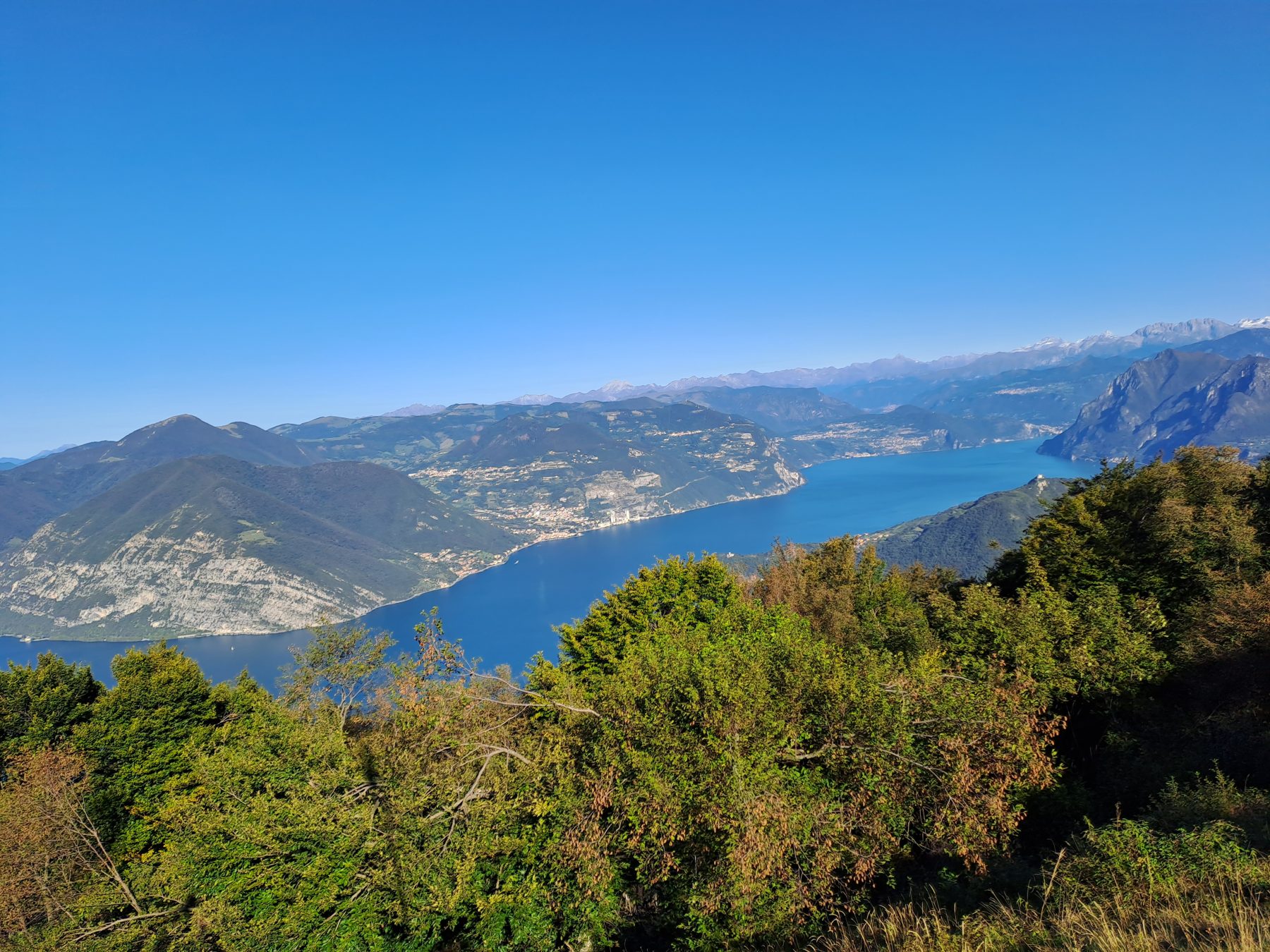
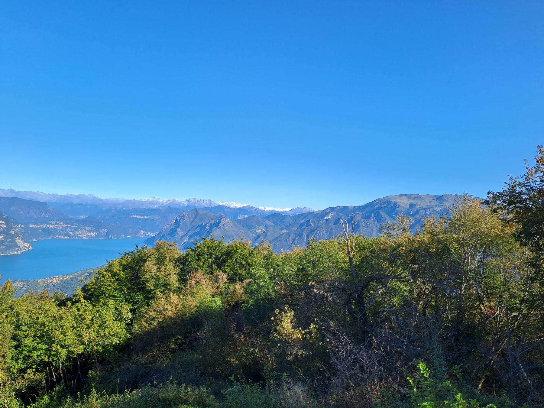
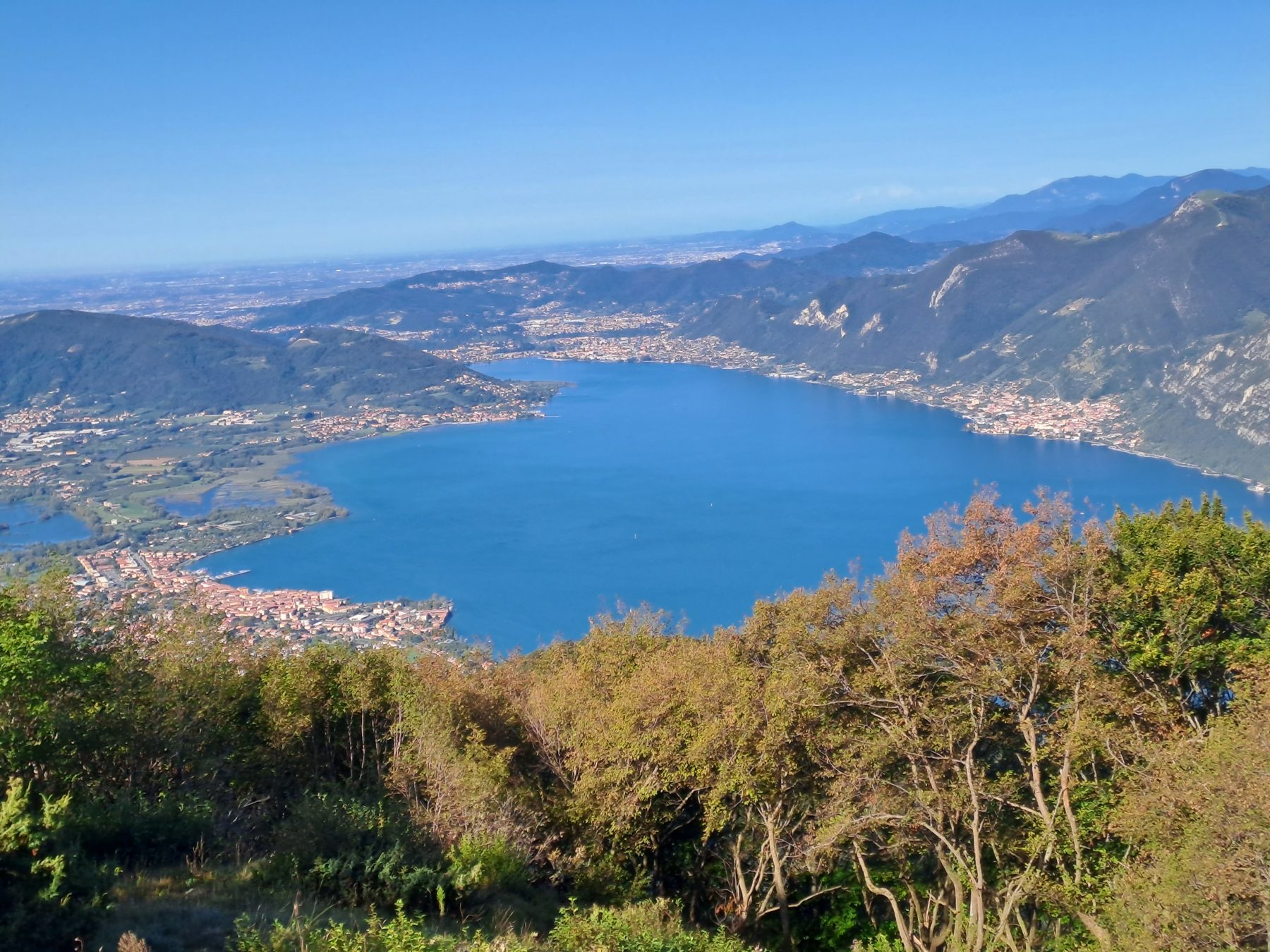
Once you arrive in Pilzone d’Iseo by car or by train, reach Piazza Basilio Cittadini from where the itinerary starts. Following the signs, turn left and then right onto Via San Tommaso. At the end of the street, continue left following the signs for the Big Bench and the signs to the Church of San Fermo (489 m) which can be reached via a cobbled road (CAI 242), which is steep and strenuous at times. If you want, you can visit the clearing of S. Fermo where there is the small church and its bell tower which is completely detached and located at the edge of the meadow, thus offering the first views of the lake. The itinerary continues following the signs for Punta dell’Orto (CAI trail sign 242), always uphill at times steep; at a crossroads of paths continue straight without changing direction. The slope, which remains considerable, characterizes almost the entire final stretch until it suddenly emerges onto a dirt road which we take to the left. Soon you reach an area where there are hunting posts, after which the well-marked path faces the steepest part of the entire ascent, but still short, until reaching the top of Punta dell’Orto (1001 m), a meadow with a large Cross (Croce Foresti). Finally, the view can also extend over Lake Iseo and towards the Bergamo mountains.
To return, take the backward path that leads to the summit; once you reach the path that goes up from Pilzone, continue straight along the dirt road. Leave the huts on the left and once passed pay attention to the white and red CAI trail sign on the trunk of a plant on your left, which indicates the route to follow for the descent until you get to the intersection with the path 290. Here turn left and next crossroads, after about 300 metres, continue right on a steeply downhill path until you reach a crossroads where you continue right towards San Fermo until you reach the entrance to the clearing with the church. Continue downhill along the same mule track as for the ascent, until you reach the starting square.
DE – Die Route beginnt von Piazza Basilio Cittadini. Folgen Sie den Schildern für die Antica Valeriana und biegen Sie links und dann rechts in die Via San Tommaso ab. Am Ende der Straße, gehen Sie links weiter und folgen den Schildern zur Big Bench und den Schildern zum Eremo di San Fermo (489 m), den Sie über eine steile und anstrengende gepflasterte Straße (CAI 242) erreichen. Wenn Sie möchten, können Sie die Lichtung von S. Fermo besuchen, wo sich die kleine Kirche und ihr Glockenturm befinden, der völlig freistehend am Rande der Wiese steht und so den ersten Blick auf den See bietet. Die Route geht weiter und folgt der Beschilderung nach Punta dell’Orto (CAI-Wegweiser 242), immer bergauf, teilweise steil; An einer Wegkreuzung gehen Sie geradeaus weiter. Das immer noch beträchtliche Gefälle prägt fast das gesamte letzte Stück, bis wir plötzlich auf einen unbefestigten Weg münden, den wir nach links nehmen. Bald erreicht man ein Gebiet mit Jagdreviere. Danach führt der gut markierte Weg zum Gipfel der Punta dell’Orto (1001 m) mit ein großes Kreuz (Croce Foresti) und ein herrlichen Blick am Iseosee.
Um zurückzukehren, nehmen Sie den Rückweg, der zum Gipfel führt. Gehen Sie am Bereich mit der Jagdreviere vorbei. Sobald Sie den Weg erreicht haben, der von Pilzone hinaufführt, gehen Sie geradeaus auf der unbefestigten Straße weiter. Lassen Sie die Hütten auf der linken Seite und achten Sie auf das weiß-rote CAI-Wegweiser am Stamm einer Pflanze zu unserer Linken, das den Weg für den Abstieg bis zur Kreuzung mit dem Weg 290 anzeigt. Hier biegen Sie links ab und weiter Nach etwa 300 Metern geht es rechts weiter auf einem steil bergab führenden Weg bis zu einer Kreuzung, an der man rechts weiter in Richtung San Fermo geht, bis man den Eingang zur Lichtung erreicht, auf der sich die kleine Kirche befindet. Weiter geht es bergab auf demselben Saumpfad wie beim Aufstieg, bis Sie den Startplatz erreichen.
How to arrive and where to park/Anreise und Parkplatz
Follow indications for Lake Iseo and Iseo. Take the former provincial road SP 510 until you reach Pilzone d’Iseo.
Free parking space near Pilzone d’Iseo’s cemetery.
DE – Man muss den Wegbeschreibungen für den Iseosee und Iseo folgen, und dann die ex SP 510 Straße bis Pilzone d’Iseo nehmen.
Kostenlose Parkplätze in der Nähe vom Friedhof in Pilzone d’Iseo.
Credits: Massimo Colosio
DETAILS
- Difficulty:
Medium - Duration:
3 h - Distance:
7 km - Elevation gain:
+800 m - Starting point:
Piazza Basilio Cittadini, Pilzone d'Iseo - Arrival point:
Piazza Basilio Cittadini, Pilzone d'Iseo
Book now:
Treasure hunt in Franciacorta
Franciacorta
A fun experience suitable for everyone in the vineyards of Franciacorta: a team orientation test bet...
 BOOK NOW
Scenic walk to the Big Bench in Franciacorta
Rovato
Among vineyards, woods, and breathtaking views, enjoy an authentic experience in the heart of Franci...
BOOK NOW


