Trekking from Marone to Monte Cunicolo
Ring route, which is not so known and little frequented, but very fascinating and challenging, recommended only to experienced hikers, both for its difficulty and for the exposure.
DE – Es handelt sich um einen Rundweg, wenig bekannt und wenig begangen, aber sehr faszinierend und lehrreich, aufgrund des Schwierigkeitsgrads und der Exposition nur für erfahrene Wanderer zu empfehlen.
The trail / der Weg
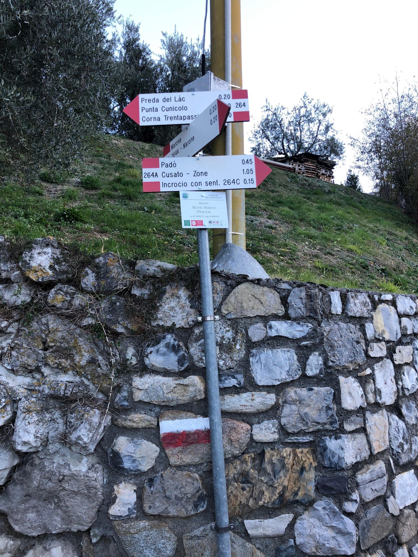
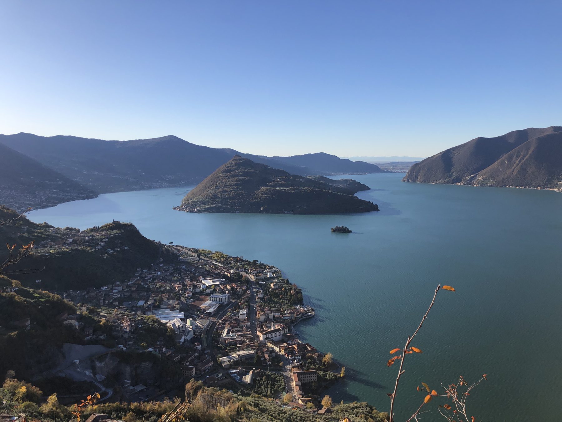
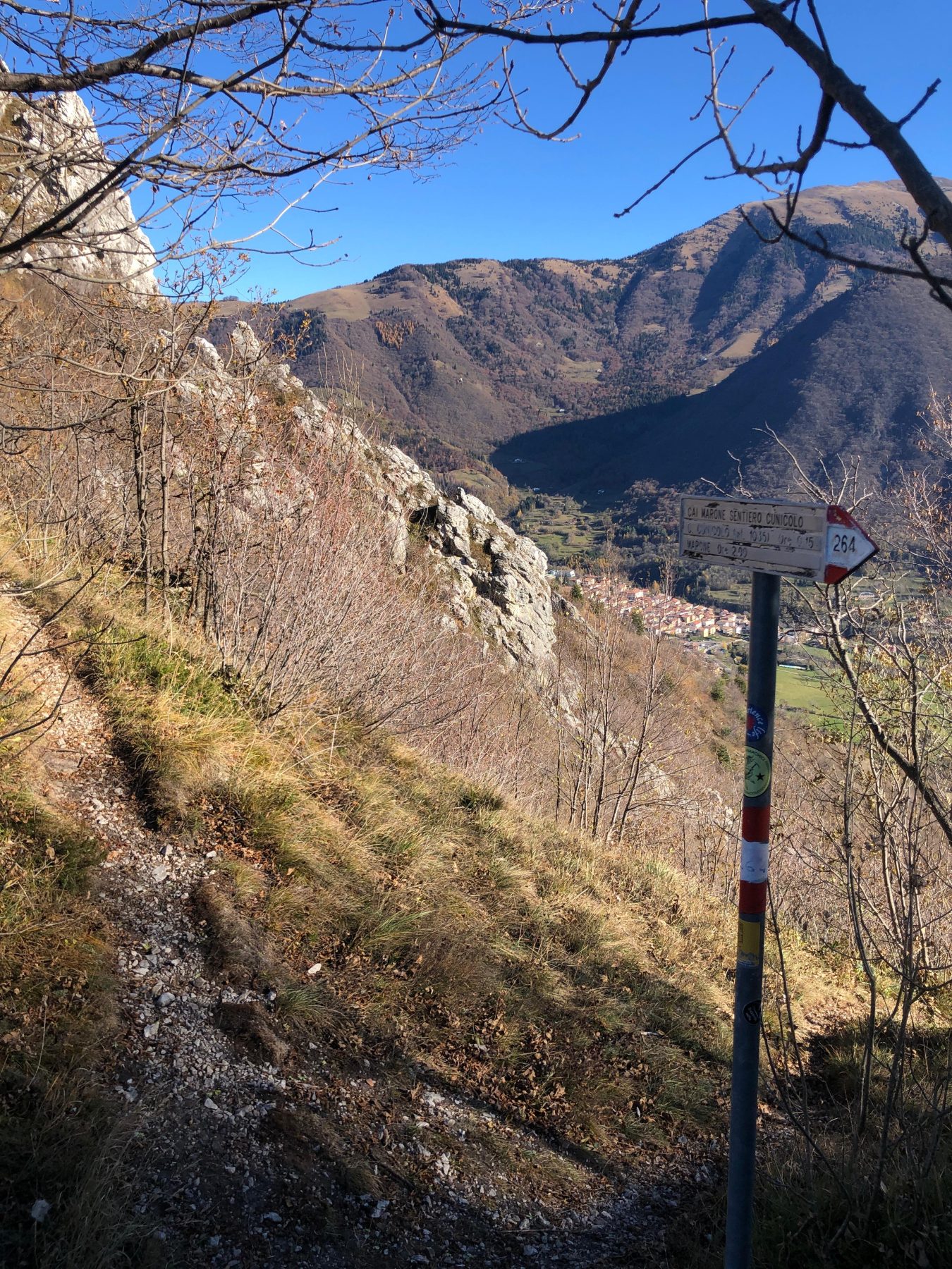
The itinerary starts from Marone, in Piazze, where there is the CAI 264 sign. The path, on a cobbled road, leads to the village of Monte di Marone. Turn left on the paved road and, immediately after, right at the CAI signs, taking the path that leads steeply into the woods. After twenty minutes of walking in the vegetation, you reach the “Pietra del Lago”: a huge and characteristic erratic boulder from which you begin to admire the lake below.
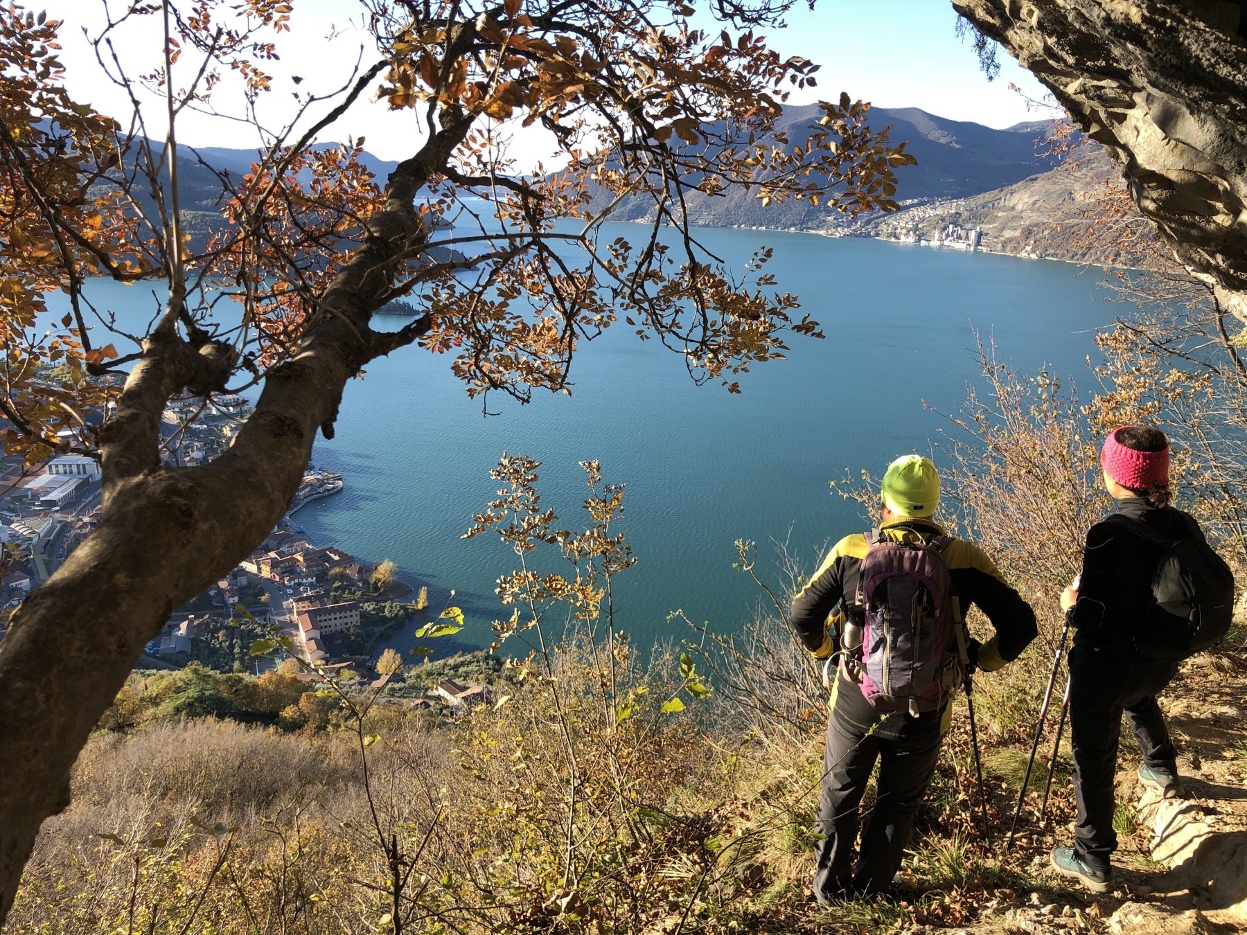
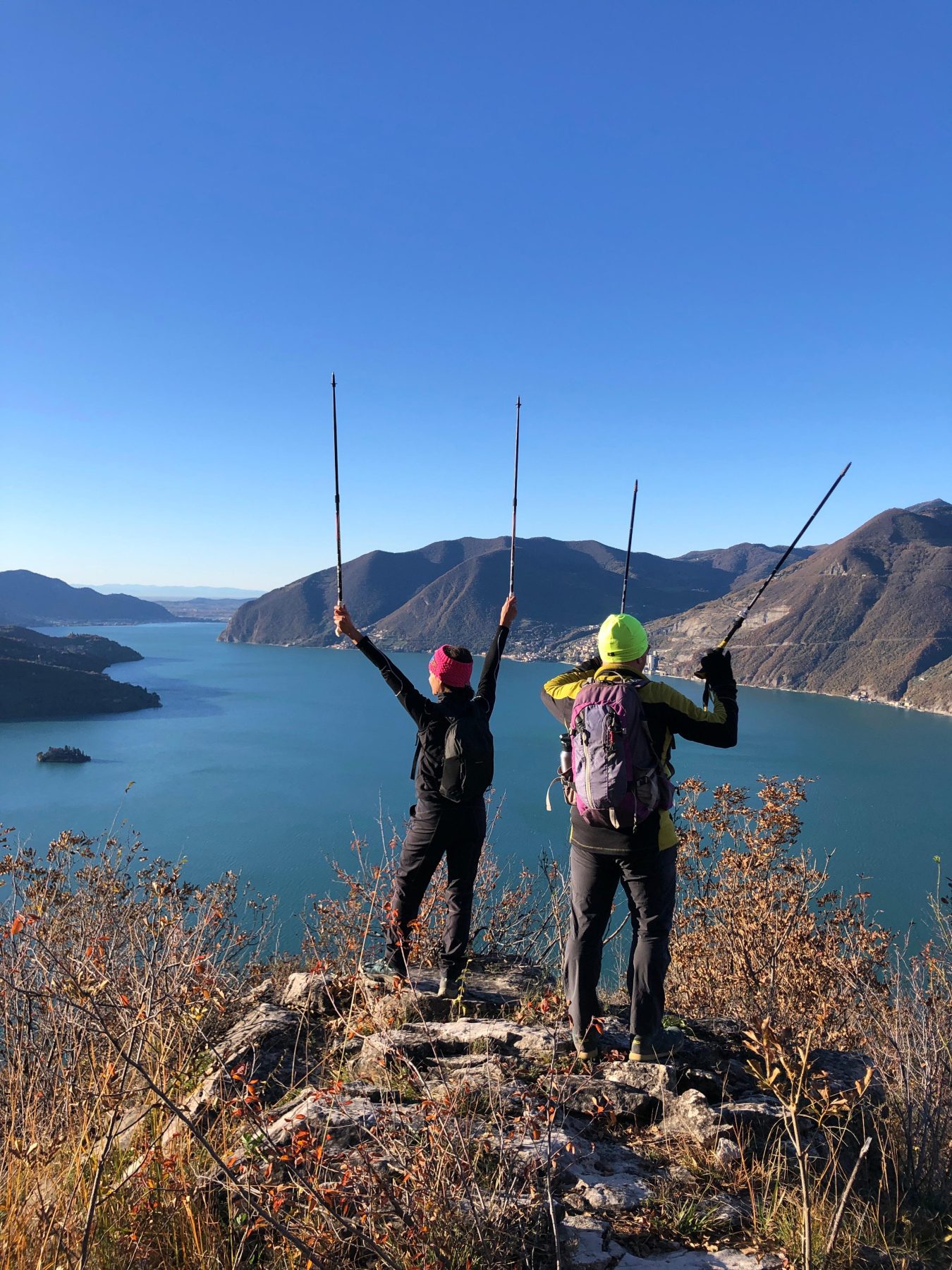
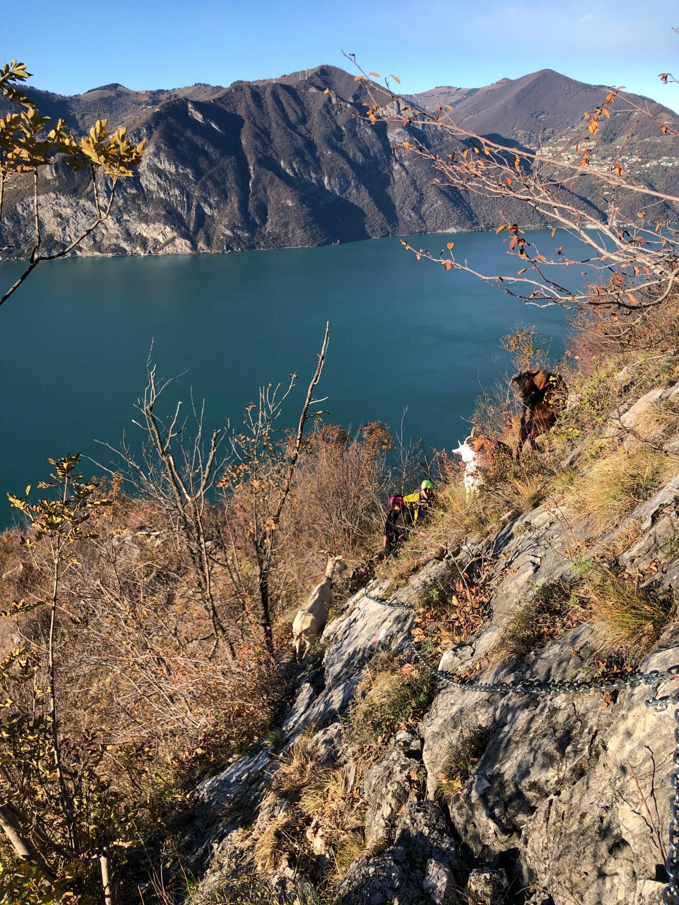
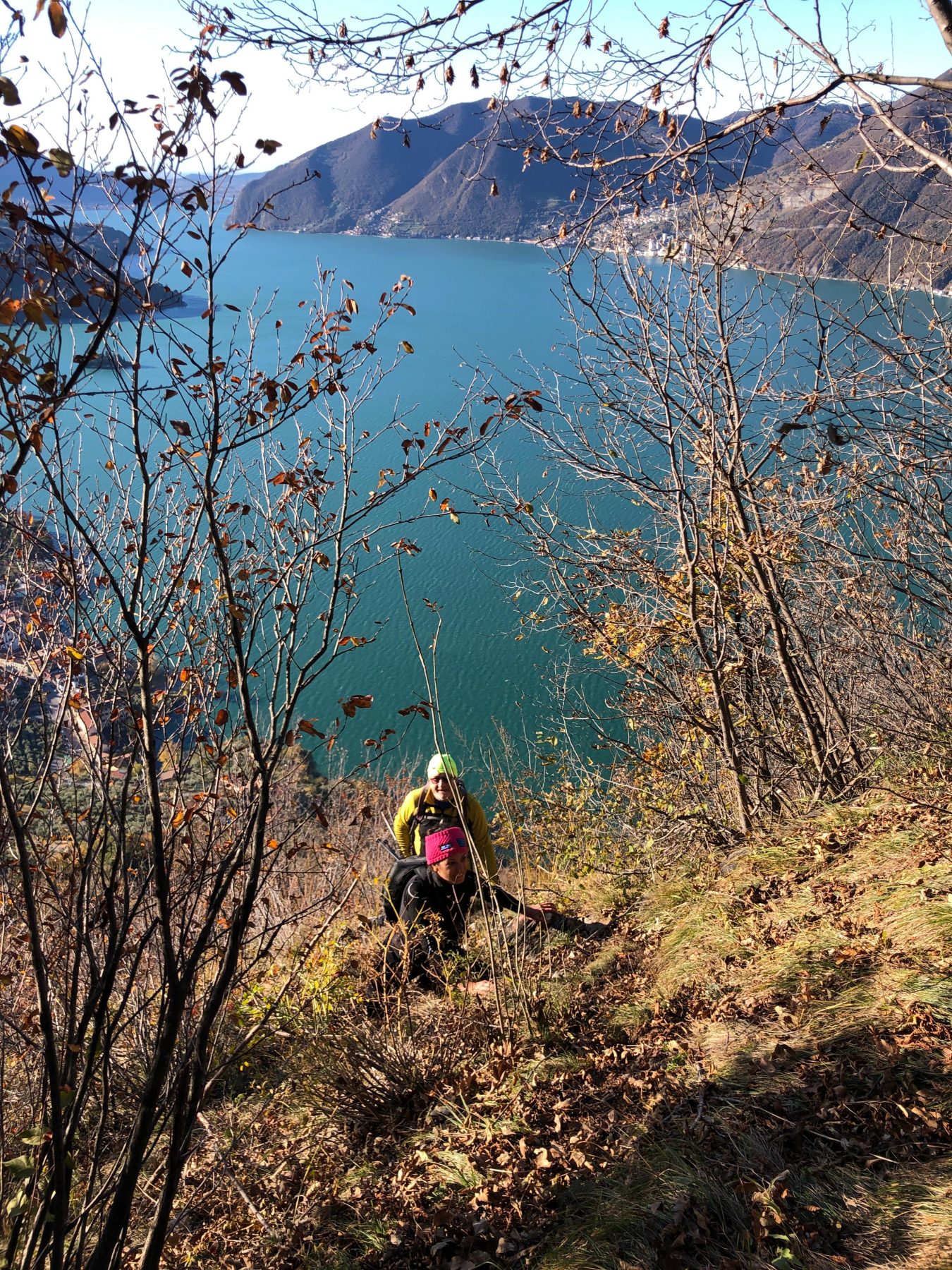
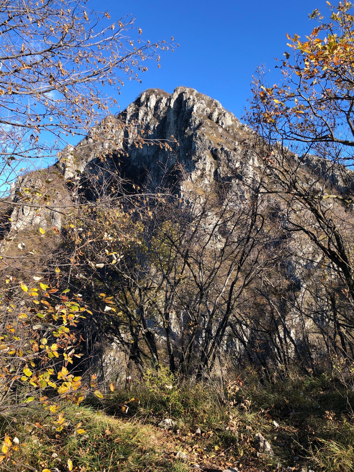
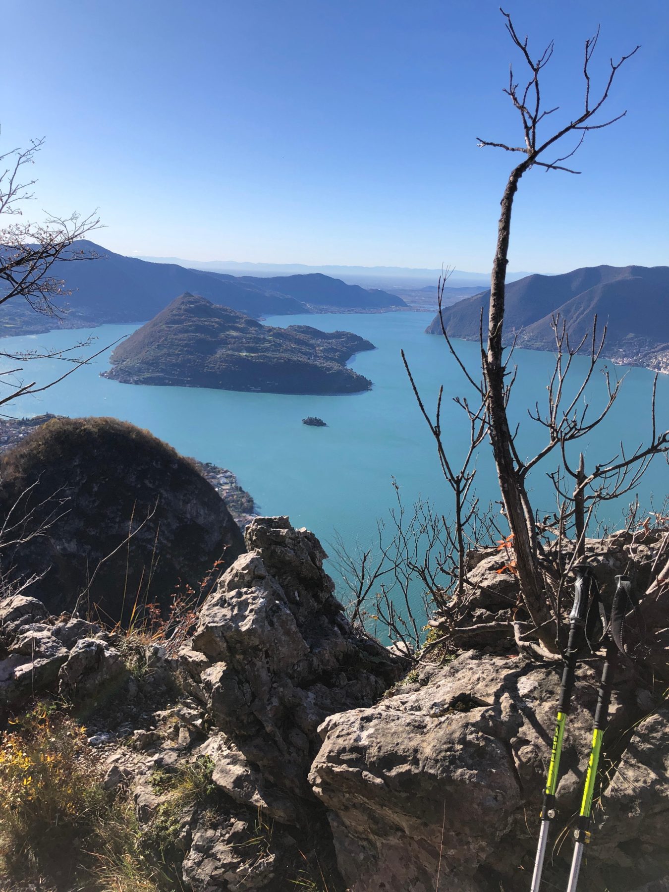
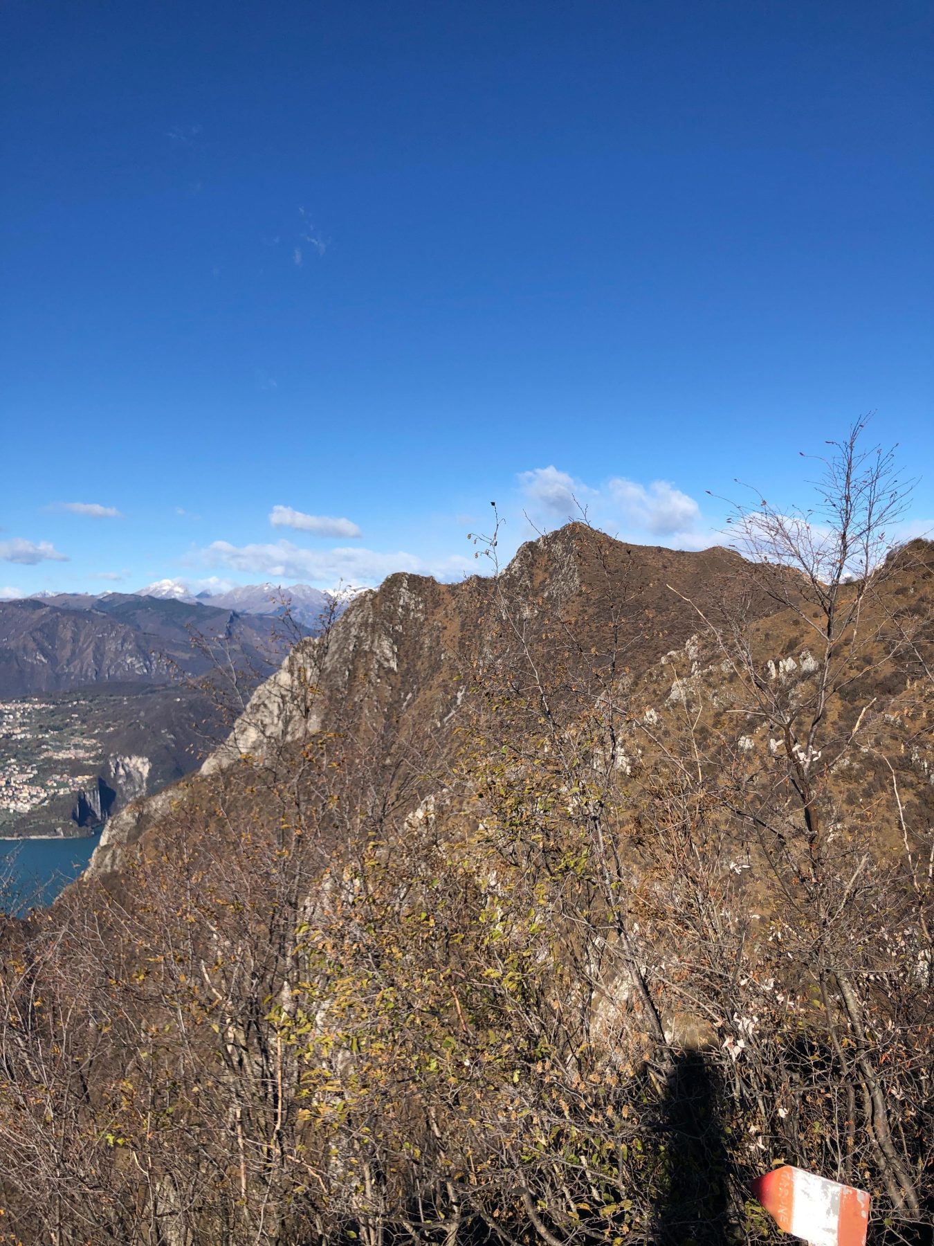
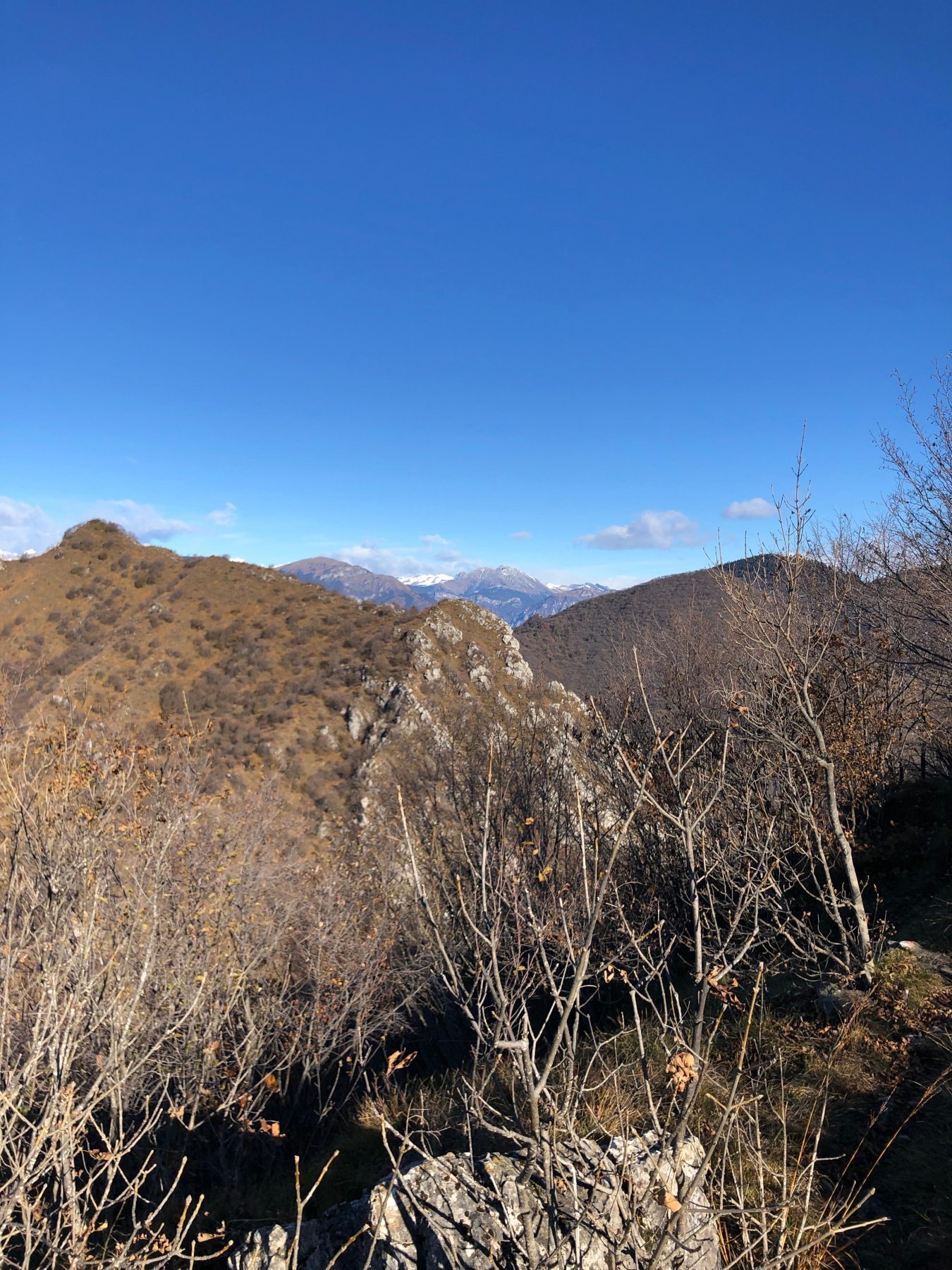
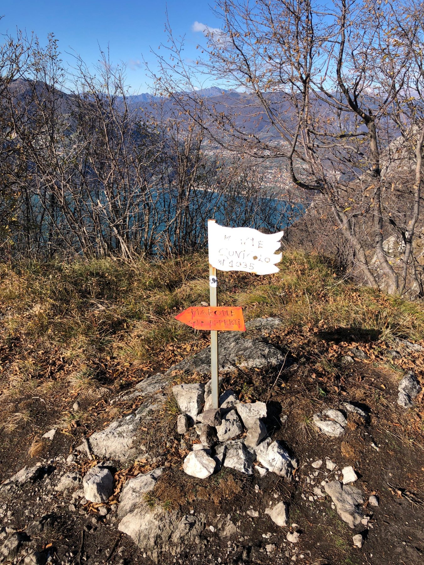
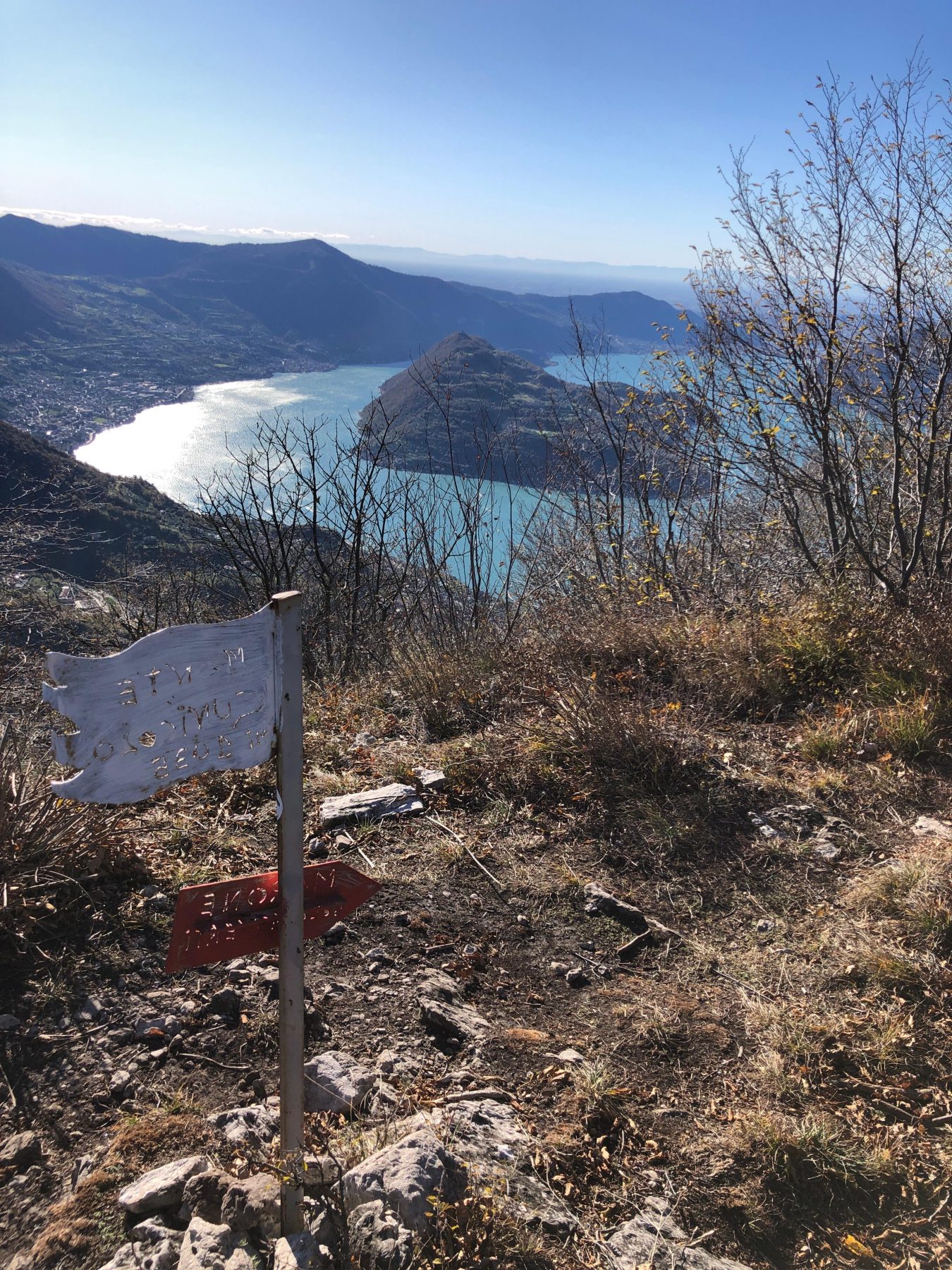
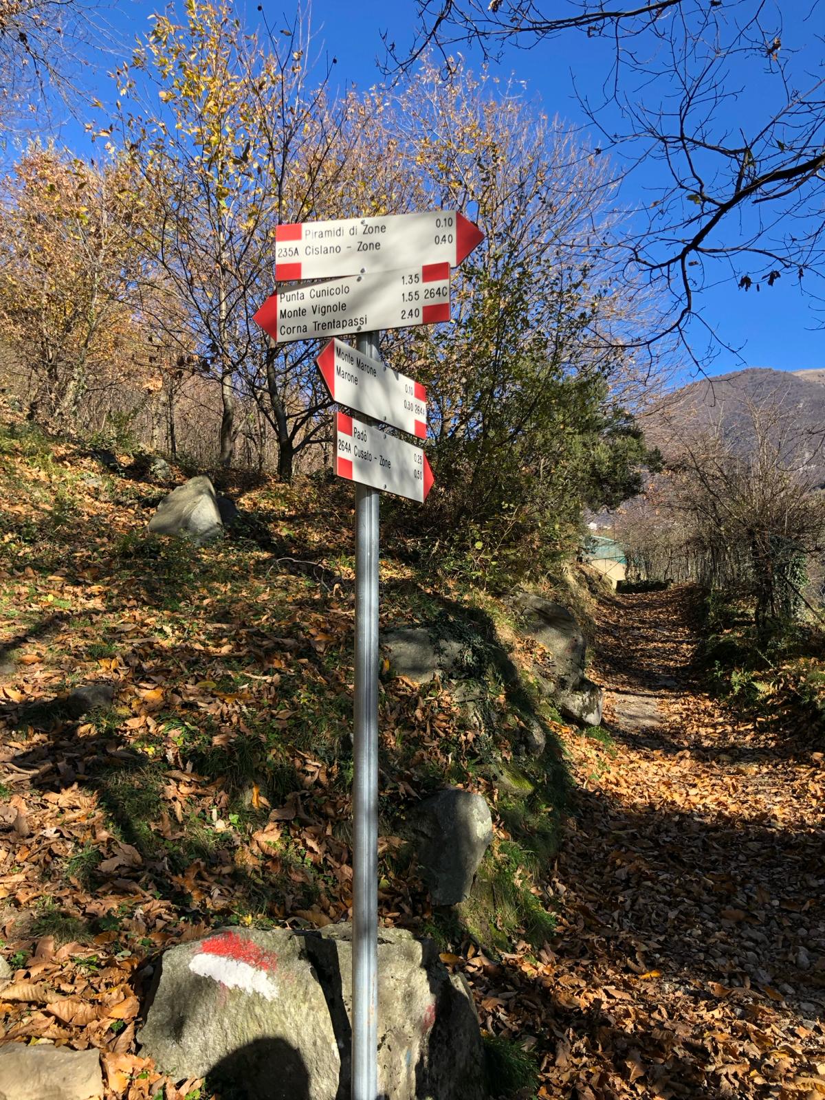
The route becomes challenging, as a passage on diagonal rock, equipped with metal cables, deserves a little attention. On the other hand, the view is spectacular, with views of Monte Isola, Iseo, Vello and the Bergamo shore of Lake Iseo, from Tavernola to Lovere. The path enters the woods again and continues on the ridge until you reach the foresummit of the peak Cunicolo, at 768 meters. From here, a slight descent leads to a mountain pass, where a forcella allows a possible return to the hamlet of Monte Marone, along the path 264 C, which is a variant of the climb. Continuing towards north, north-west, cross a grassy ledge with a direct view on the village of Vello. The path then continues to climb to the summit of Mount Cunicolo at 1034 meters, where the view repays the effort made.
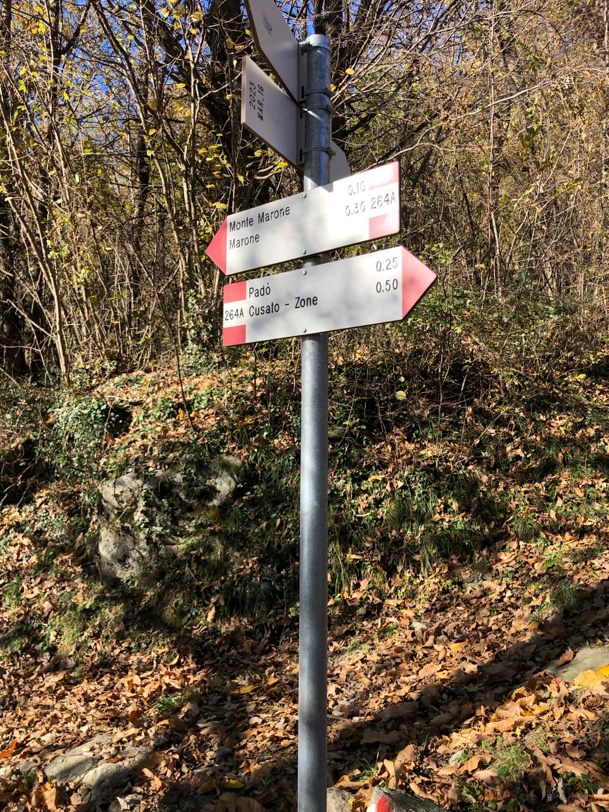
From the top of Monte Cunicolo, the trail continues downhill to the little forcella Gadol, where the trail ends and the CAI 229 trail continues in the direction of Monte Vignole and Corna Trentapassi. The proposed itinerary, instead, from the small forcella proceeds on trail 229, but in the opposite direction, going down to the right, towards Zone. After about 20 minutes from the small forcella, before the entrance in the hamlet of Cusato Sant’Antonio, you find a bridge on the left. Cross it and, following the CAI 264A trail you enter the path that in 45 minutes leads back to Monte Marone and, continuing for another 15 minutes, to the village of Marone, where you left the car.
DE – Die Route beginnt in Marone im Piazze-Gebiet, wo sich das Wegweiser CAI 264 befindet. Der Weg führt auf einer gepflasterten Straße zum Dorf Monte di Marone. Man biegt links auf die Asphaltstraße ab und nimmt gleich rechts an den CAI-Schildern den Weg, der steil in den Wald führt. Nach einem zwanzigminütigen Spaziergang durch die Vegetation erreicht man den „Stein des Sees“: einen riesigen und charakteristischen Findling, von dem aus man beginnt, den Spiegel des Sees darunter zu bewundern.
Die Route wird anspruchsvoll, da eine diagonale Felspassage, ausgestattet mit Metallseilen, eine gewisse Aufmerksamkeit benötigt. Andererseits ist die Aussicht spektakulär, mit Blick auf Monte Isola, Iseo, Vello und das Bergamo-Ufer des Iseosees, von Tavernola bis Lovere. Der Weg führt wieder in den Wald und führt weiter auf dem Bergrücken bis zum Vorgipfel der Punta Cunicolo auf 768 Metern. Von hier aus führt ein leichter Abstieg zu einer Gabelung, wo eine Kreuzung eine mögliche Rückkehr zum Weiler Monte Marone über den Weg 264 C ermöglicht, der auch eine Variante des Aufstiegs darstellt. Wenn man den Weg in nördlicher, nordwestlicher Richtung fortsetzt, überquert man einen grasbewachsenen Felsvorsprung mit direktem Blick auf die Stadt Vello. Anschließend steigt der Weg wieder bergauf bis zum Gipfel des Monte Cunicolo auf 1034 Metern, wo die Aussicht wie immer die Anstrengung belohnt.
Vom Gipfel des Monte Cunicolo führt der Weg weiter bergab bis zum Ausstieg Gadol, wo der Weg endet und den Staffelstab zum CAI-Weg 229 übergibt, der weiter in Richtung Monte Vignole und Corna Trentapassi führt. Die empfohlene Route verläuft ab der Ausstiegsstelle auf derselben Straße 229, jedoch in entgegengesetzter Richtung, und führt nach rechts bergab in Richtung Zone. Etwa 20 Minuten nach der Ausstiegsstelle, bevor man den Weiler Cusato Sant’Antonio erreicht, findet man auf der linken Seite eine kleine Brücke. Man überquert ihn und folgt dem Wegweiser CAI 264A. Man gelangt auf den Weg, der in 45 Minuten zurück zum Monte Marone und nach weiteren 15 Minuten zum Ort Marone führt, wo man das Auto abgestellt hat.
How to arrive and where to park / Anreise und Parkplätze
Go along the coastal road ex SP 510 until you reach Marone.
Cross the centre of the village up to the municipal library, where you can park your car (Via Roma 83/85).
DE – Man folgt der Küstenstraße ex SP 510 bis nach Marone. Man durchquert die Innenstadt bis zur Stadtbibliothek.
Wir empfehlen, das Auto in der Nähe der Stadtbibliothek Marone in der Via Roma 83/85 zu parken.
DETAILS
- Difficulty:
EQUIPPED EXPERT HIKER - Duration:
4h - Distance:
8,1 km - Elevation gain:
+885 m - Starting point:
Via Risorgimento, Marone - Arrival point:
Via Risorgimento, Marone - Trail number:
264, 229, 264A
Book now:
Treasure hunt in Franciacorta
Franciacorta
A fun experience suitable for everyone in the vineyards of Franciacorta: a team orientation test bet...
 BOOK NOW
Scenic walk to the Big Bench in Franciacorta
Rovato
Among vineyards, woods, and breathtaking views, enjoy an authentic experience in the heart of Franci...
BOOK NOW


