


Sentiero delle Tre Santelle
Mid-mountain circular itinerary in a very varied environment between cliffs, gorges, pleasant paths in the woods and high pastures with a view of Lake Iseo, Val Borlezza and the Sovere mountains in front.
DE – Mittelgebirgsrundweg in einer sehr abwechslungsreichen Umgebung zwischen Klippen, Schluchten, angenehmen Waldwegen und Hochweiden mit Blick auf den Iseosee, das Val Borlezza und die davor liegenden Sovere-Berge.
The trail / der Weg
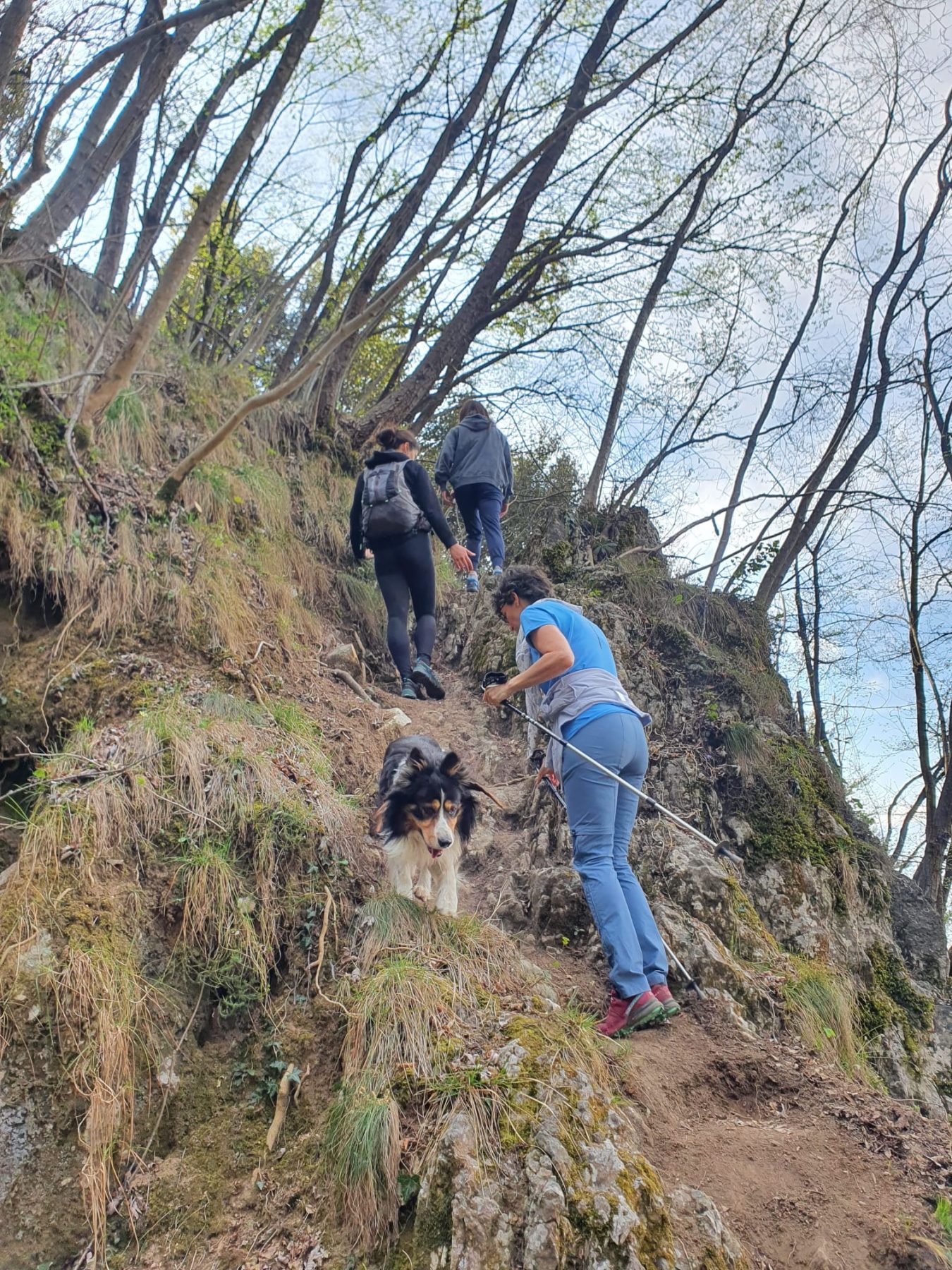
Take the path that enters the valley and soon begins to climb following some red marks, passing staircases and crossing the suggestive Val di Palem with a waterfall. Continuing uphill you enter a denser forest and turning left you walk at the foot of a cliff until you emerge near the entrance to the Val di Palem gorge. Having crossed a dirt road, turn right and shortly afterwards left following the agricultural-forestry-pastoral road which shortly leads to the votive shrine of the Tre Santelle, from which the view extends over Lake Iseo and Monte Isola.
Continue straight on along a comfortable dirt road in the shade of the fir trees and, at this point, it is recommended following the yellow signs of the Cammino Tre Laghi. After passing the pastures and farmhouses near the Corno Maelì, which from here appears like a placid wooded summit, you leave the dirt road to take a path on the left, which descends, going around the Corno and its cliffs that overlook the Val Borlezza.
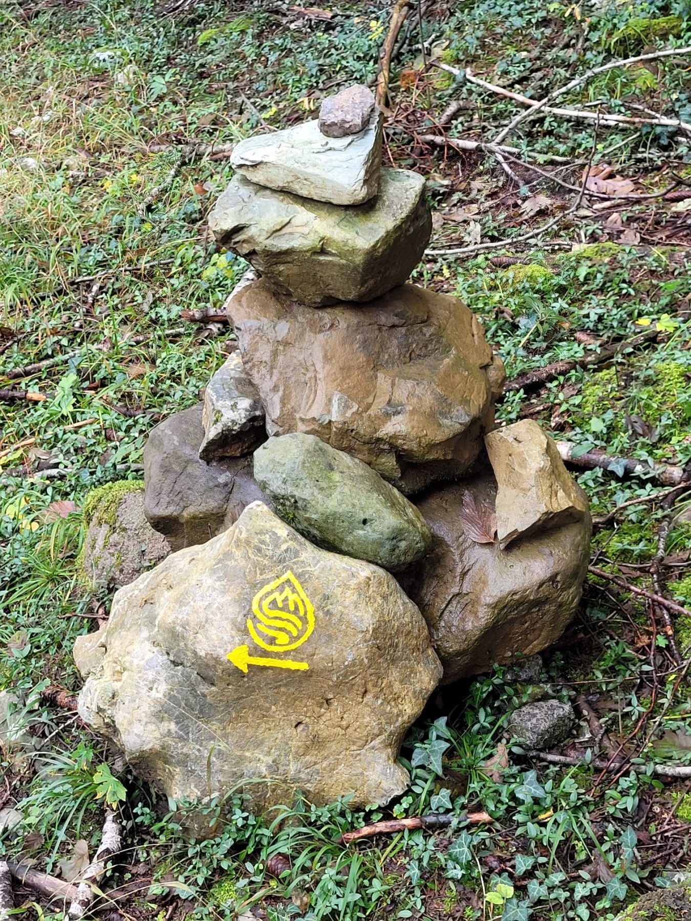
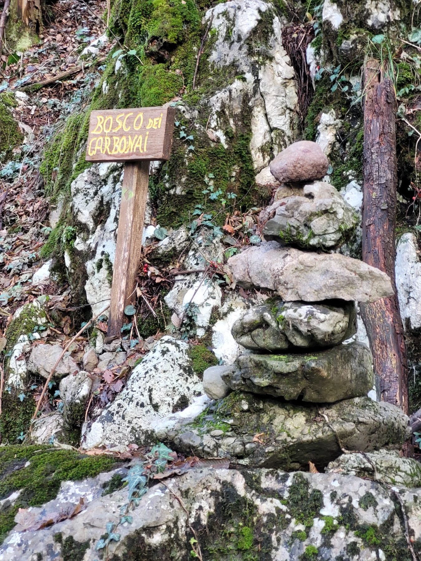
You descend following the “sentiero dei carbonai” between pleasant hairpin bends with many stone men. Always following the yellow pictograms of the Cammino Tre Laghi you reach the locality Piazza. At a crossroads, to avoid walking back to the edge of the provincial road, it is advisable to go straight upstream, taking a path which then bends to the right and slopes gently down to the Bossico crossroads.Attention: this last part has no indications and you must therefore orient yourself by sight or by following the digital traces of the route.
DE – Man nimmt den Weg, der ins Tal führt, und beginnt bald anzusteigen. Man folgt den deutlichen roten Markierungen, begeht Stufen und durchquert das eindrucksvolle Val di Palem mit einem Wasserfall. Wenn man weiter bergauf geht, gelangt man in einen dichteren Wald, biegt links ab und geht am Fuße einer Klippe entlang, bis man in der Nähe des Eingangs zur Schlucht Val di Palem wieder auftaucht. An der Kreuzung einer unbefestigten Straße biegt man rechts und kurz darauf links ab und folgt der Land-, Forst- und Weidestraße, die kurz darauf zum Votivheiligtum der Tre Santelle führt, von dem aus sich der Blick auf den Iseosee und den Monte Isola erstreckt.
Man geht geradeaus auf einer bequemen unbefestigten Straße im Schatten der Tannen weiter. An dieser Stelle ist es empfehlenswert, den gelben Schildern des Cammino Tre Laghi zu folgen. Nachdem man die Weiden und Bauernhöfe in der Nähe des Corno Maelì vorbeigegangen ist, der von hier aus wie ein ruhiger, bewaldeter Gipfel aussieht, verlässt man die unbefestigte Straße und nimmt links einen Weg, der abwärts führt und um den Corno und seine Klippen herumgeht, die das Borlezza-Tal überblicken.
Der Abstieg erfolgt auf dem „Sentiero dei carbonai“ zwischen angenehmen Serpentinen und vielen Steinmännchen. Immer den gelben Piktogrammen des Cammino Tre Laghi folgend erreicht man den Ortsteil Piazza. Um zu vermeiden, dass man an einer Kreuzung wieder an den Rand der Provinzstraße zurückläuft, empfiehlt es sich, geradeaus flussaufwärts zu gehen und einen Weg einzuschlagen, der dann nach rechts abbiegt und sanft bis zur Kreuzung Bossico abfällt.
Achtung: Auf diesem letzten Teil gibt es keine Hinweise. Daher muss man sich anhand der Sicht oder anhand der digitalen Routenspuren orientieren.
How to arrive and where to park / Anreise und Parkplätze
Follow the signs for Sovere and continue on the SP 53 until you reach the town entrance, where you take Via Belvedere until you reach the car park near Bar La Lucciola.
There are some parking spaces near Bar La Lucciola, along the SP 53.
DE – Man folgt der Beschilderung nach Sovere und fährt weiter auf der SP 53 bis zum Ortseingang, wo man die Via Belvedere nimmt, bis man den Parkplatz in der Nähe der Bar La Lucciola erreicht.
Parkplätze in der Nähe der Bar La Lucciola, entlang der SP 53.
Credits: Foto Sara Bianchi
DETAILS
- Difficulty:
Medium - Duration:
3h 35 min - Distance:
8 km - Elevation gain:
+590 m - Starting point:
Via Filone, Sovere - Arrival point:
Via Filone, Sovere
Book now:
Treasure hunt in Franciacorta
Franciacorta
A fun experience suitable for everyone in the vineyards of Franciacorta: a team orientation test bet...
 BOOK NOW
Scenic walk to the Big Bench in Franciacorta
Rovato
Among vineyards, woods, and breathtaking views, enjoy an authentic experience in the heart of Franci...
BOOK NOW


