Trekking from Tavernola to Punta Alta and Colle del Giogo
Scenic loop itinerary on the hills of Tavernola Bergamasca, recommended for hikers with good physical conditioning due to the duration and steepness of the trails.
DE – Panorama-Rundweg auf dem Hügel von Tavernola Bergamasca, der aufgrund der Länge und Steilheit der Wege für gut trainierte Wanderer empfohlen wird.
The trail / der Weg
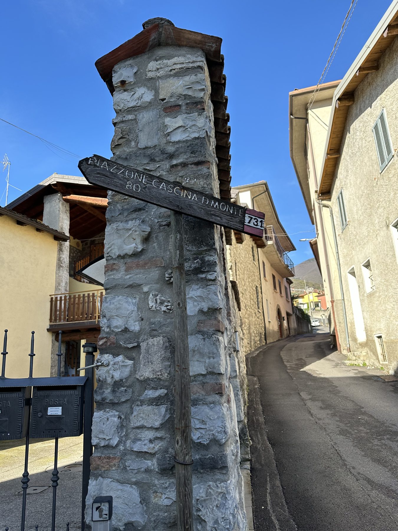
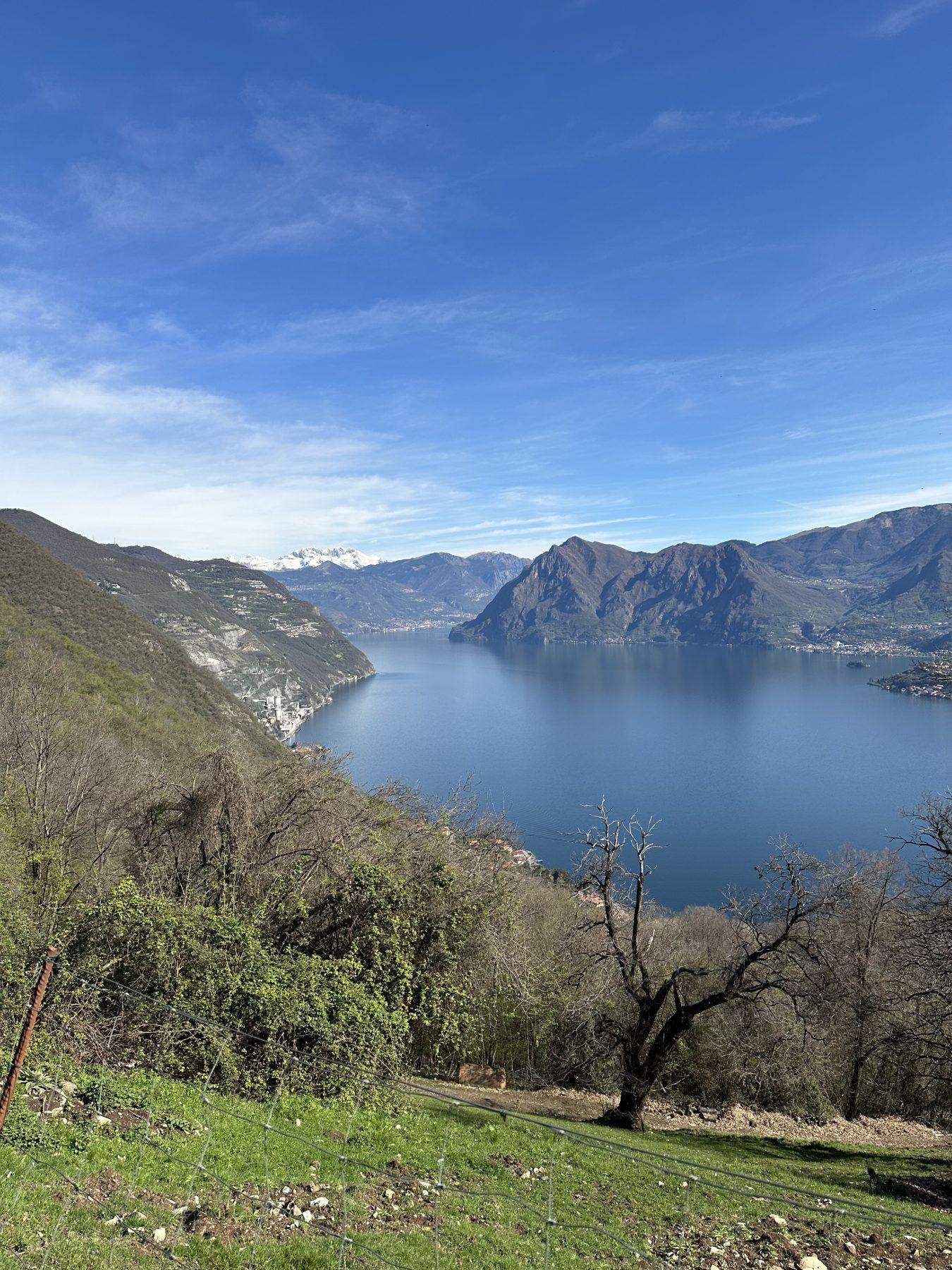
The itinerary starts from Tavernola, in the locality Bianica. Once you have parked the car, after a few steps into the village, turn right following the signs for “Piazzone Cascina D. Monte 731”. After about 400 metres, take a dirt road that bends right behind a house towards “Cascina del Monte”. From here, you ascend steeply along a trail that alternates forest and panoramic viewpoints of the lake. You pass through steps and fences until reaching a junction, where you continue climbing, keeping to the right.
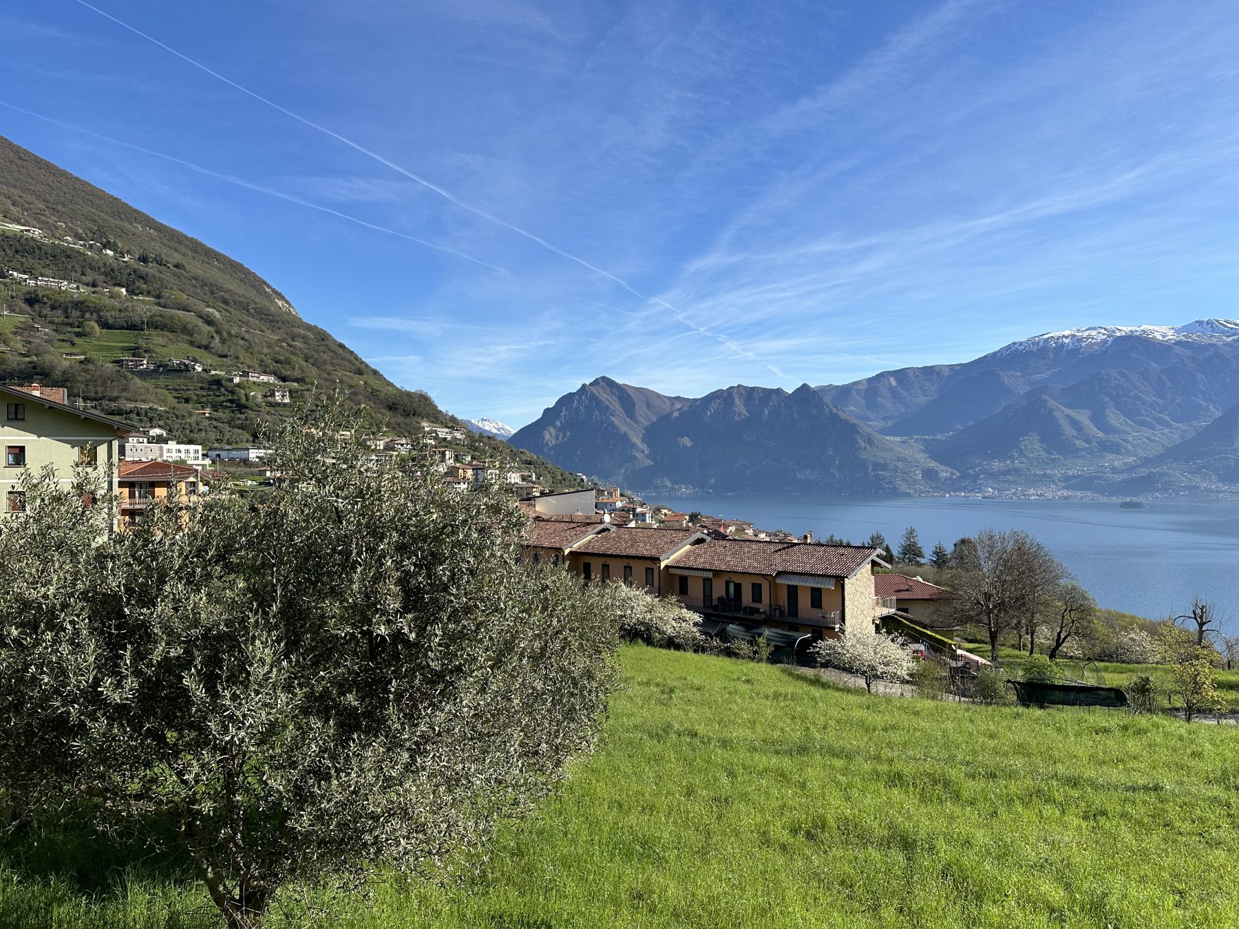
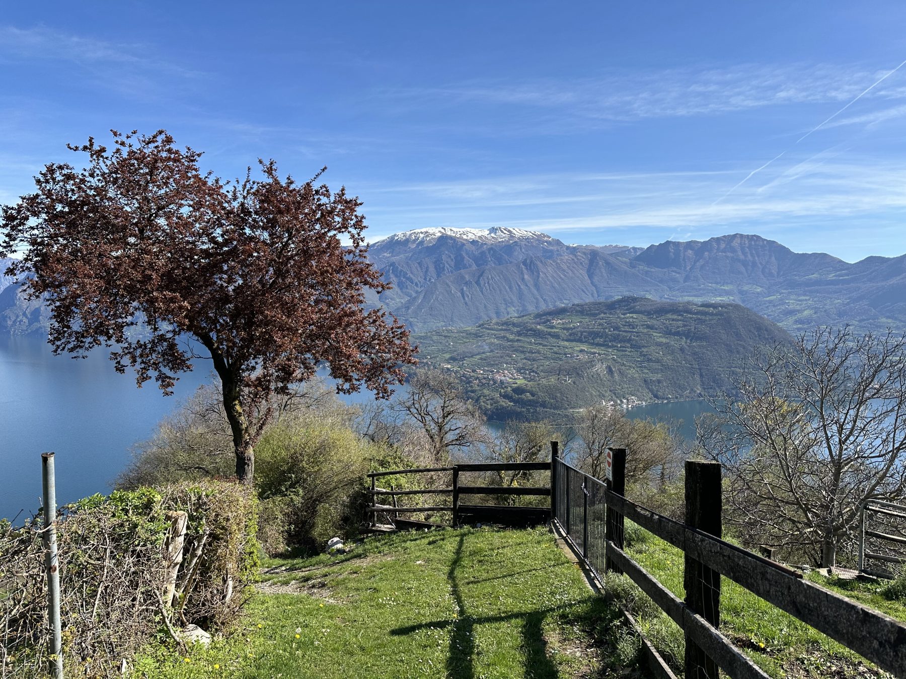
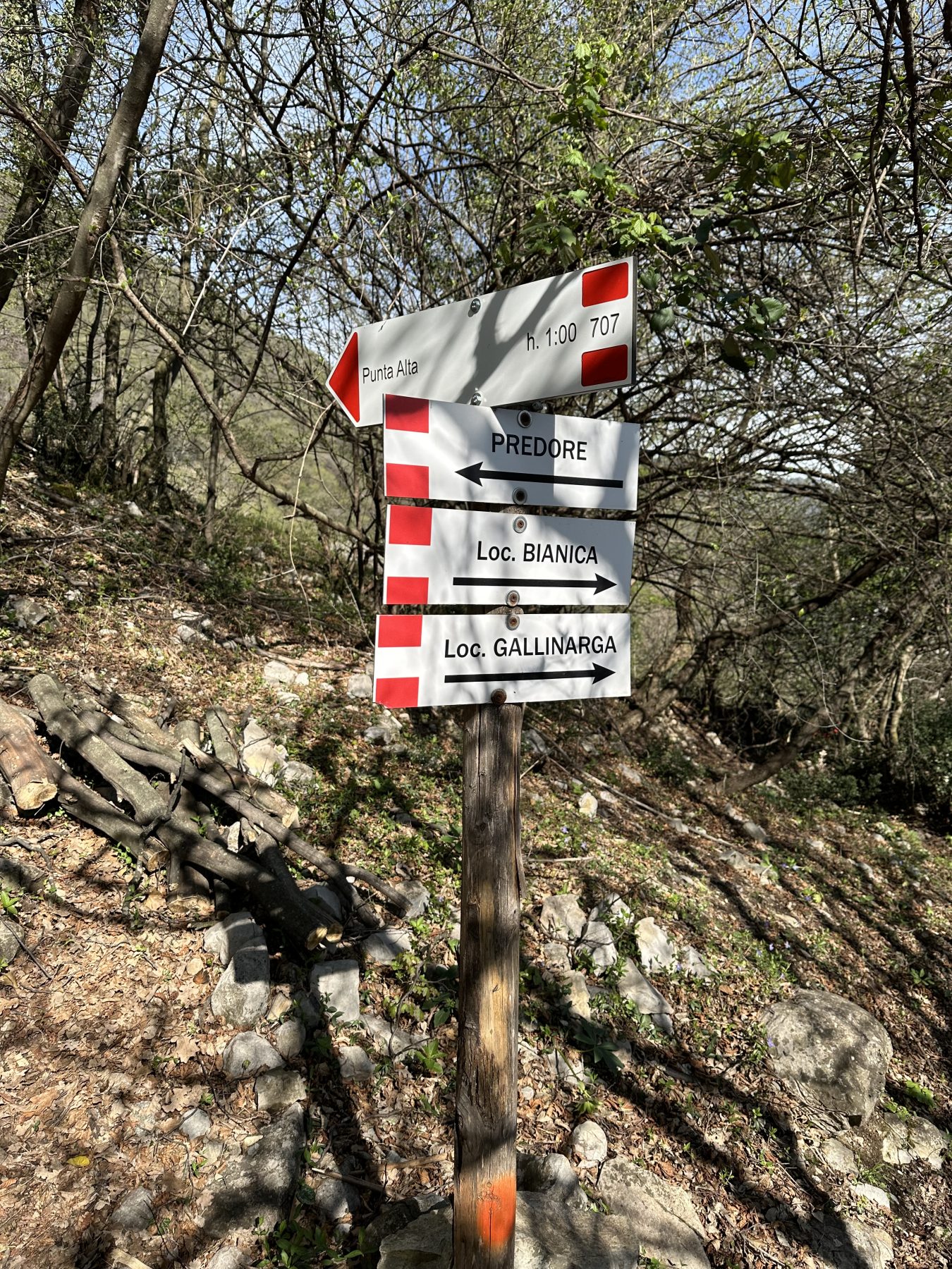
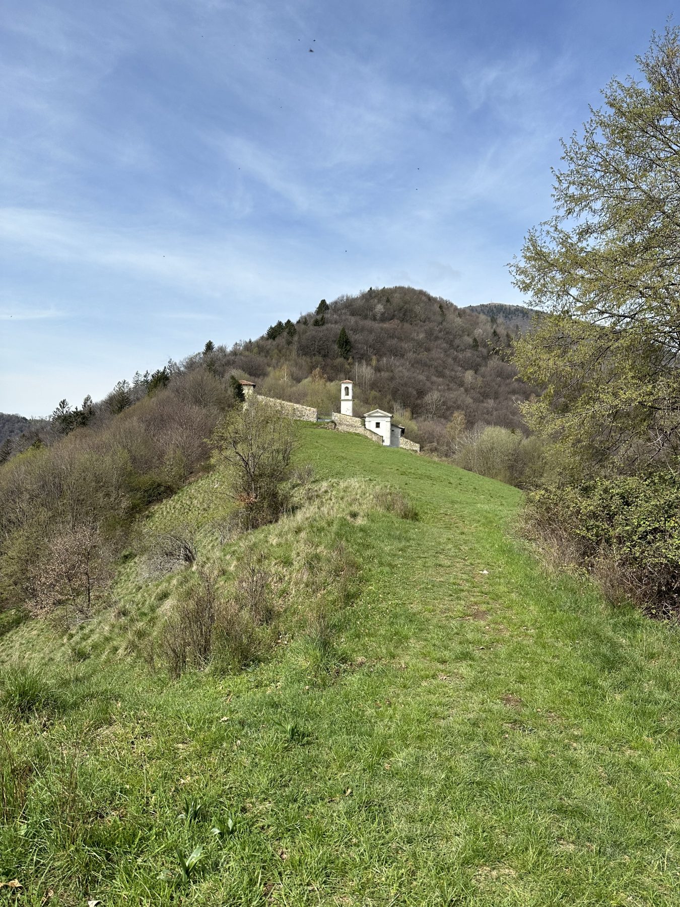
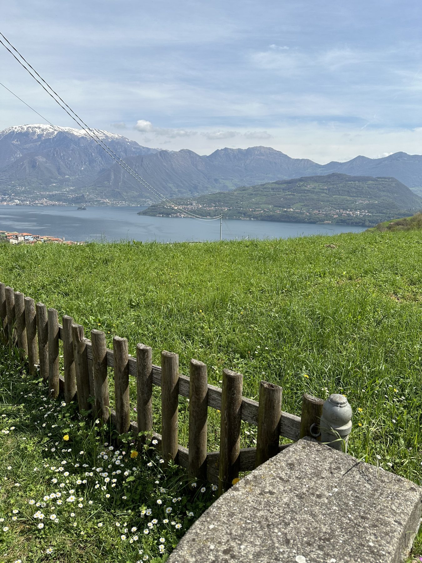
After about 3 km of walking, you emerge from the forest and find yourself in the locality of Mut (588 m), where you have a wonderful view of the lake. You reach a beautiful farmhouse on the southern summit of the promontory. Passing through the fence barrier, shortly after, turn right onto the steep path that ascends the ridge towards “Punta Alta”.
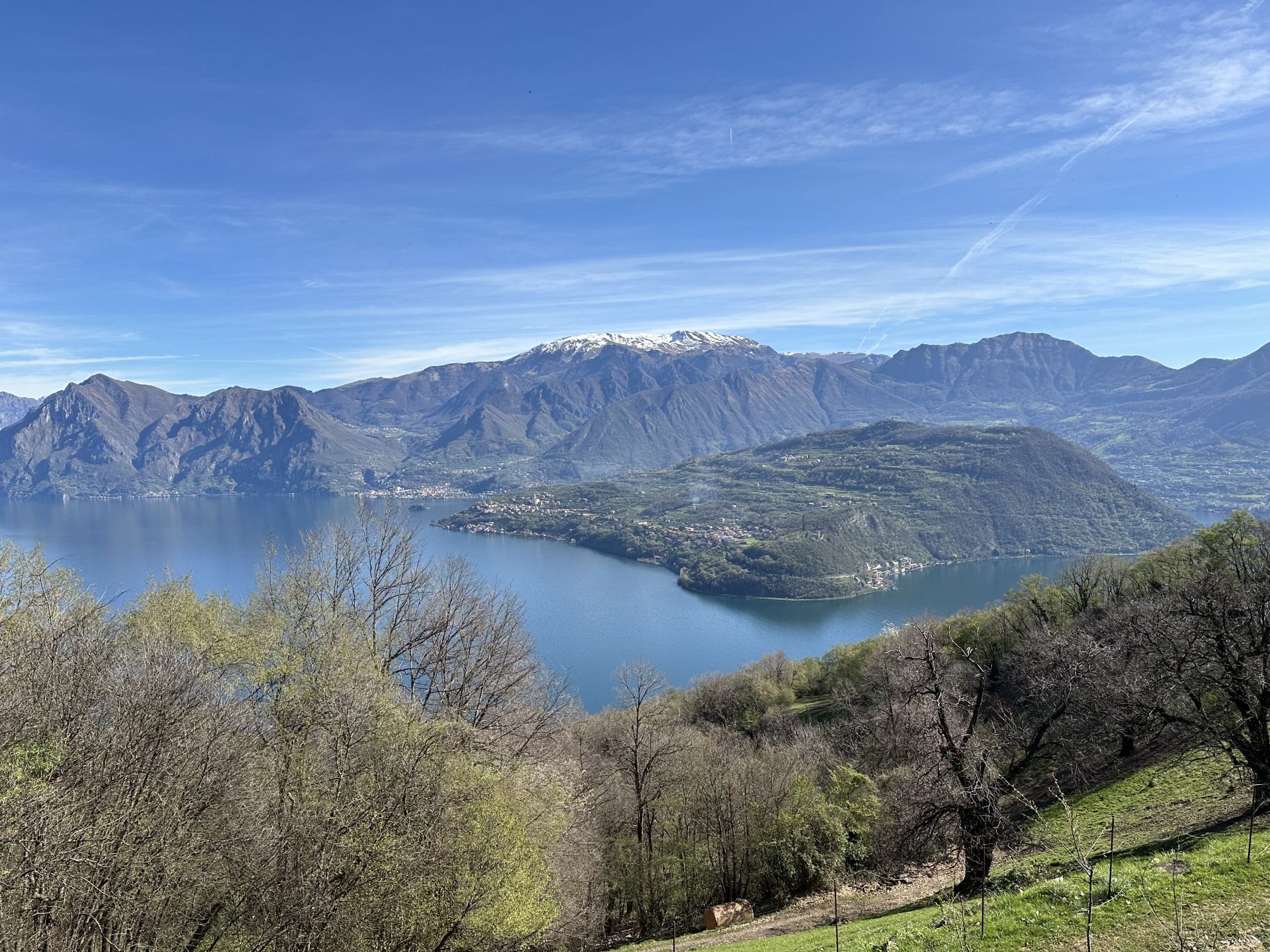
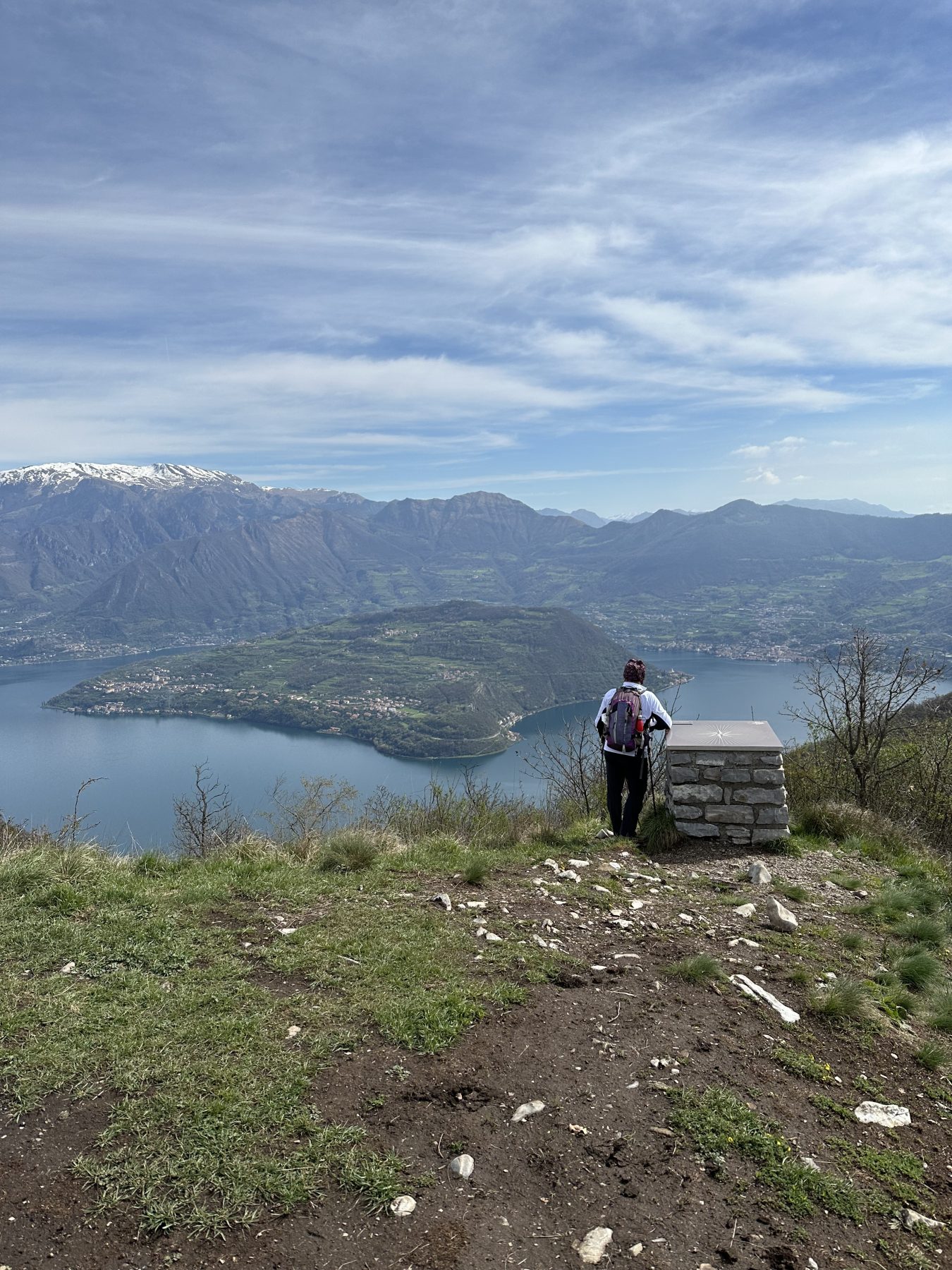
After about an hour of walking and a 350-metre elevation gain, you reach Punta Alta (953 m). In addition to being a remarkable viewpoint overlooking the lake (to the south you can see the Po Valley and lower Lake Iseo with the Torbiere Nature Reserve, in front of Monte Isola and Monte Guglielmo and to the north the Presolana peak), Punta Alta is the heart of a Provincial Oasis for Faunal Protection.
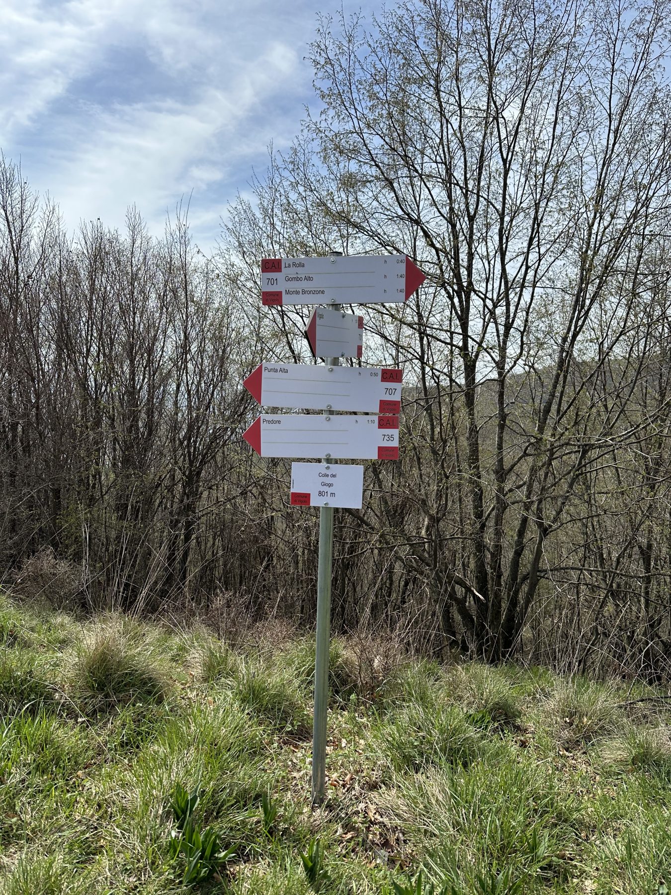
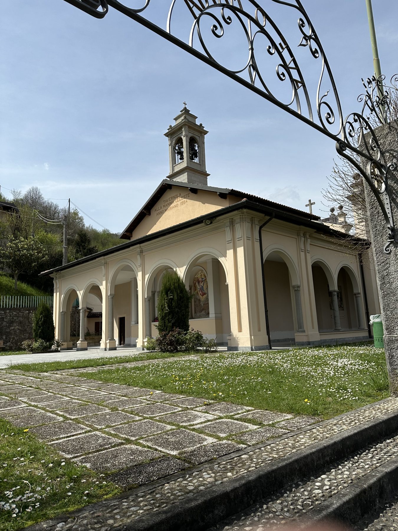
From here, the trail continues northwest, following a wooded ridge to the wide grassy saddle of Colle del Giogo (800 m). Taking the mule track on the saddle, you cross the forest and arrive at the locality of Vasso (Vas). From here, continue on the main road, passing through the locality of Negrignana until, after 300 metres, you encounter a dirt road on the right to be followed for about 400 metres, then sharply turning left onto an old mule track that reconnects to the paved road. This road leads first to the Sanctuary of Cortinica and immediately after to the locality of Bianica, the starting and ending point of the itinerary.
DE – Die Route beginnt in Tavernola, in dem Ortsteil Bianica. Sobald man das Auto geparkt hat, biegt man nach ein paar Schritten ins Dorf rechts ab und folgt den Schildern „Piazzone Cascina D. Monte 731“. Nach etwa 400 Metern nimmt man einen Feldweg, der hinter einem Haus nach rechts in Richtung „Cascina del Monte“ abbiegt. Von hier aus geht es steil bergauf auf einem Weg, der abwechselnd durch den Wald und zu Aussichtspunkten über den See führt. Über Treppen und Zäune gelangt man zu einer Kreuzung, an der man rechts weiter bergauf geht.
Nach ca. 3 km Fußmarsch verlässt man den Wald und befindet sich im Ortsteil Mut (588 m), wo man einen herrlichen Blick auf den See hat. Man erreicht ein wunderschönes Bauernhaus auf der Südspitze des Vorgebirges. Man passiert den Zaun und biegt kurz darauf rechts auf den steilen Weg ab, der den Grat hinauf in Richtung „Punta Alta“ führt.
Nach etwa einer Stunde Gehzeit und 350 Höhenmetern erreicht man Punta Alta (953 m). Abgesehen davon, dass es sich um einen wertvollen Aussichtspunkt über dem See handelt (man kann im Süden die Poebene und den unteren Iseosee mit dem Naturschutzgebiet Torbiere, vor Monte Isola und Monte Guglielmo und im Norden den Pizzo della Presolana sehen), Punta Alta ist das Herz einer Provinz-Wildschutzoase.
Von hier aus führt der Weg weiter nach Nordwesten, einem bewaldeten Bergrücken folgend, hinauf zum weiten Wiesensattel des Colle del Giogo (800 m). Über den Saumpfad am Sattel des Hügels durchquert man den Wald und erreicht den Ortsteil Vasso (Vas). Von hier aus geht es weiter auf der Hauptstraße, vorbei an der Ortschaft Negrignana, bis man nach 300 Metern auf der rechten Seite auf einen unbefestigten Weg trifft, dem man etwa 400 Meter lang folgt. Dann biegt man scharf links auf einen alten Saumpfad ab, der wieder an die Asphaltstraße anschließt der zunächst zum Heiligtum von Cortinica und unmittelbar danach nach Bianica, dem Start- und Endpunkt des Rundwegs, führt.
How to arrive and where to park / Anreise und Parkpläzte
In Tavernola Bergamasca, follow the signs towards Vigolo-Parzanica. After a few hairpin turns, turn left towards Bianica, where you turn left, leaving the car in the small parking lot just after the entrance to the village, again on the left.
DE – Sobald man Tavernola Bergamasca erreicht hat, biegt man in Richtung Vigolo-Parzanica ab. Nach einigen Haarnadelkurven hält man sich links in Richtung Bianica. Sobald man das Ziel erreicht hat, biegt man links ab und lässt das Auto auf dem kleinen Parkplatz stehen. Gleich danach biegt man links ab, am Ortseingang.
DETAILS
- Difficulty:
Medium - Duration:
4h - Distance:
9,5 km - Elevation gain:
+604 m - Starting point:
Località Bianica, Tavernola Bergamasca - Arrival point:
Località Bianica, Tavernola Bergamasca - Trail number:
731, 707, 730
Book now:
Excursion to the Pyramids of Zone and Corna Trentapassi
Zone
Your perfect day among the natural beauties surrounding Lake Iseo! Ready for an excursion that takes...
 BOOK NOW
Treasure hunt in Franciacorta
Franciacorta
A fun experience suitable for everyone in the vineyards of Franciacorta: a team orientation test bet...
BOOK NOW
Monte Isola and Franciacorta with Susanna Allegri
Lovere
A few steps in Franciacorta, among vineyards and cellars, and in Monte Isola, where the road is comp...
BOOK NOW
What comes out of the top hat
Lovere
FISH FROM THE HAT AND FIND OUT WHAT YOU HAVE WON! With Susanna Allegri Hiking and MTB guide Trekking...
BOOK NOW


