
Trekking from Rogno to Monte Alto and Pian del Termen
Long and rather steep hiking itinerary, which allows you to reach the top of Monte Alto without difficulty, a mountain in the Orobie Prealps, located between Val Seriana and Valle Camonica, whose summit offers great views.
DE – Langer und ziemlich steiler Wanderweg, der es ermöglicht, ohne Schwierigkeiten den Gipfel des Monte Alto zu erreichen, eines Berges in den Orobie-Voralpen, der zwischen Val Seriana und Valle Camonica liegt und dessen Gipfel mit herrlichen Aussichten geschmückt ist.
The trail / der Weg
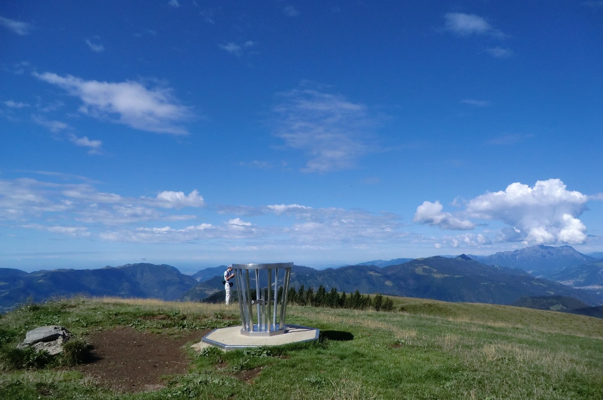
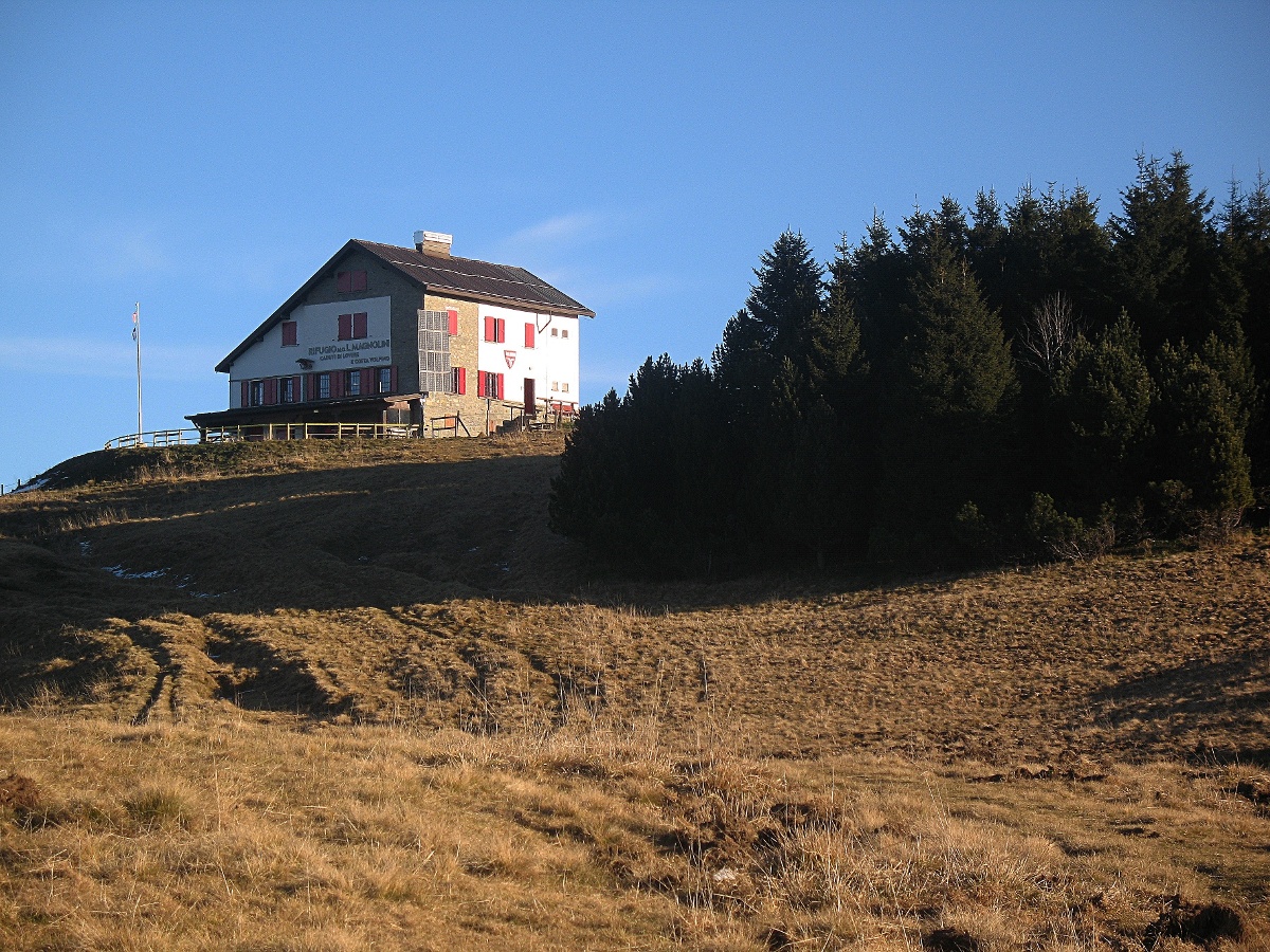
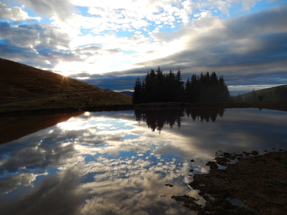
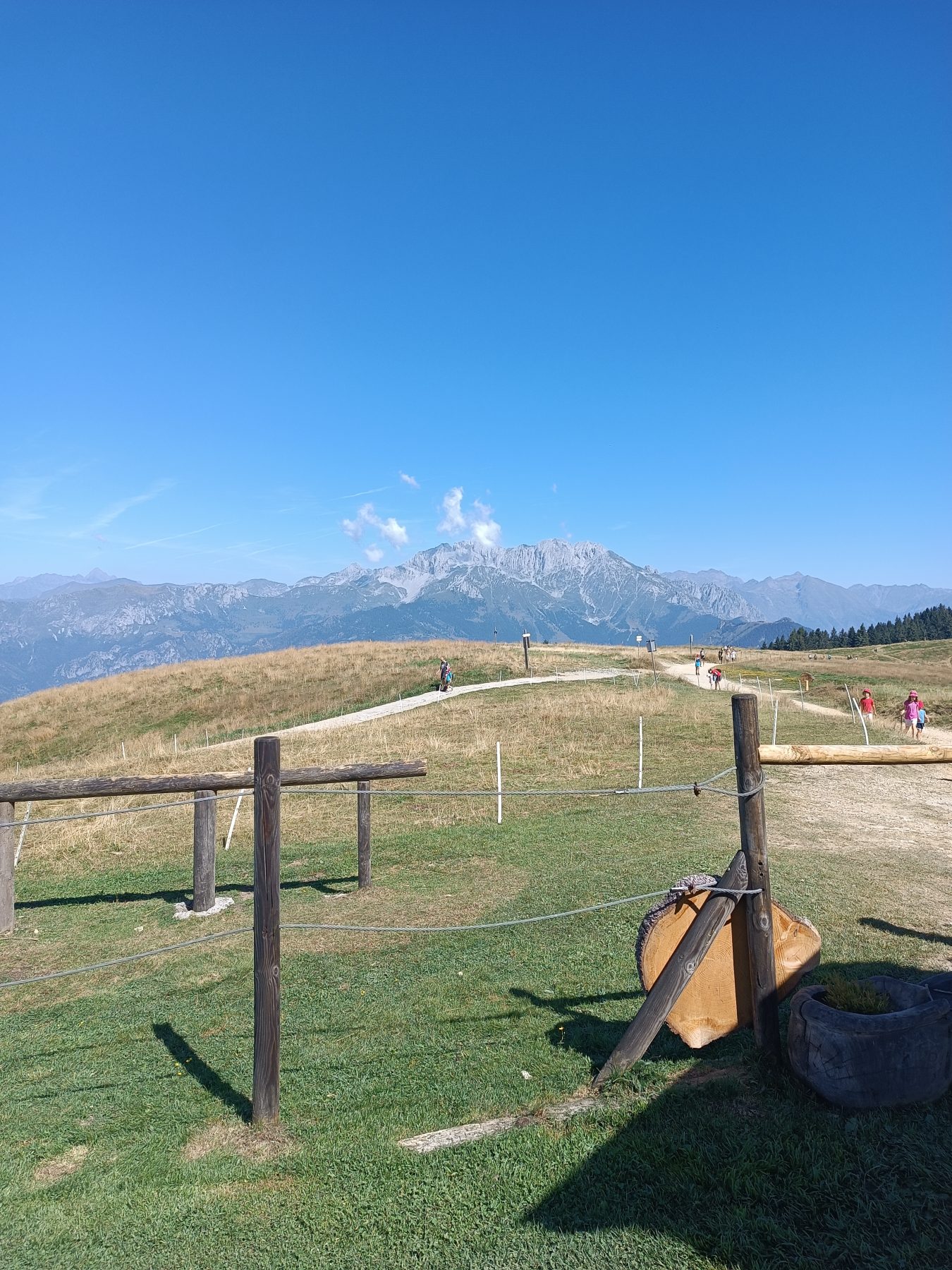
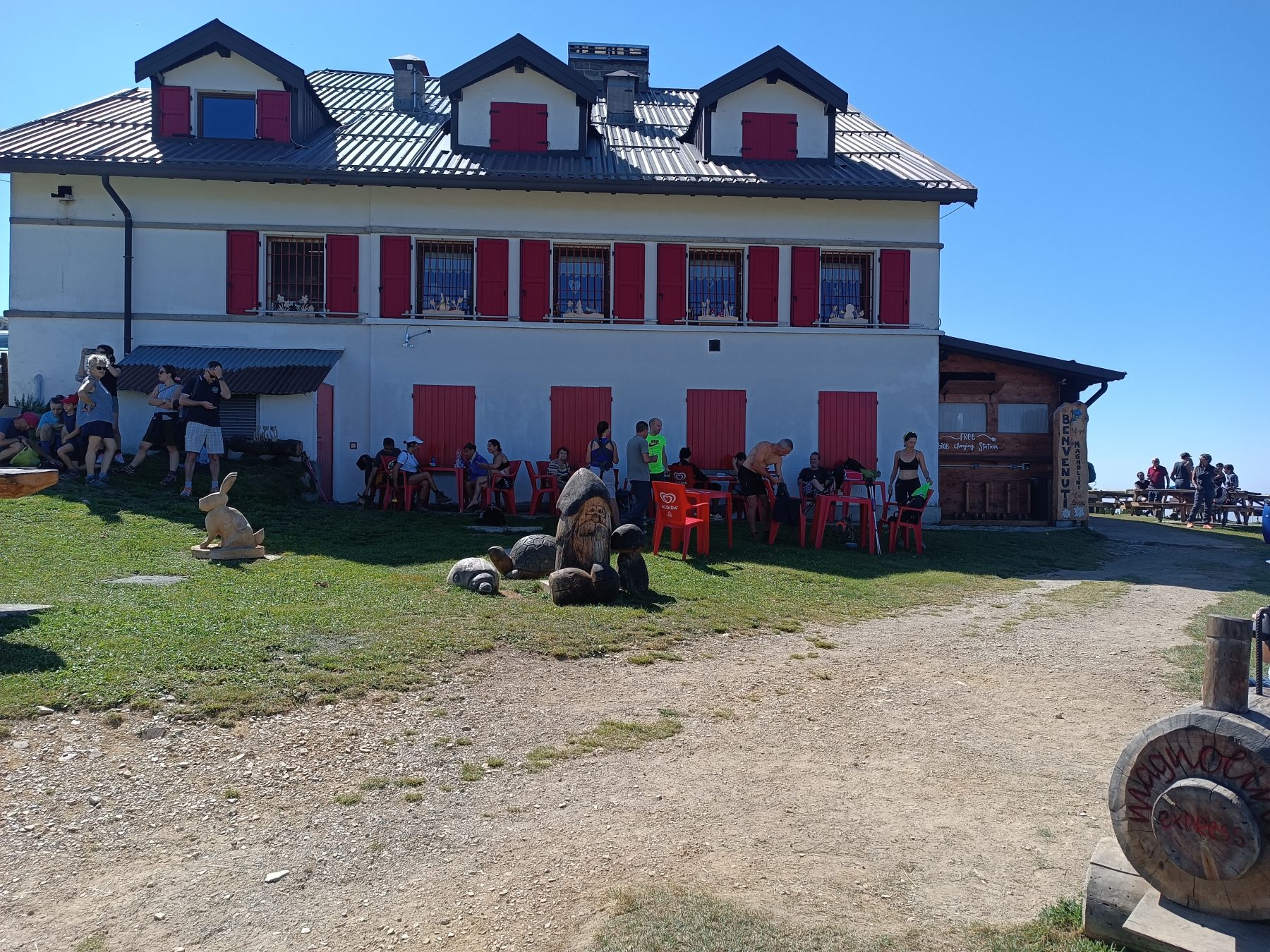
The itinerary starts from San Vigilio di Rogno and follows CAI path 559. Follow the paved road for less than a kilometre in the direction of Monti, until you reach the helicopter landing platform. Shortly before, turn left onto a fairly steep concrete road, entering the woods. After about 100 meters from the start of the mountain road, there is a crossroads, where you have to keep left. The road soon becomes dirt. Going up you find a further crossroads; continue to keep left and, after several bends, you reach a small chapel. Here, the road becomes concrete again, and it is steeper. Almost two hours after departure, you exit the woods and proceed across the flat pastures of Monte Alto. Once you reach the Magnolini Hut, in less than twenty minutes, you can reach the summit of Monte Alto (1723 m), where a geodesic plate helps you recognise all the surrounding mountains.
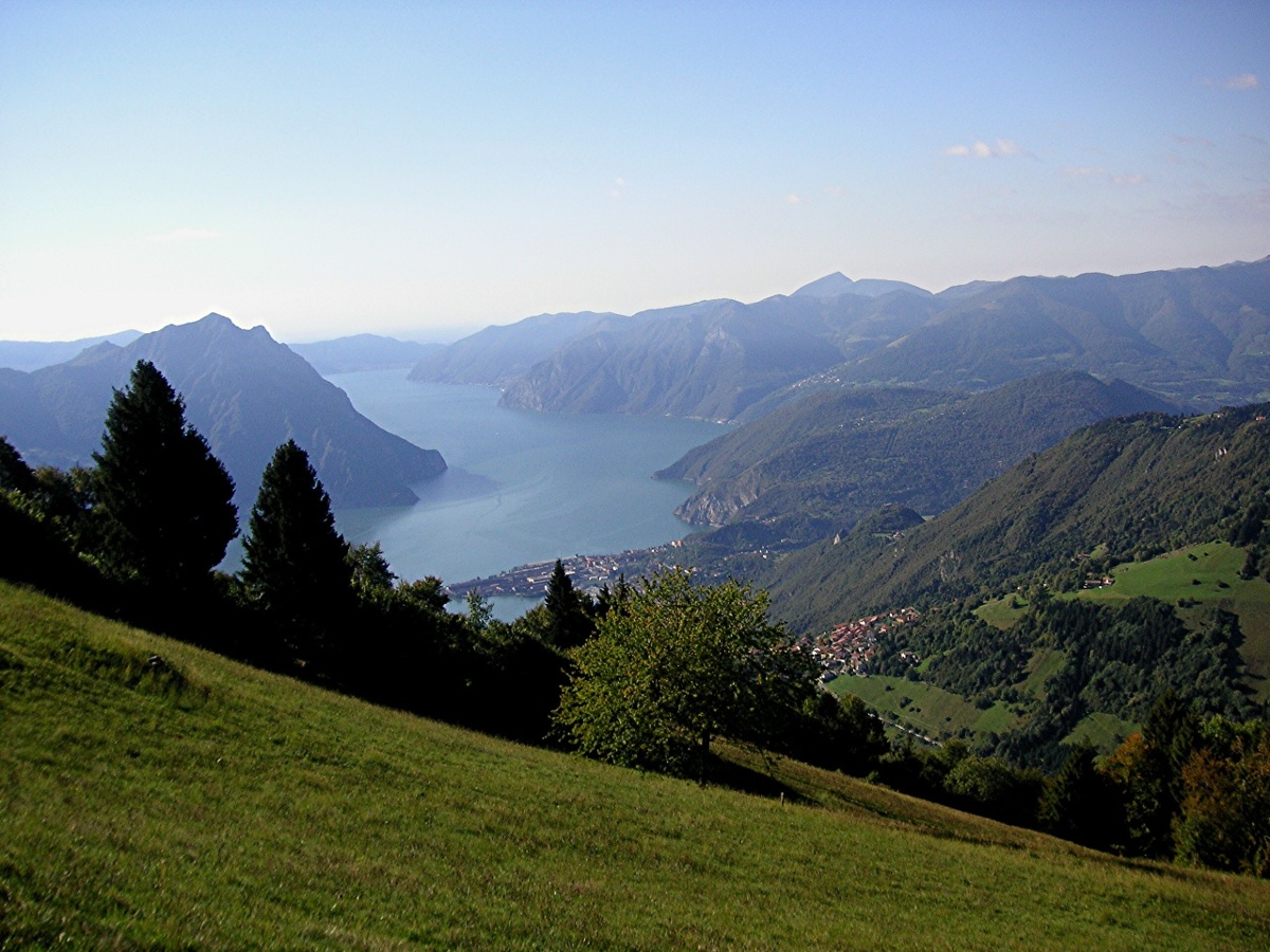
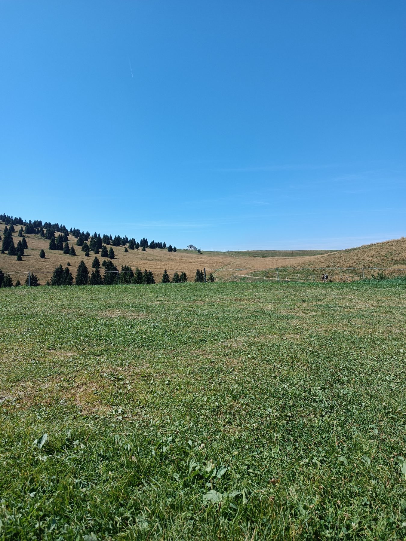
For the return, returning to the hut, it is suggested to follow the direct route that leads to the Pian del Termen ski slope, where the Baita Termen is located. Then, head towards the large basin used for artificial snow, passing it on the left downhill, in order to find the mule track that descends into the Valle dell’Orso, in the direction of Monti. Following this mule track, you quickly lose altitude until it is convenient to abandon it, taking a comfortable dirt road on the right. This road crosses a beautiful stretch of woods, allowing you to return to the opposite side of the valley and reconnect with the road taken on the outward journey (CAI 559).
DE – Die Route beginnt in San Vigilio di Rogno und folgt dem CAI-Weg 559. Man folgt der Asphaltstraße für weniger als einen Kilometer in Richtung Monti, bis man die Hubschrauberlandeplattform erreicht. Kurz davor biegt man links auf eine ziemlich steile Betonstraße ab und gelangt in den Wald. Etwa 100 Meter vom Beginn der Bergstraße entfernt kommt man an eine Kreuzung und man muss sich links halten. Die Straße wird bald unbefestigt. Wenn man nach oben geht, findet man eine weitere Kreuzung; Man hält sich weiterhin links und erreicht nach zahlreichen Kurven eine kleine Kapelle. Hier wird die Straße wieder betoniert und steiler. Knapp zwei Stunden nach der Abfahrt verlässt man den Wald und wandert über die flachen Weiden des Monte Alto. Sobald man die Magnolini-Hütte erreicht hat, kann man in weniger als zwanzig Minuten den Gipfel des Monte Alto (1723 m) erreichen, wo eine geodätische Platte hilft, alle umliegenden Berge zu erkennen.
Für den Rückweg zur Hütte wird empfohlen, dem direkten Weg zu folgen, der zur Skipiste Pian del Termen führt, wo sich die Baita Termen befindet. Anschließend geht man in Richtung des großen Beckens, das zur Beschneiung dient, und passiert es auf der linken Seite bergab, um den Saumpfad abzufangen, der ins Valle dell’Orso in Richtung Monti führt. Wenn man diesem Saumpfad folgt, verliert man schnell an Höhe, bis man ihn bequem verlassen und rechts einen bequemen Feldweg nehmen kann. Diese Straße durchquert einen wunderschönen Waldabschnitt und ermöglicht es, auf die gegenüberliegende Talseite zurückzukehren und wieder auf die Straße der Hinfahrt (CAI 559) zu gelangen.
How to arrive and where to park / Anreise und Parkplätze
Follow the signs for Costa Volpino and Rogno. Take via del Corno and continue until you reach the locality San Vigilio.
Parking spaces available in San Vigilio.
DE – Man folgt den Schildern nach Costa Volpino und Rogno. Man nimmt die Via del Corno und fährt weiter bis San Vigilio.
Parkplätze sind in San Vigilio vorhanden.
Credits: Cristian Molinari
DETAILS
- Difficulty:
Medium - Duration:
5h 35 min - Distance:
13,4 km - Elevation gain:
+1016 m - Starting point:
San Vigilio, Rogno - Arrival point:
San Vigilio, Rogno - Trail number:
559
Book now:
Scenic walk to the Big Bench in Franciacorta
Rovato
Among vineyards, woods, and breathtaking views, enjoy an authentic experience in the heart of Franci...
 BOOK NOW
Treasure hunt in Franciacorta
Franciacorta
A fun experience suitable for everyone in the vineyards of Franciacorta: a team orientation test bet...
BOOK NOW


