Antica Strada Valeriana route
The Antica Strada Valeriana (CAI path 291), of unspecified origin, was the only route to Valle Camonica for many millennia. Fully revamped and reinstated for tourism purposes, the route is today a harmonious encounter between landscape, art and history.
DE – Die Antica Strada Valeriana (CAI-Pfad 291), deren Ursprung unbekannt ist, war über Jahrtausende den obligatorischen Übergang in Richtung Valle Camonica. Die Route wurde vollständig wiederhergestellt und für den touristischen Gebrauch restauriert. Heute präsentiert sie sich als harmonische Begegnung zwischen Landschaft, Kunst und Geschichte.
The trail / der Weg
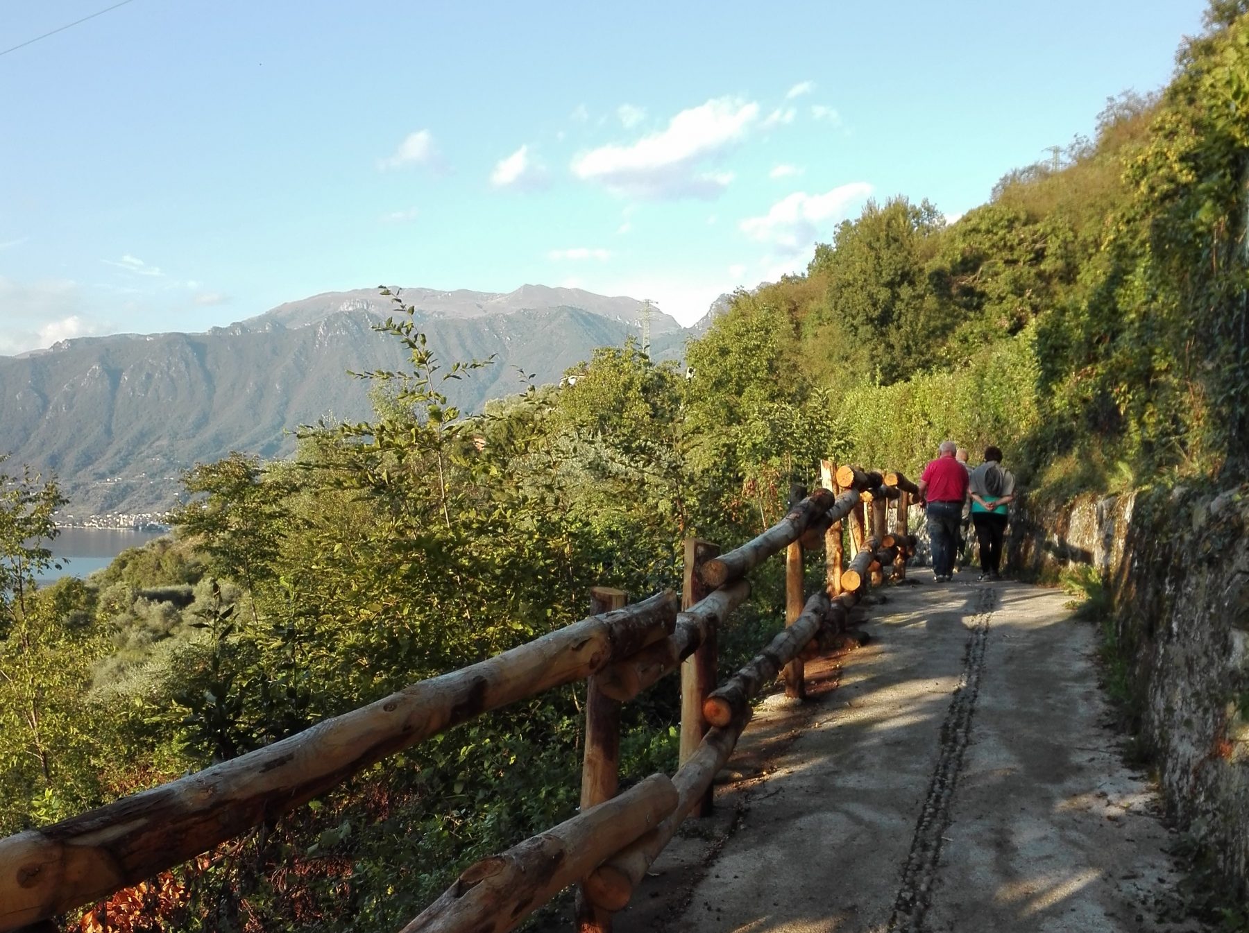
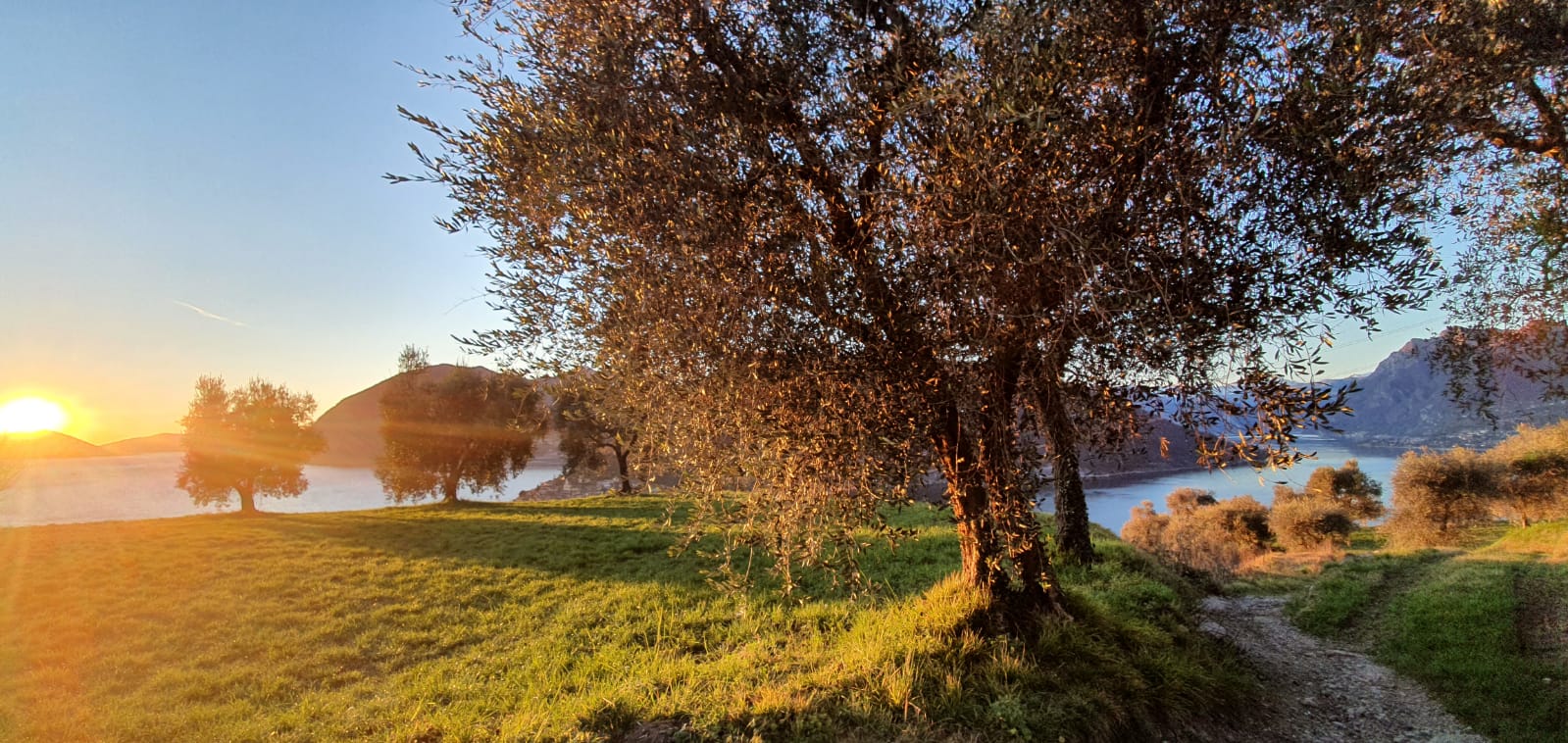
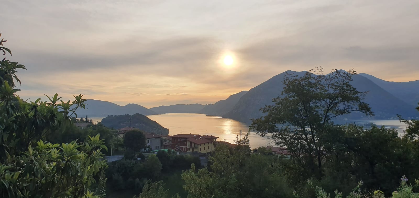
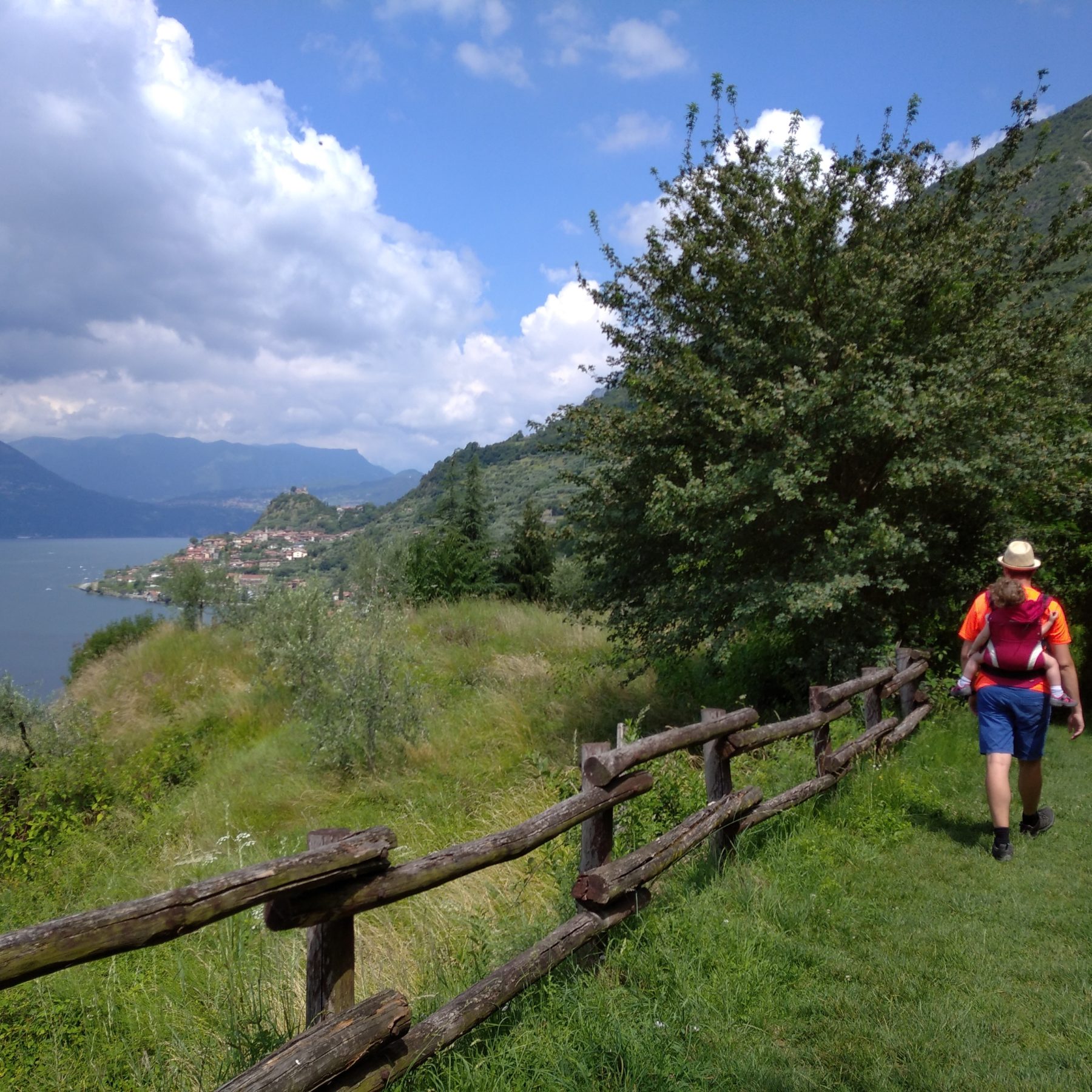
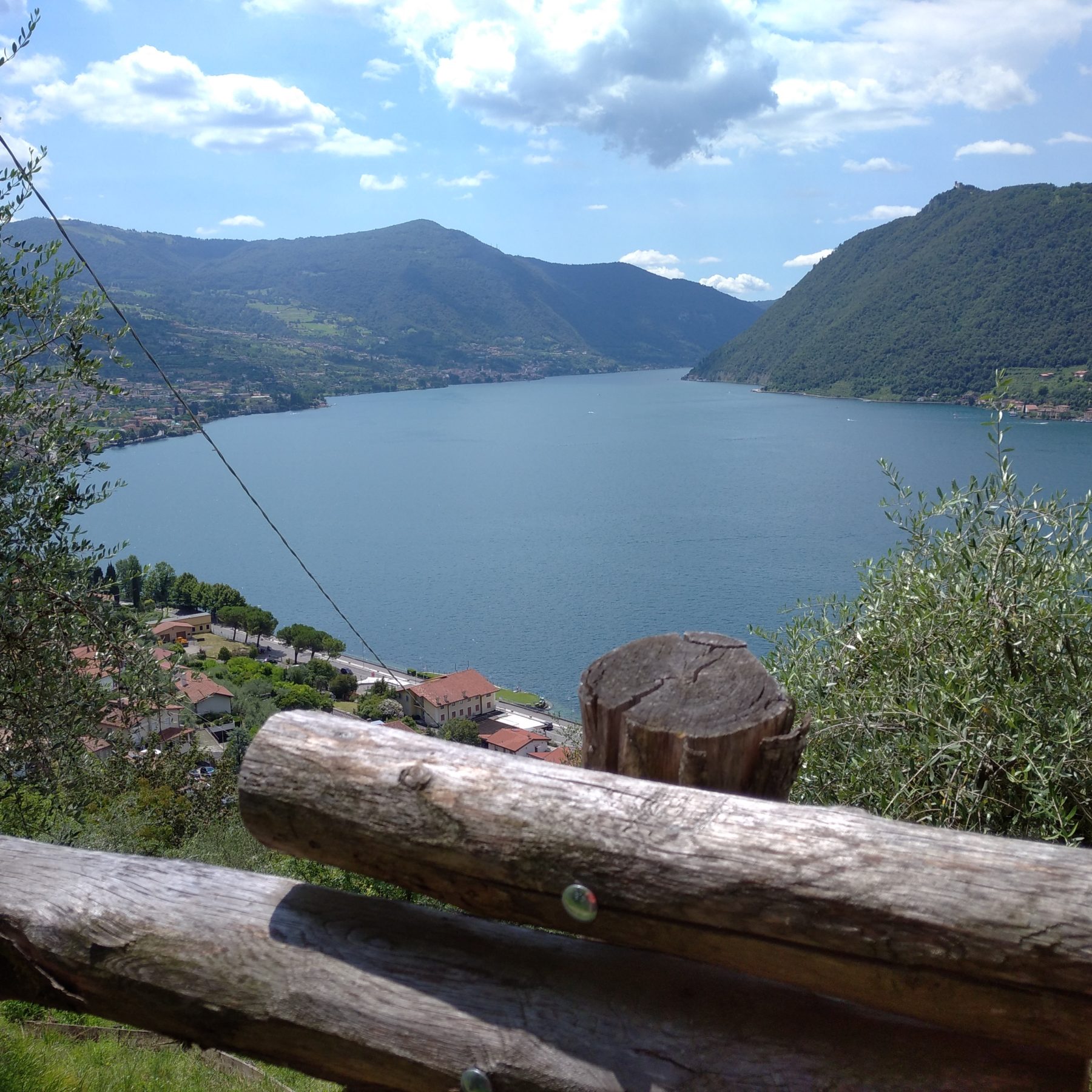
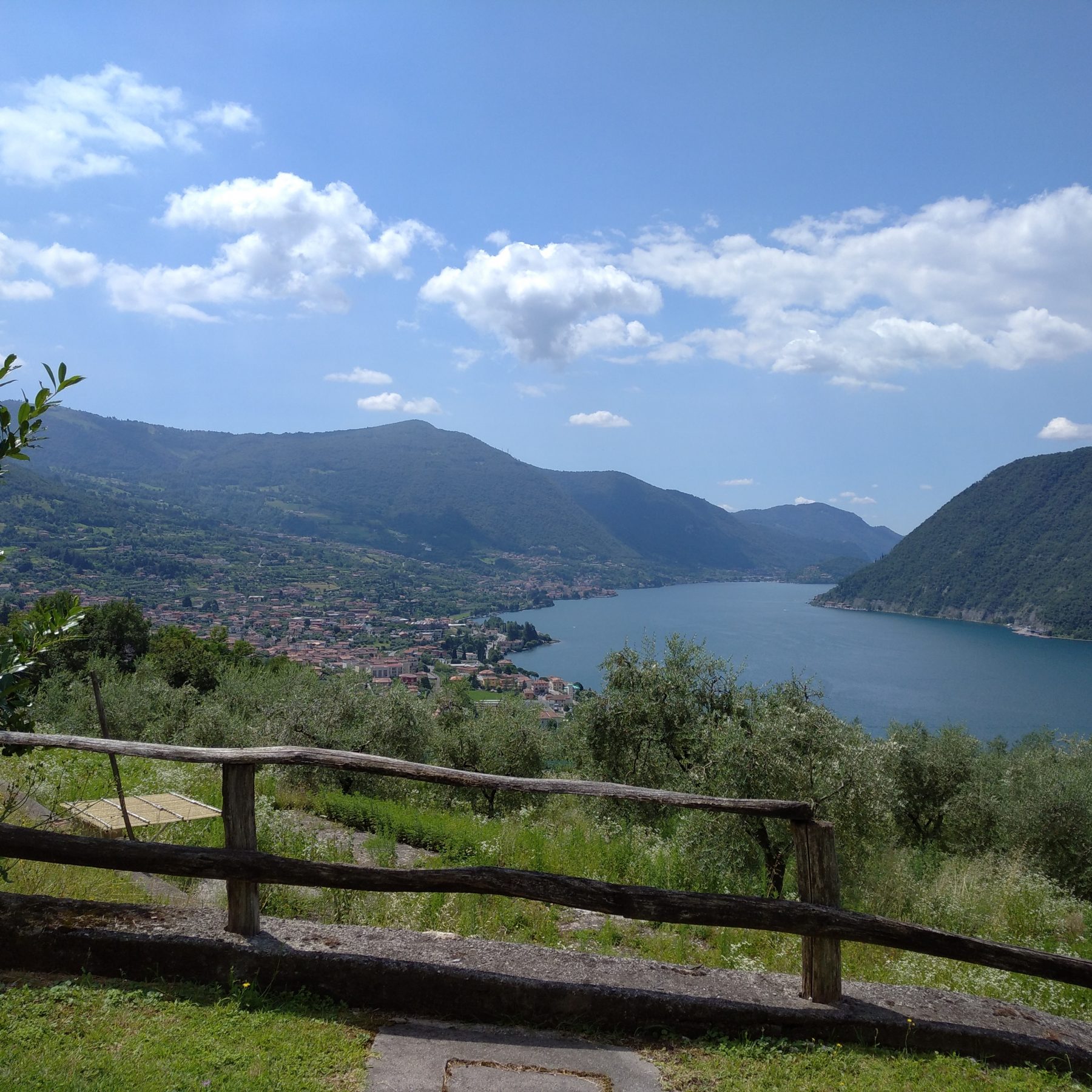
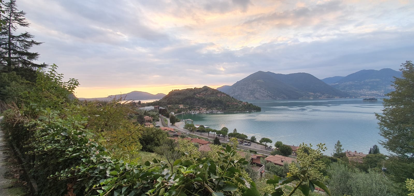
The route runs along the hinterland of the eastern shore of the lake, from Pilzone d’Iseo to Pisogne (there is a project in progress to extend it as far as Monticelli Brusati and Ome), passing through the territories of Sulzano, Sale Marasino, Marone and Zone. The trip is extraordinarily stunning because it is always accompanied by views of Lake Iseo and the surrounding mountains. It is made of a succession of country roads and trails, dirt tracks and paved roads with little traffic, sometimes outlined by stone walls. The Valeriana is an easy route until Marone, through the villages of Gazzane, Tassano, Maspiano, Gandizzano, Marasino, Conche, Distone, Dosso and Massenzano – scenic spots above Sulzano and Sale Marasino. From here the path starts to climb north of Marone, between the villages of Vesto, Pregasso and Colpiano, where the climb towards Zone begins. It is possible to see the Erosion Pyramids, witness of the glacier present during the Würm glacier era. The journey continues through the hamlet of Cislano and the village of Zone until Croce di Zone (903 m). After Croce di Zone, it takes about an hour and a half to reach Pisogne with the final stretch of the path, characterised by red spruce and beech forests, scattered meadows, farms and pastures. The Antica Strada Valeriana is also cited as the ‘Route of Spiritual Devotion’. The presence of churches, shrines, monasteries and chapels is in fact quite extraordinary; they were used in the past to provide assistance and refreshment to travellers and pilgrims, and today contribute to determine the historical importance of the itinerary. Given the length of the route, it is recommended to walk certain stretches and use the navigation service or the regional railway line to reach the various locations.
Recommended alternative – From the hamlet of Cusato in Zone, CAI path 229 leads to the summit of Corna Trentapassi (1248 m), which offers a magnificent panorama of the entire Lake Iseo and the Alpine foothills around it (return trip Cusato-Trentapassi 2h 30 mins).
DE – Die Route verläuft entlang des Hinterlandes des orientierten Seeufers von Pilzone d’Iseo nach Pisogne (eine Verlängerung der ersten Strecke bis nach Monticelli Brusati und Ome wurde auch geplant) und führt durch die Gebiete Sulzano, Sale Marasino, Marone und Zone. Die Reise ist sehr suggestiv, da man immer vom Blick auf den Iseosee und die umliegenden Berge begleitet wird. Es gibt eine Abwechslung von Landstraßen und Wegen, unbefestigten und asphaltierten Straßen mit wenig Verkehr, die zeitweise von Steinmauern umrissen werden. Die Valeriana ist bis nach Marone leicht zu begehen durch die Dörfer Gazzane, Tassano, Maspiano, Gandizzano, Marasino, Conche, Distone, Dosso und Massenzano – Ortschaften oberhalb von Sulzano und Sale Marasino. Von hier aus steigt die Route nördlich von Marone zwischen den Ortsteilen Vesto, Pregasso und Colpiano an, wo der Aufstieg in Richtung Zone beginnt. Tatsächlich erscheinen hier die Erosionspyramiden, die den Durchgang des Gletschers während der Wurmschen Vereisung bezeugen. Die Reise geht weiter und durchquert die Ortschaft Cislano und Zone, bis man Croce di Zone (903 m) erreicht. Nach dem Croce di Zone erreicht man in etwa 1.30 Stunden Pisogne und nimmt den letzten Abschnitt des Weges, der von Wiesen, Bauernhäusern und Weiden geprägt ist. Die Route kann in Etappen unterteilt werden und die Rückfahrt ist immer über die Trenord Bahnlinie Brescia-Iseo-Edolo möglich.
Empfohlene Variante – Vom Cusato di Zone führt der CAI-Pfad 229 zum Gipfel des Corna Trentapassi (1248 m), von dem aus man einen herrlichen Blick auf den gesamten Iseosee und die umliegenden Voralpen genießen kann (Rundfahrt Cusato – Trentapassi 2h 30 mint).
Useful info / nützliche Info
The route is indicated at junctions and intersections by information boards, arrows and a yellow and brown coloured V.
DE – Die Route ist an Kreuzungen durch Hinweisschilder, Pfeile und ein gelb-braunes V gekennzeichnet
DETAILS
- Difficulty:
Medium - Duration:
9 h - Distance:
24,3 km - Elevation gain:
+1135 - Starting point:
Pilzone d'Iseo - Arrival point:
Pisogne - Trail number:
291
Book now:
Scenic walk to the Big Bench in Franciacorta
Rovato
Among vineyards, woods, and breathtaking views, enjoy an authentic experience in the heart of Franci...
 BOOK NOW
Treasure hunt in Franciacorta
Franciacorta
A fun experience suitable for everyone in the vineyards of Franciacorta: a team orientation test bet...
BOOK NOW


