Trekking in Predore’s Valley
Rather steep itinerary that leads to the Corno Buco in Predore and allows you to cross its beautiful and always sunny valley.
DE – Ziemlich steile Strecke, die zum Corno Buco in Predore führt und es ermöglicht, das schöne und immer sonnige Tal zu durchqueren.
The trail / der Weg
From Piazza Vittorio Veneto take the road that leads to the upper part of the town, to the right of the Rino stream. Following the steep main road, at the car park on the left of Via Molini, continue on the steps that lead to the Rino waterfall, with a wonderful view of the ancient town of Predore. The route continues first along the pedestrian passage of Via Molini and then between the houses with two more flights of stairs. Once you reach Via Cima Predore, turn right and, after an underpass, keep left and walk along Via Fossato, with another flight of stairs. Once you reach the municipal aqueduct, continue along the steep asphalt road, leaving the gate with staircase that leads to the sanctuary on the right.
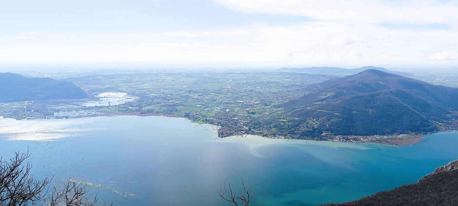
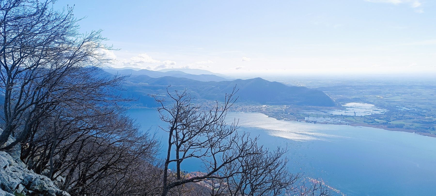
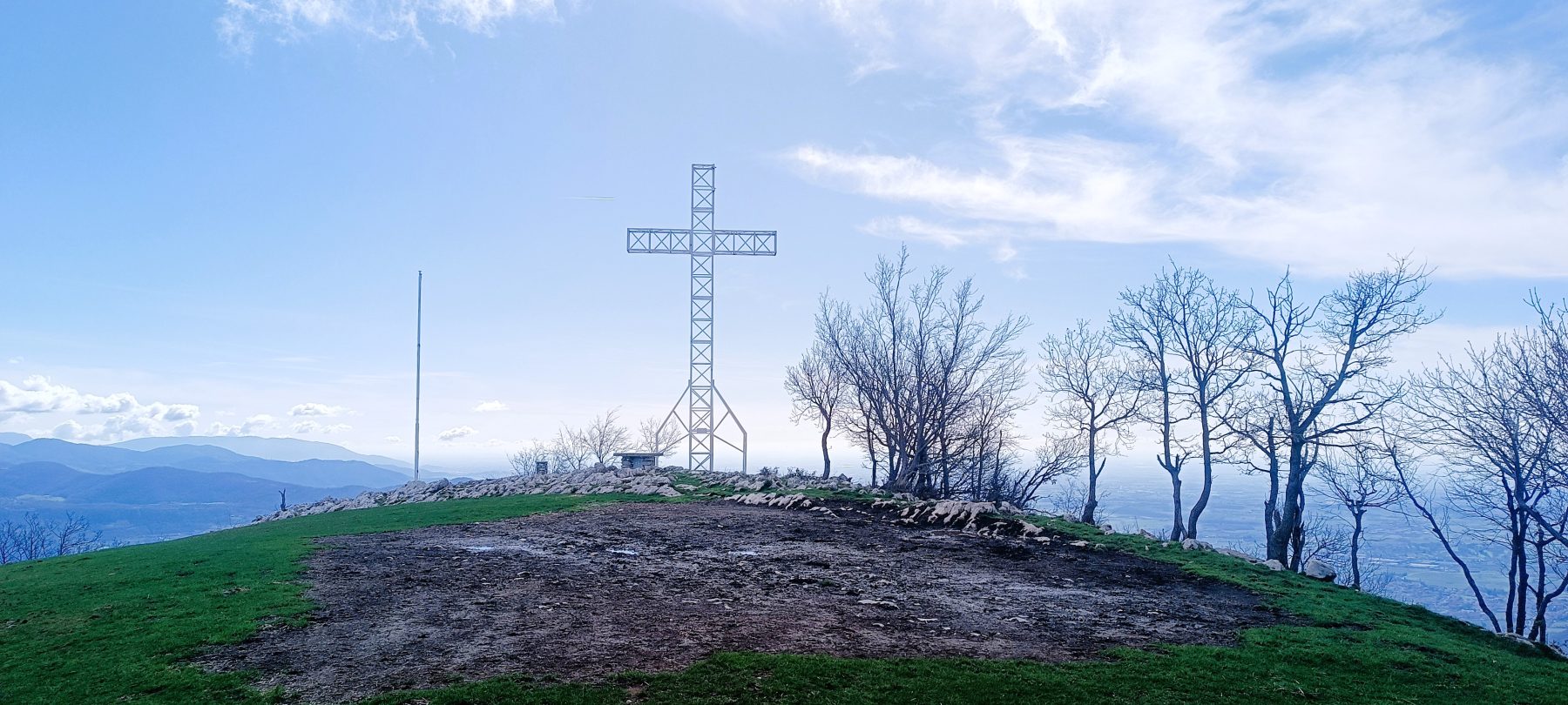
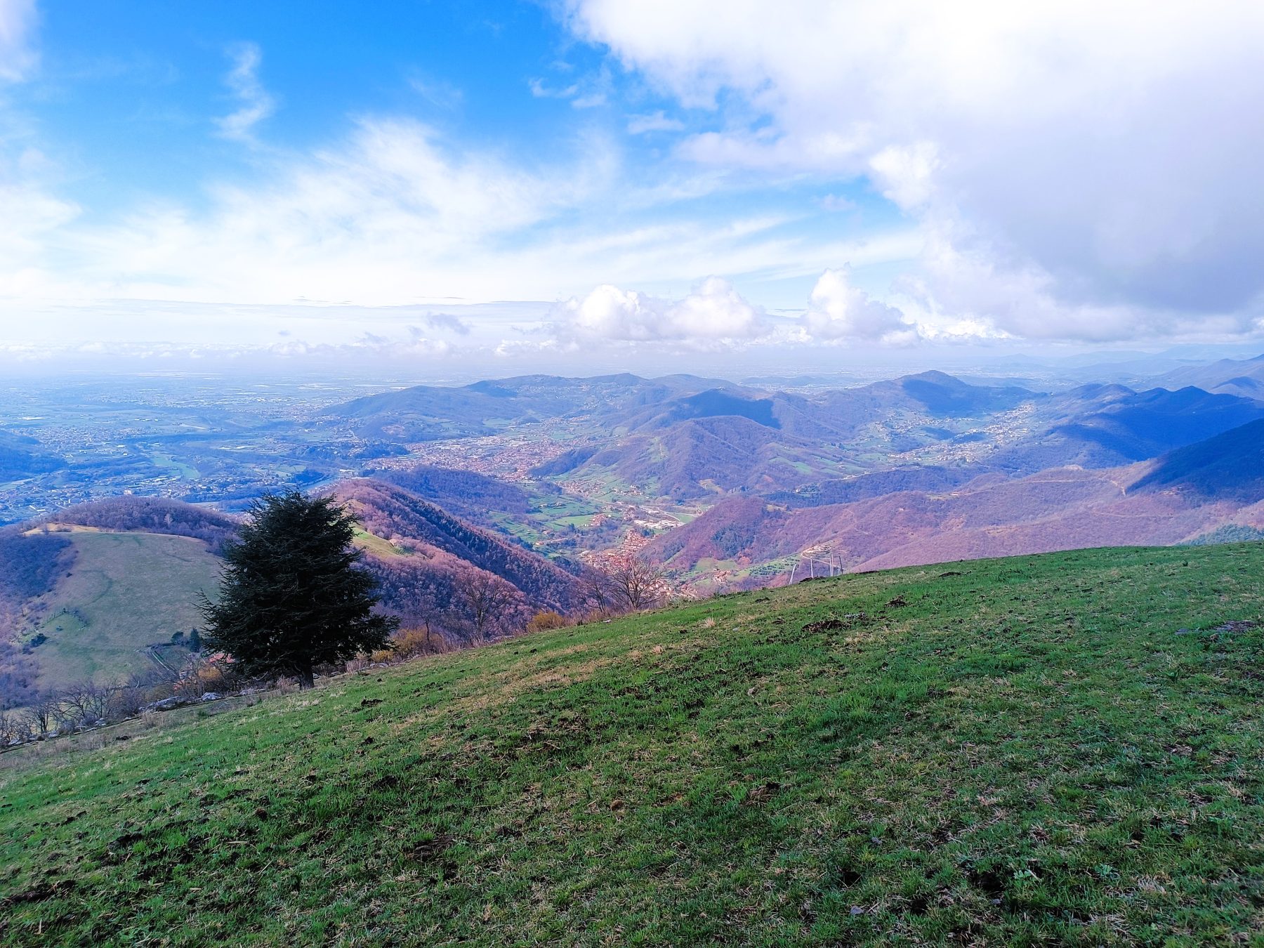
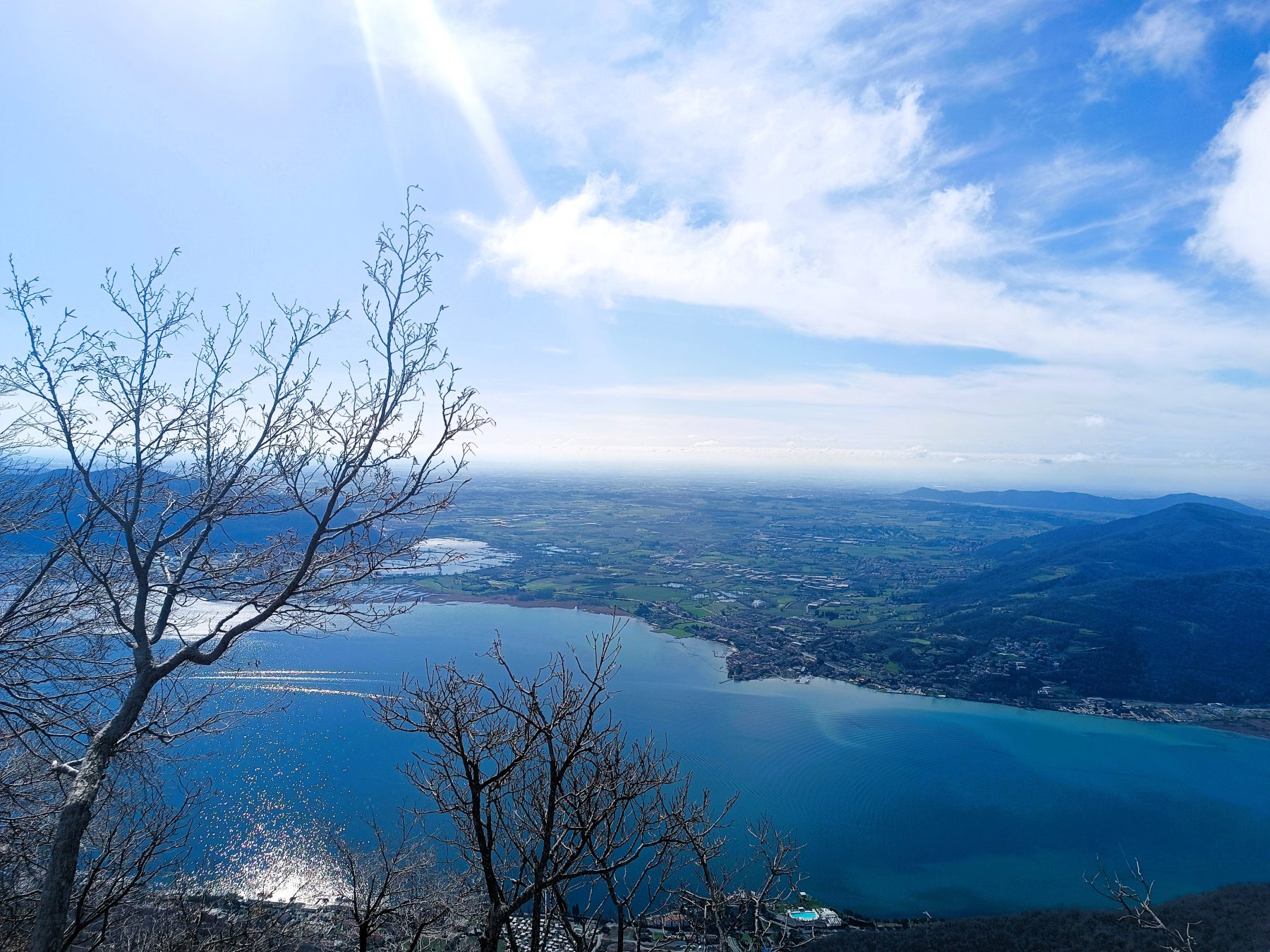
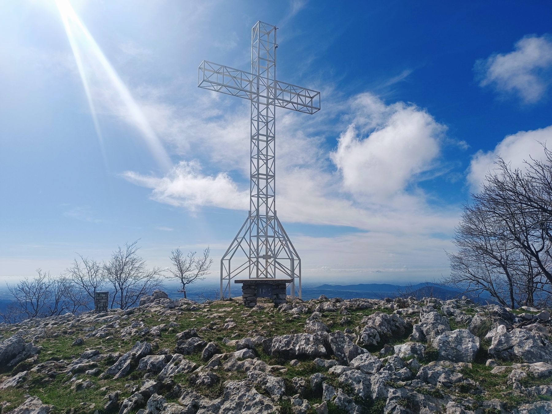
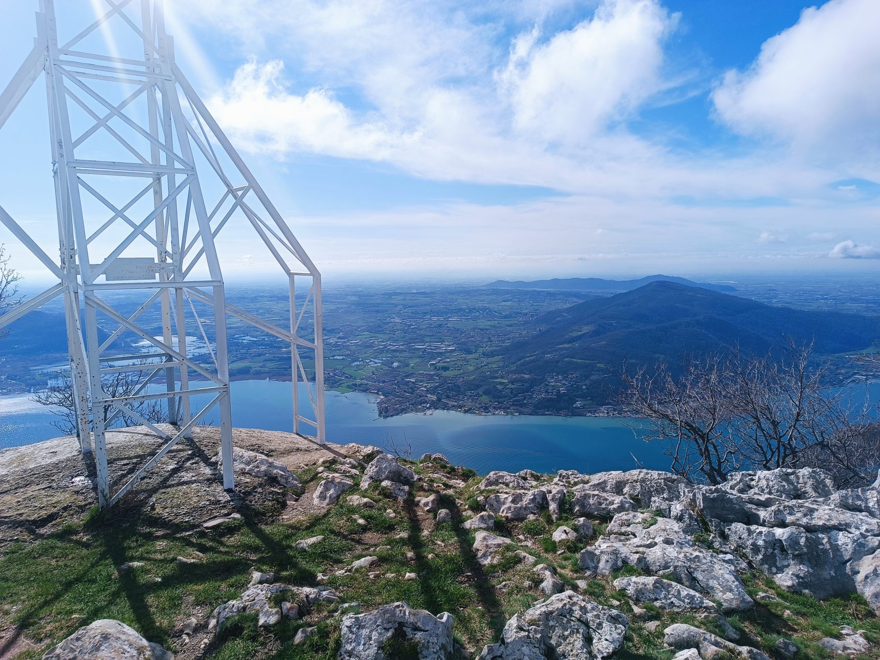
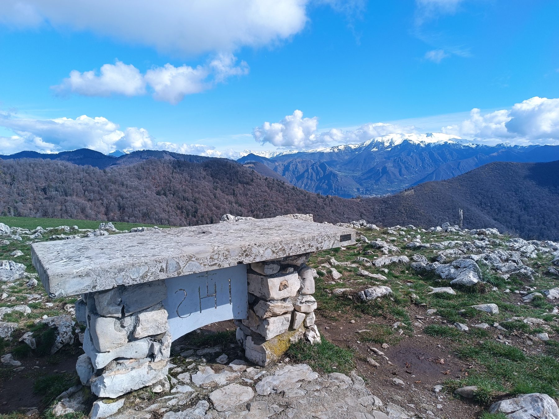
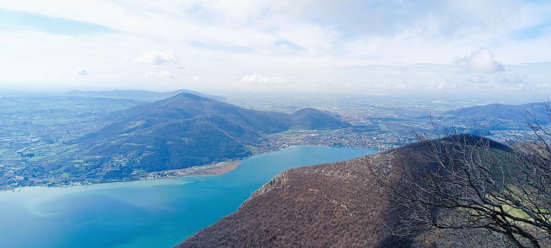
In the Dessi area, near a shrine, continue straight, where the road flattens for about 300 metres. Keeping left, the road becomes increasingly narrow until it becomes a path (trail sign 708 on the left). The path leads to the meadows of Col Giera where, at the top right, the summit of Corno Buco appears. Continue until you reach the majestic metal cross (960 m), from which you can admire the lower Lake Iseo, the Torbiere del Sebino Nature Reserve and the Pianua Padana. For the descent, retrace your steps to the Col Giera area, where you take path 737 which leads to the Vertino forest, and then arrive at the Dessi area on the road taken on the outward journey to the starting point.
DE – Von der Piazza Vittorio Veneto aus nimmt man die Straße, die in den oberen Teil der Stadt führt, rechts vom Bach Rino. Man folgt der steilen Hauptstraße am Parkplatz links von der Via Molini und folgt den Stufen, die zum Rino-Wasserfall führen, mit herrlichem Blick auf die Altstadt. Die Route verläuft zunächst über den Fußgängerweg der Via Molini und dann zwischen den Häusern über zwei weitere Treppen. Sobald man die Via Cima Predore erreicht hat, biegt man rechts ab, hält sich nach einer Unterführung links und geht über eine weitere Treppe die Via Fossato entlang. Sobald man das städtische Aquädukt erreicht hat, folgt man der steilen Asphaltstraße weiter und verlässt das Tor mit der Treppe auf der rechten Seite, die zum Heiligtum führt.
In der Gegend von Dessi, in der Nähe eines Schreins, geht man geradeaus weiter, wo die Straße etwa 300 Meter lang flacher wird. Links haltend wird die Straße zunehmend schmaler, bis sie zu einem Pfad wird (Wegweiser 708 auf der linken Seite). Der Weg führt zu den Wiesen des Col Giera, wo oben rechts der Gipfel des Corno Buco erscheint. Man wandert weiter, bis man das majestätische Metallkreuz (960 m) erreicht, von dem aus man den unteren Iseosee, das Naturschutzgebiet Torbiere del Sebino und die Poebene bewundern kann. Für den Abstieg geht man zurück zum Col Giera-Gebiet, wo man den Weg 737 nimmt, der zum Vertino-Wald führt, und dann zum Dessi-Gebiet, über die Straße, die man auf dem Hinweg genommen hat, um zum Ausgangspunkt zu gelangen.
How to arrive and where to park / Anreise und Parkplätze
Follow the directions to Lake Iseo and then towards Predore along SP 469.
It is possible to park near the starting point.
DE – Man folgt den Schildern zum Iseosee und dann nach Predore entlang der SP 469.
Parkplätze in der Nähe der Piazza Vittorio Veneto.
Credits: Amministrazione Comunale, Gruppo Alpini and Pro Loco Eventi Predore
DETAILS
- Difficulty:
Medium - Duration:
3h - Distance:
7,3 km - Elevation gain:
+744 m - Starting point:
Piazza Vittorio Veneto, Predore - Arrival point:
Piazza Vittorio Veneto, Predore - Trail number:
708, 737
Book now:
Treasure hunt in Franciacorta
Franciacorta
A fun experience suitable for everyone in the vineyards of Franciacorta: a team orientation test bet...
 BOOK NOW
Scenic walk to the Big Bench in Franciacorta
Rovato
Among vineyards, woods, and breathtaking views, enjoy an authentic experience in the heart of Franci...
BOOK NOW


