
Oglio River Green Way
The trail / der Weg
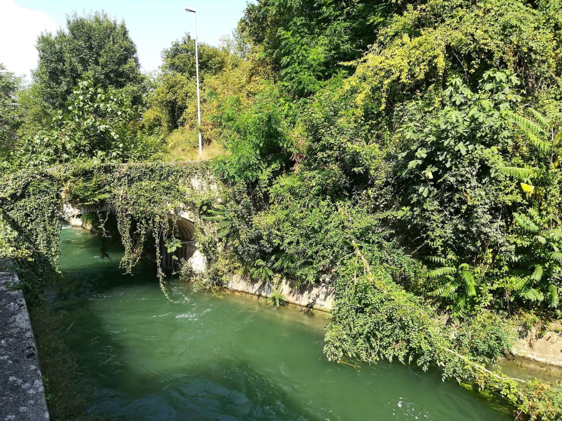
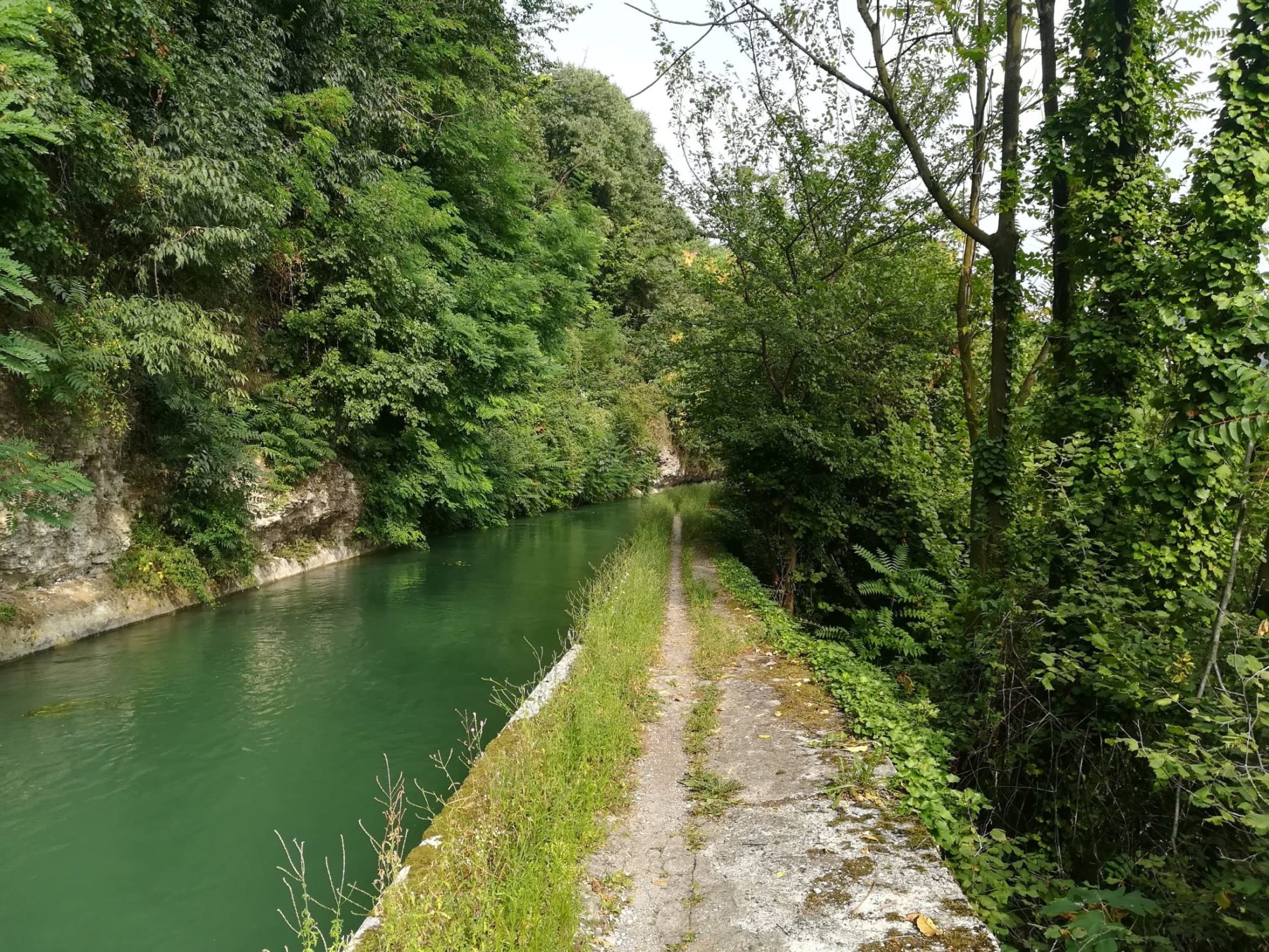
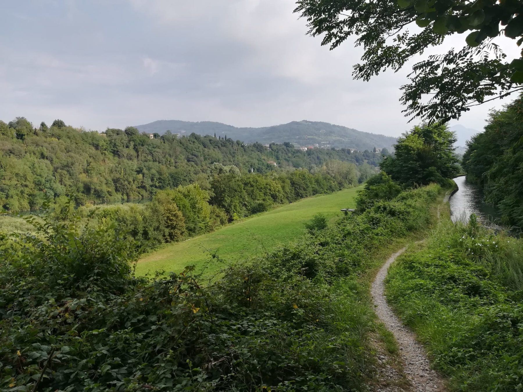
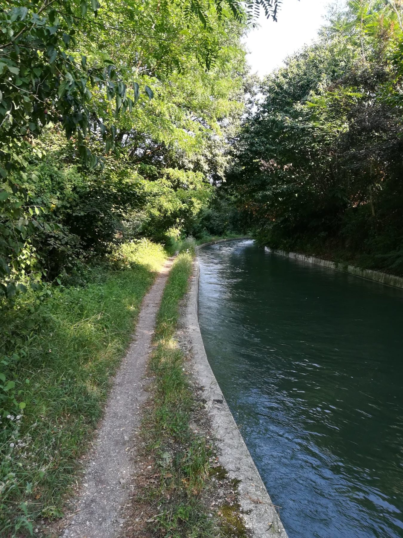
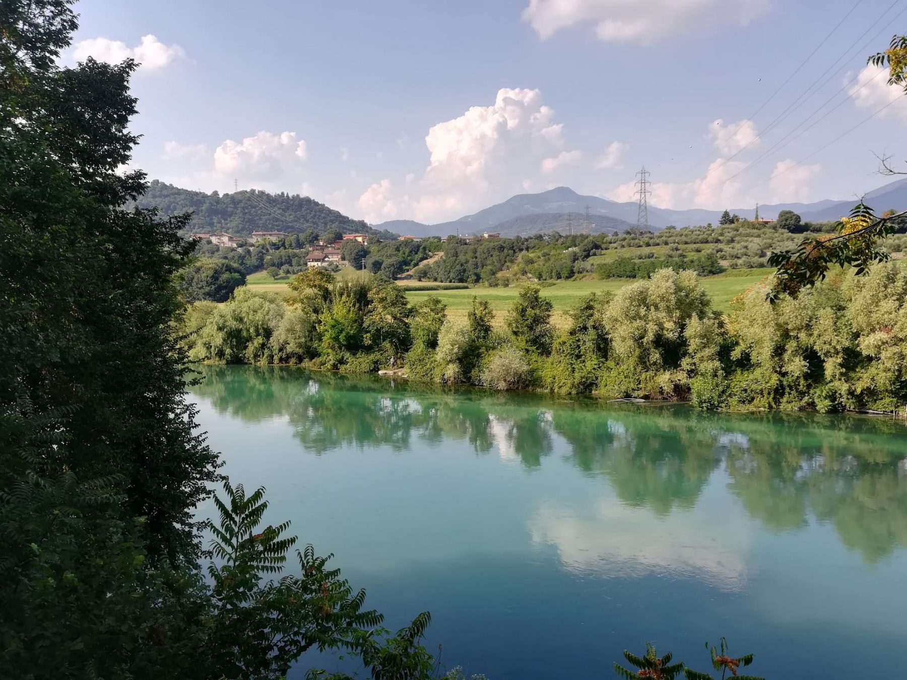
The Green Way of the Oglio develops along the Oglio river and along some of its canals (also known as seriole) in a fluvial and plain environment, mainly using country roads and paths.
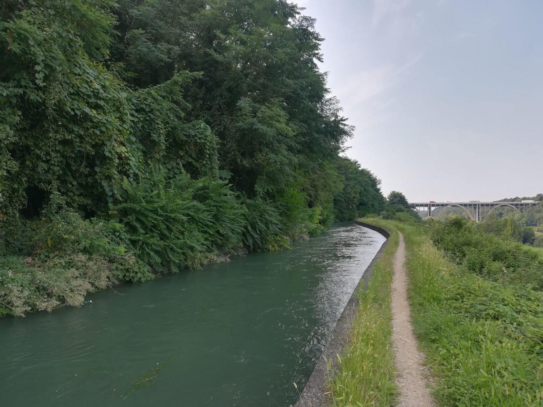
Starting from the Paratico / Sarnico station, take the provincial road to Iseo up to the first roundabout, and take via XXV Aprile. Shortly after, take via Della Santa on the right, which leads to via Don Giacomo Moioli, that then becomes via S. Pietro. After a few hundred meters, take the road downhill. A small bridge overpasses the Palazzolo – Paratico touristic railway, and shortly afterwards, the mouth of the Fusia canal. From here to Palazzolo, the path uses the right orographic embankment of the Fusia, at the entrance of which there is a gate that allows only pedestrian passage. Before arriving at the historic cotton mill NK in Capriolo, you will pass the railway twice . Once you have reached the cotton mill, cross a small stream that descends and continue on the right bank of the Roggia Fusia. Cross the provincial road Capriolo – Castelli Calepio on the Bergamo side right at the height, on the Bergamo side, of the small village called Castel de ‘Conti, which deserves a small detour. Underpass the viaduct of the Milan – Venice motorway. Following the path, go down to the right towards the river, near the Italcementi dam, and continue on the unpaved road that runs alongside the former Ferrari cotton mill. After the disused cotton mill, walk to the right up to a ladder that leads directly to the river. A gate leads into the Robinie Park, with a bar and picnic area. At the end of the park you reach Piazza Giovanni XXIII. If you turn left, in 10 minutes you will reach Palazzolo railway station, the arrival and departure point of the Franciacorta Path, which leads – in 2 stretches – to the Santuario della Stessa di Gussago and to Brescia (Urago Mella). If you continue straight, instead, you will reach Piazza Roma, in the heart of Palazzolo sull’Oglio.
DE – Der grüne Weg des Oglio entwickelt sich fast ausschließlich entlang des Flusses Oglio und einiger Kanäle (auch Seriole genannt) in einer fließenden und flachen Umgebung. Der Weg nutzt hauptsächlich Landstraßen und Pfade.
Vom Bahnhof Paratico/Sarnico begeht man die Landstraße nach Iseo bis zum ersten Kreisverkehr hinein, und dann geht man über via XXV Aprile. Kurz darauf, nimmt man via Della Santa auf der rechten Seite, die zur via Don Giacomo Moioli führt, die dann zur Via S. Pietro wird. Nach einigen hundert Metern beginnt den Abstieg. Eine kleine Brücke führt über die Touristenbahn Palazzolo – Paratico und kurz darauf über die Mündung des Kanals Fusia. Von hier bis nach Palazzolo führt der Weg über den rechten orografischen Damm des Fusia, an dessen Eingang sich ein Gitter befindet, das nur für Fußgänger zugänglich ist. Bevor man zur „historischen“ Baumwollspinnerei NK in Capriolo gelangt, wird man zweimal die Eisenbahn vorbeigehen, die in einigen Abschnitten auch den Weg entlang verläuft. Sobald man das Baumwollspinnerei erreicht hat, geht man einen kleinen Bach vorbei, der immer am rechten Ufer des Fusia weiterführt. Man überquert die Landstraße Capriolo – Castelli Calepio auf der Höhe des kleinen Dorfs Castel de ‘Conti, das einen kleinen Umweg verdient. Man geht weiter und unterfährt den imposanten Viadukt der Autobahn Mailand – Venedig. Man folgt dem Pfad nach rechts in Richtung Fluss in der Nähe des Italcementi-Damms und folgt dem Feldweg, der entlang der ehemaligen Ferrari-Baumwollspinnerei verläuft. Nach der stillgelegten Baumwollspinnerei geht man rechts zu einer Leiter, die direkt zum Fluss führt. Ein Gitter führt in den Robinie Park, mit einer Bar und einem Picknickbereich. Am Ende des Parks erreicht man die Piazza Giovanni XXIII. Wenn man nach links abbiegt, gelangt man in 10 Minuten zum Bahnhof Palazzolo, dem Ankunfts- / Abfahrtsort des Franciacorta-Pfades, der in zwei Etappen zum Heiligtum Stella di Gussago und nach Brescia (Urago Mella) führt. Wenn man geradeaus geht, erreicht man die Piazza Roma im Herzen von Palazzolo sull’Oglio.
How to arrive and where to park / Anreise und Parkplätze
Follow the indications for Lake Iseo until you reach Paratico. The path starts at Paratico’s former railway station, near the bridge that links Sarnico with Paratico.
Parking space with fee next to the former railway station, in via Roma.
DE – Man muss den Anfahrtsbeschreibungen für den Iseosee folgen und Paratico erreichen. Der Ausgangspunkt der Route befindet sich am Bahnhof Paratico in der Nähe der Brücke, die Sarnico mit Paratico verbindet.
Bezahltes Parkplatz in der Nähe des Bahnhofs in via Roma.
Useful info / nützliche Info
Pay attention: in some places the trail narrows right where the bank towards the river is almost overhanging.
Trains run only on summer weekends; however, avoid crossing the track.
DE – Achtung: An einigen Stellen verengt sich der Weg, genau dort, wo das Ufer in Richtung Fluss fast überhängt.
Züge fahren nur an Sommerwochenenden; Vermeiden Sie es jedoch, die Strecke zu überqueren.
DETAILS
- Difficulty:
Medium - Duration:
3 h - Distance:
11,8 km - Elevation gain:
+42 m - Starting point:
Via Fiume, Paratico - Arrival point:
Piazza Roma, Palazzolo sull'Oglio - Trail number:
SVO
Book now:
Treasure hunt in Franciacorta
Franciacorta
A fun experience suitable for everyone in the vineyards of Franciacorta: a team orientation test bet...
 BOOK NOW
Scenic walk to the Big Bench in Franciacorta
Rovato
Among vineyards, woods, and breathtaking views, enjoy an authentic experience in the heart of Franci...
BOOK NOW


